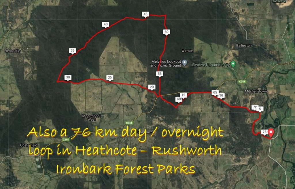
Summary
- Distance: 76 km loop
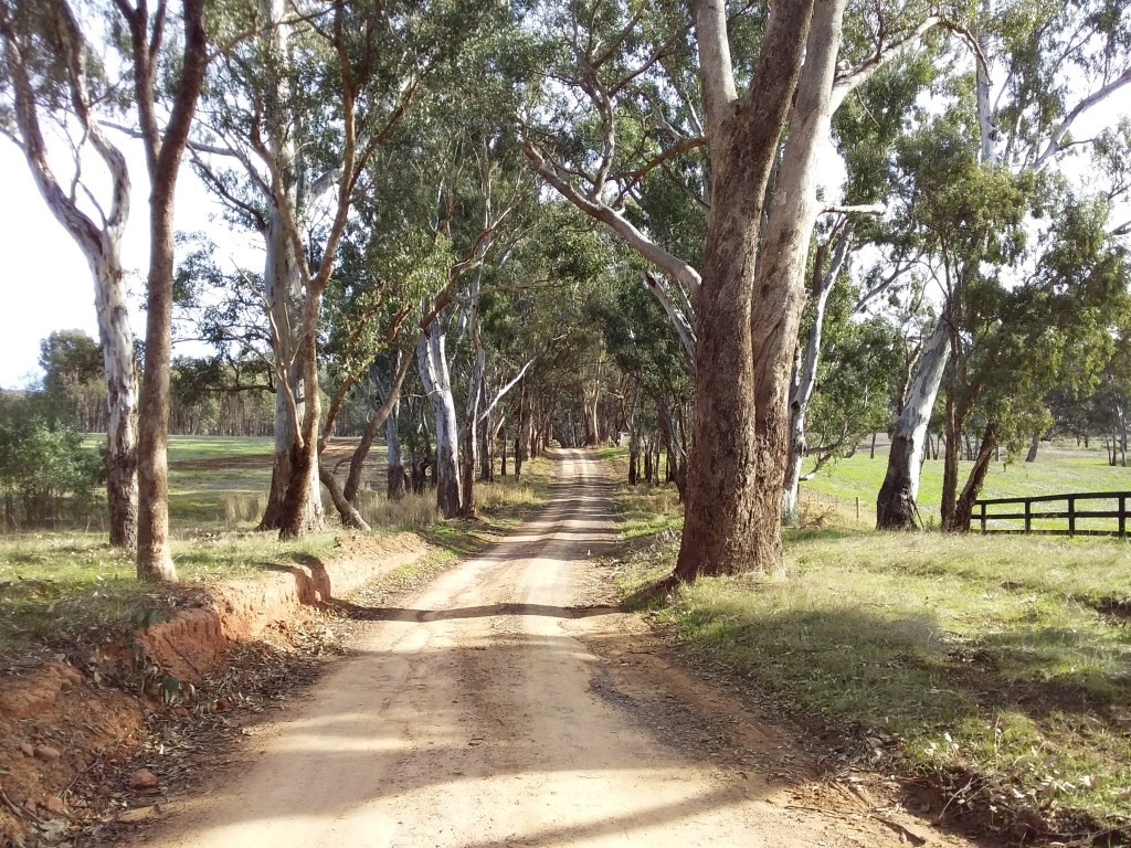
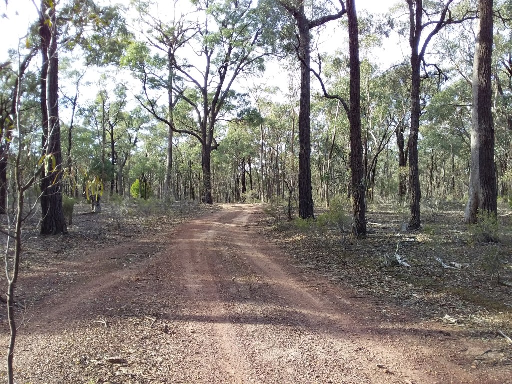
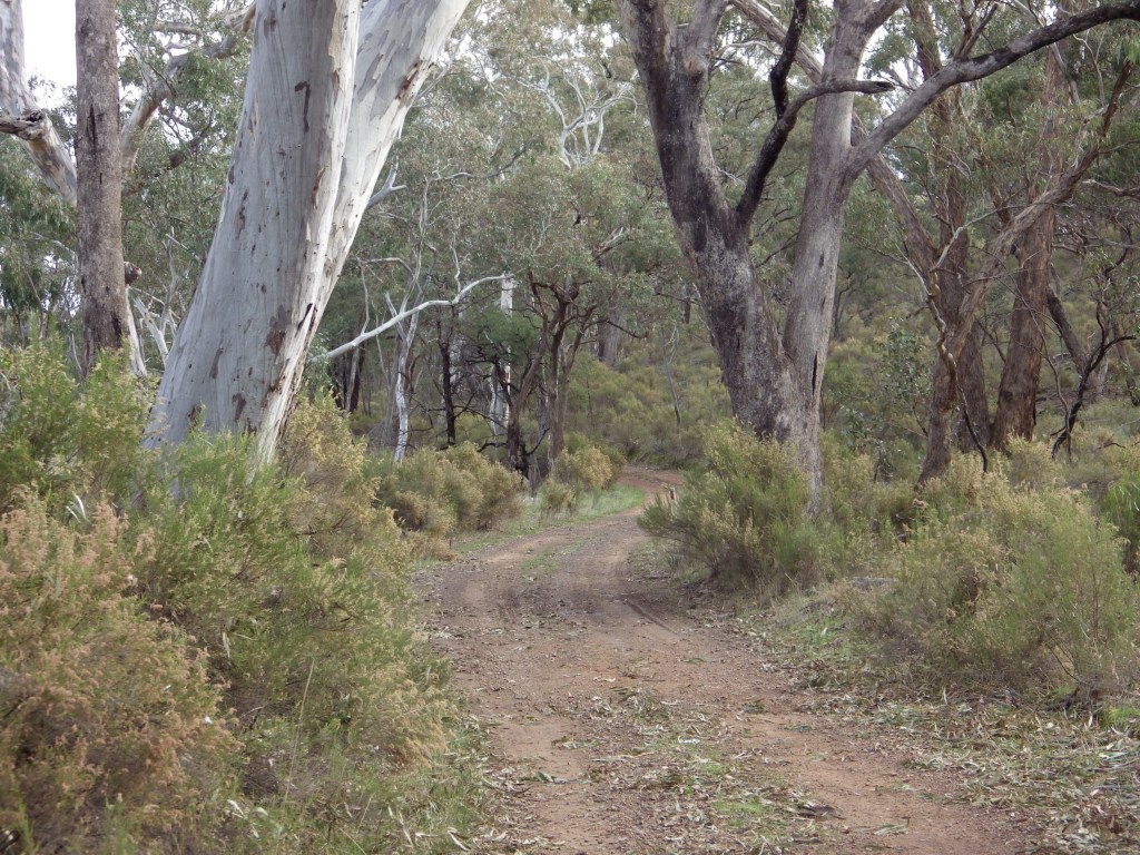
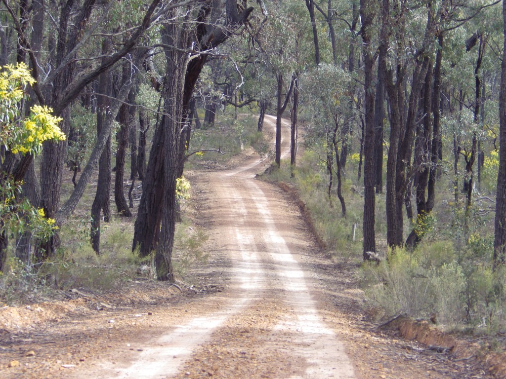
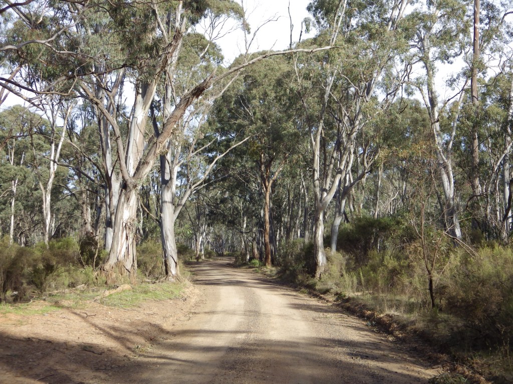
- Description: The ride is mostly on secluded gravel tracks, through the scenic native ironbark forests of the Heathcote-Rushworth National and State Parks. It will mainly be used as a southern link between other routes.
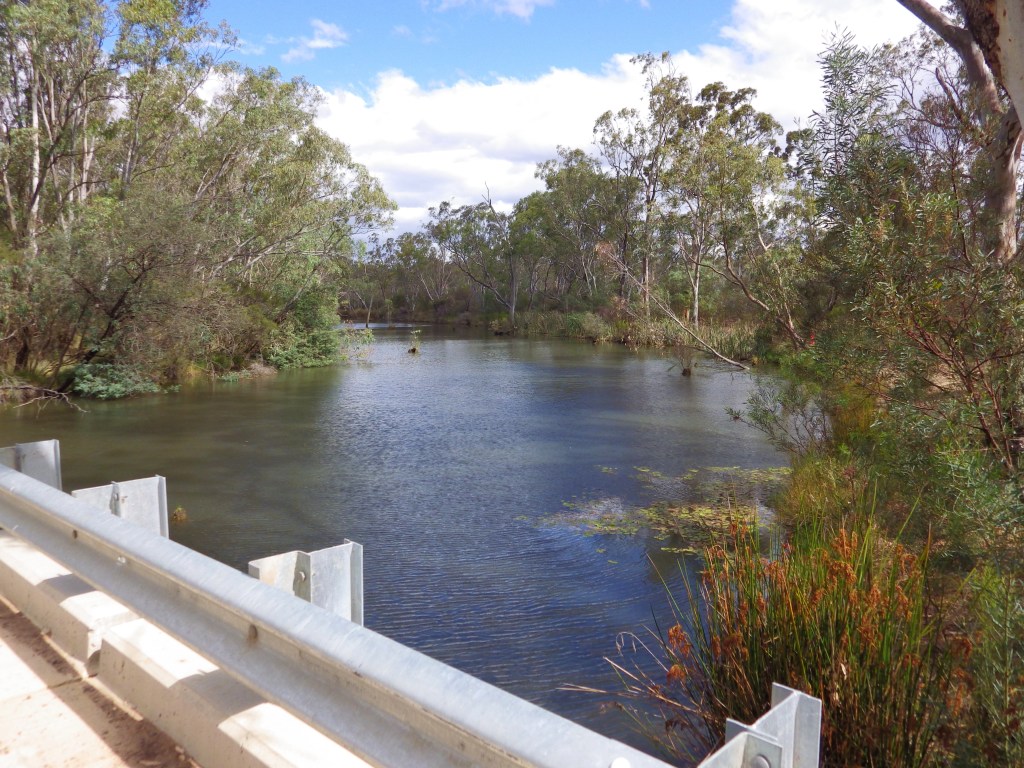
- Amenities: None on route. Michelton Winery is closest amenities to route. No water on the route so carry what you need, plus extra for emergency.
- Accommodation: Major Creek (camp with toilets).
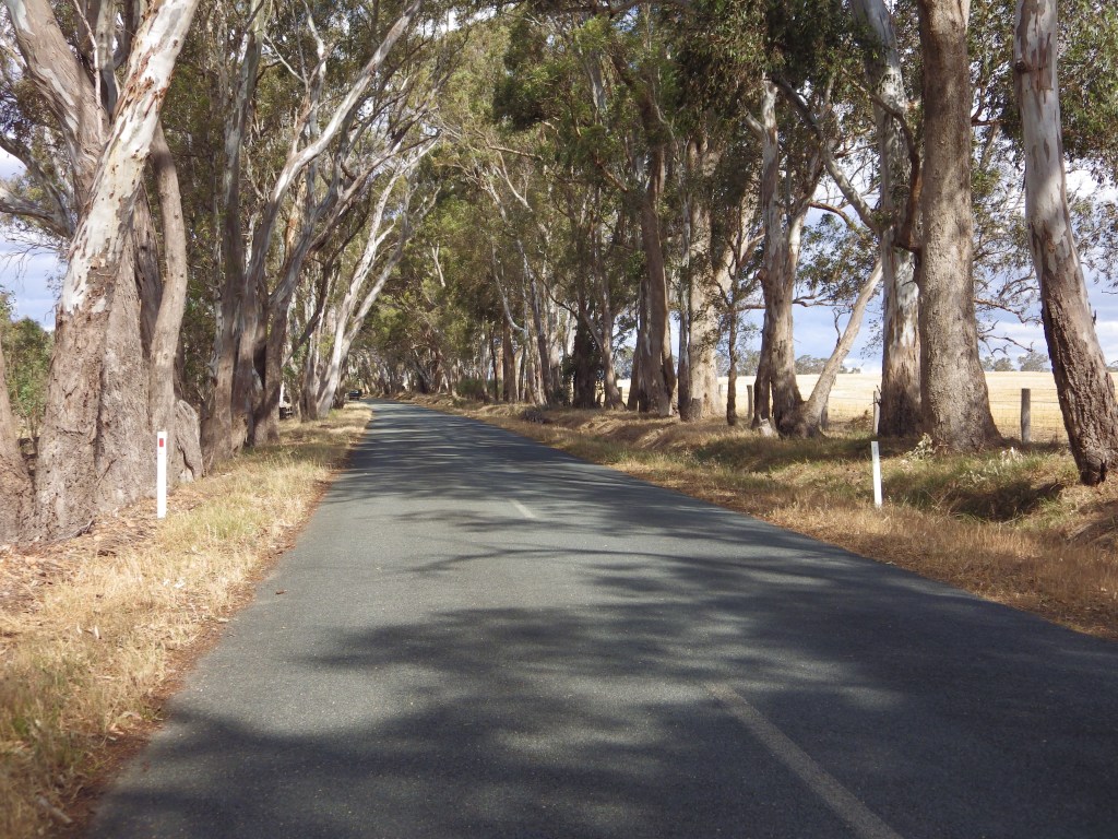
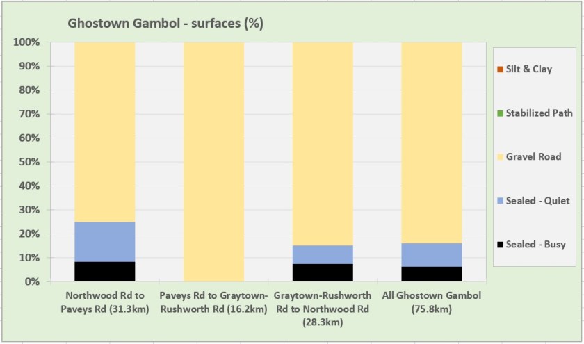
- Ride surfaces: 84% gravel, 10% quiet sealed roads, 6% busy sealed roads.
- Terrain: Flat and rolling, there are many short uphill sections along the route. Total vertical metres = 512 m.
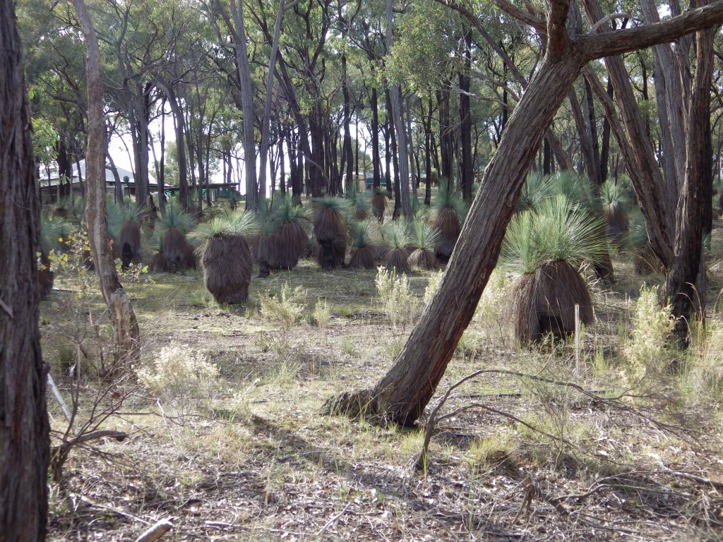
- Highlights: Being panicked by clumps of human-sized grass trees along Delaney Road when your primitive brain reflex tells you they are scary groups of spear carrying natives.
- Nearby Interest: Melville’s Lookout. Ghost towns for history buffs – Mitchellstown, Graytown, Redcastle, Whroo and Bailieston.
- Link to gpx file: Download gpx file from this link – Ghostown Gambol GPX file
- More detail: Youtube ride through video – Ghostown Gambol
- Connects with: Yellowbelly Track, Nagambie Meander, Golden Black Track. See – GABCY Network
- Pics:


More Detail
Ghostown Gambol is a 76 km bike riding loop near Nagambie and Heathcote in northern Victoria.
The ride is mostly on secluded gravel tracks, through the scenic native ironbark forests of the Heathcote-Rushworth National and State Parks. For through bikepackers the route is a link between various existing bike routes – the Great Victorian Rail Trail, O’Keefe Rail Trail, Yellowbelly Track and Goldfields Track.
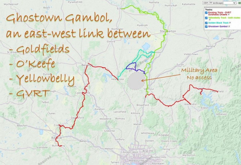
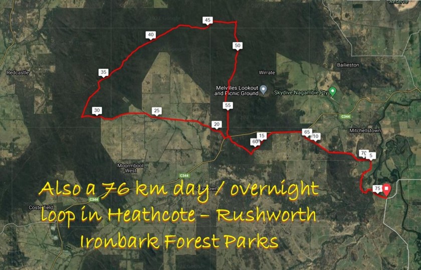
This ride is isolated and does not go through any population centres. In fact it gets its name from the many abandoned settlements or ghost towns in this area. Ghostown Gambol links up with Golden Black Track to make more ride options depending on which direction and how far you want to ride.

What will the ride be like?
The ride is mostly on secluded gravel tracks, through the scenic native ironbark forests of the Heathcote-Rushworth National and State Parks.
Ride -through video: Check out the following short ride through video to see for yourself. The video is 70 secs long and includes over 45 photos from the route.
About 64 km (84%) of the route is on gravel roads, as shown in the surface distribution graph below. Less than 5 km in total is on busy sealed roads.
.
There are no major climbs. The route rises about 100m and then descends. However it is rolling – there are lots of short uphill sections all along the route. Total vertical metres = 512 m.

Planning Your Ride
No water is available in the forest sections. The gravel roads and the constant small climbs will be more tiring than you expect, especially with a loaded bike. Therefore don’t be too ambitious with the distances you expect to cover each day.
Michelton Winery a few km from the start and finish point is the closest amenities.
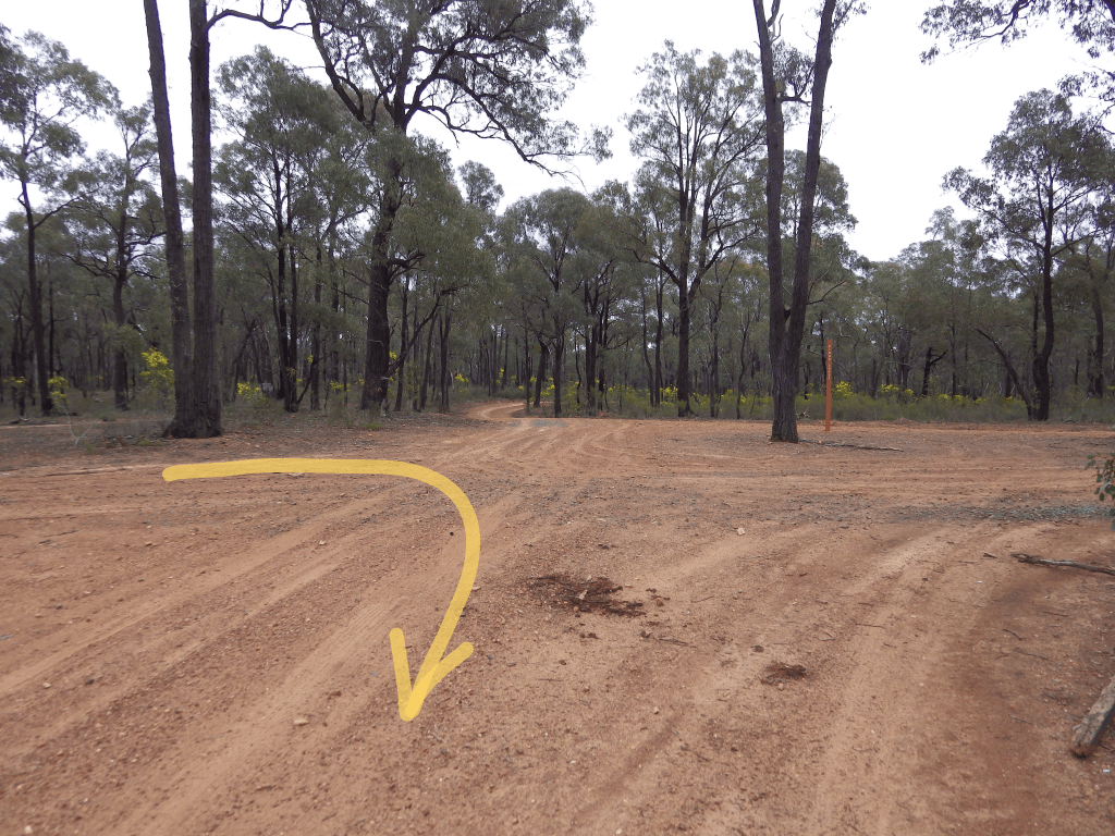
I strongly recommend you use gpx navigation. Many tracks are not signposted and some that are signed do not agree with published maps.
Download gpx files – Ghostown Gambol GPX file
