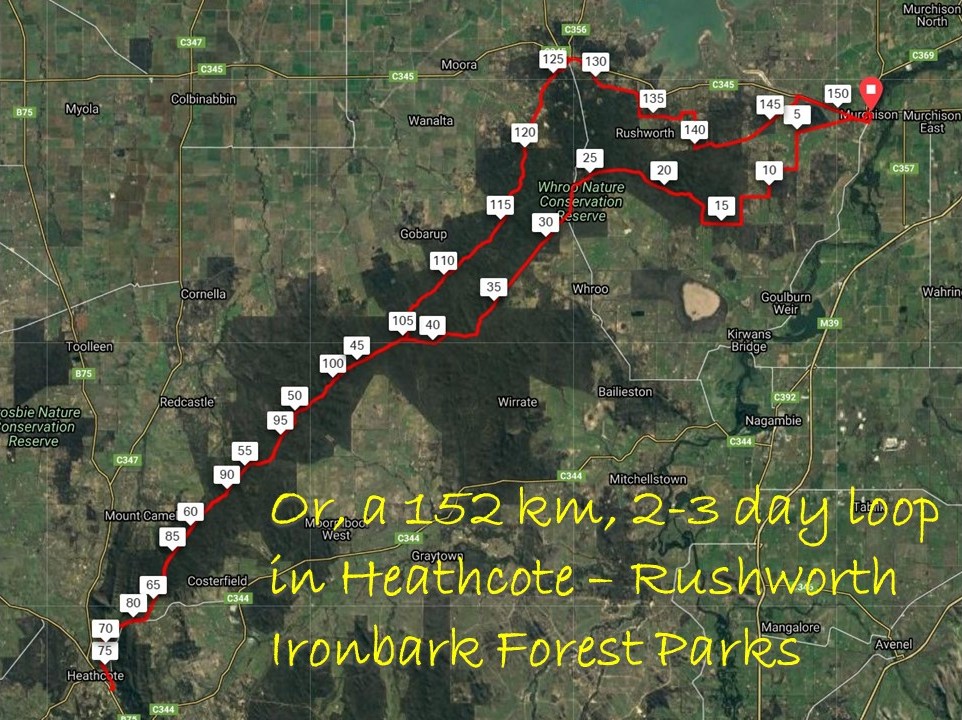
Summary
- Distance: 152 km loop
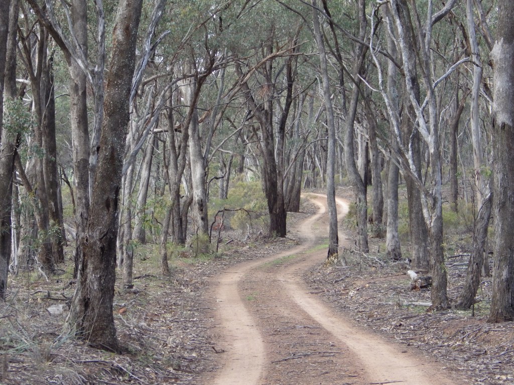
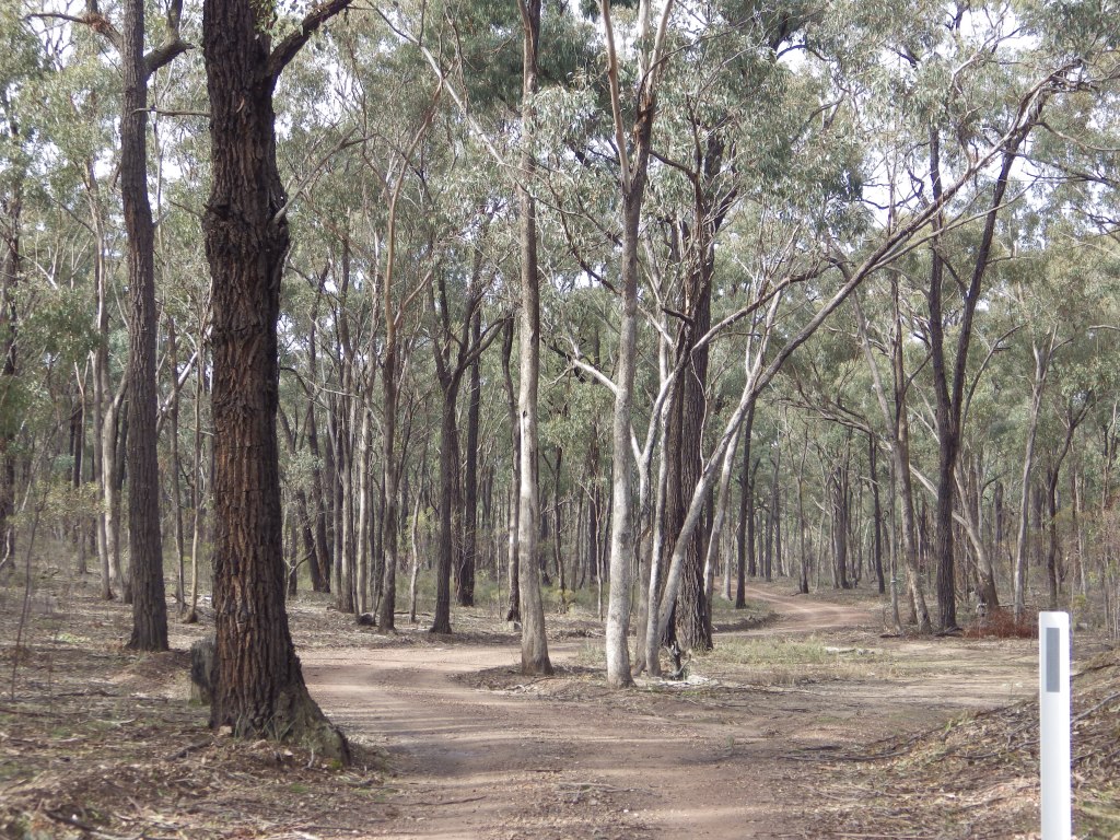
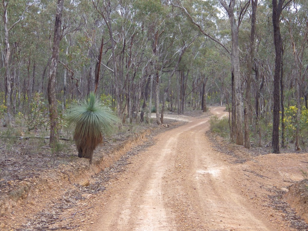
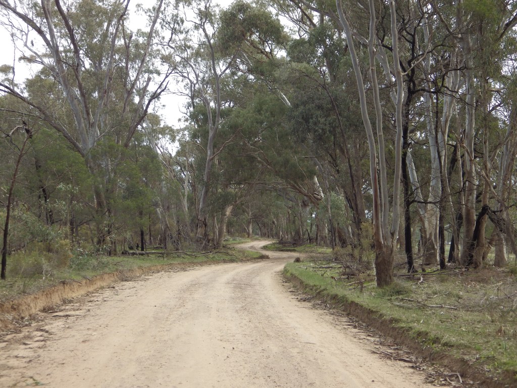
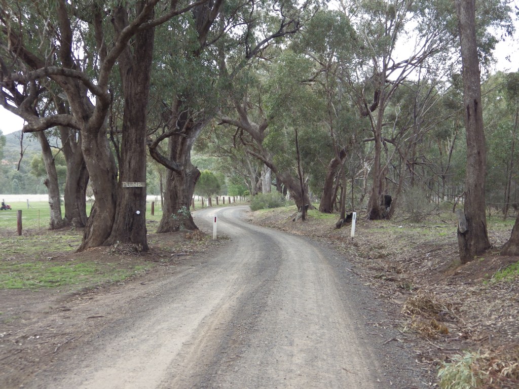
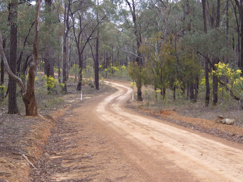
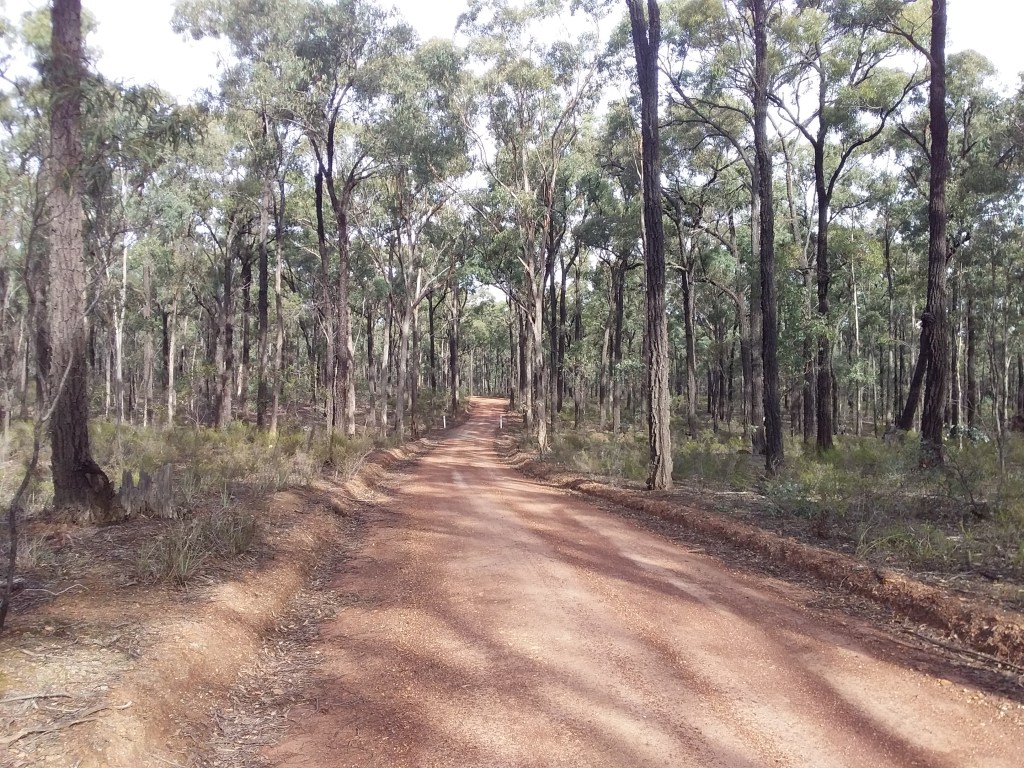
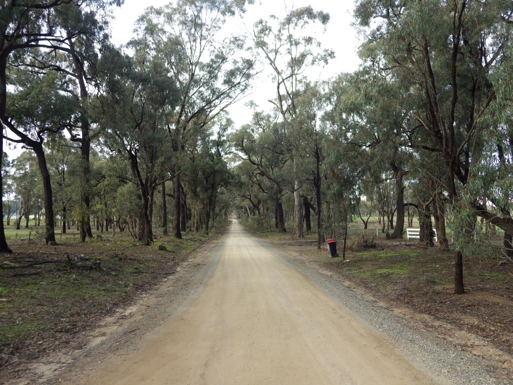
- Description: The ride is mostly on secluded gravel tracks, through the scenic native ironbark forests in the Heathcote-Rushworth National and State Parks.
- Amenities: Murchison, Heathcote, Rushworth. No water between towns so carry what you need, plus extra for emergency.
- Accommodation: Murchison, Heathcote, Rushworth. Free camping and some designated campsites in Heathcote-Rushworth State and National Parks.
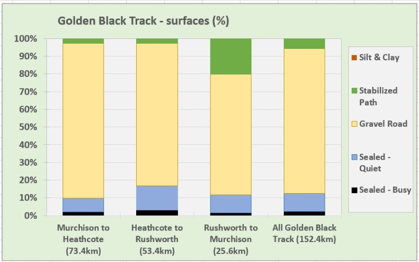
- Ride surfaces: 6% stabilized path, 82% gravel, 10% quiet sealed roads, 2% busy sealed roads.
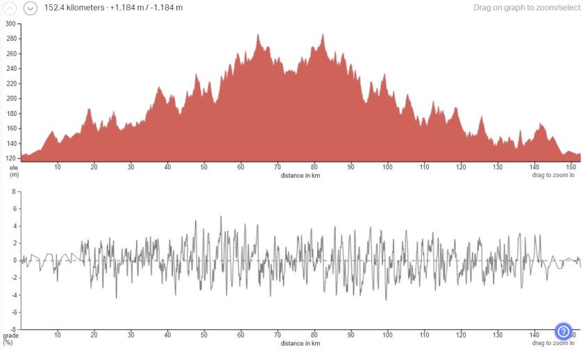
- Terrain: There are no major climbs. The route rises about 160m and then descends. However it is rolling – there are lots of short uphill sections along the route. Total vertical metres = 1,184 m.
- Suggested Ride: Start at Murchison, ride to Heathcote (the longest leg) and overnight there. Return more leisurely the next day with stop off in scenic Rushworth.
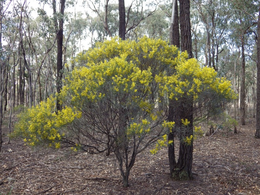
- Highlights: The ironbark forest, particularly when wattle is in bloom (early spring). Rushworth historic town.
- Link to gpx file: Download gpx file from this link –Golden Black Track gpx file
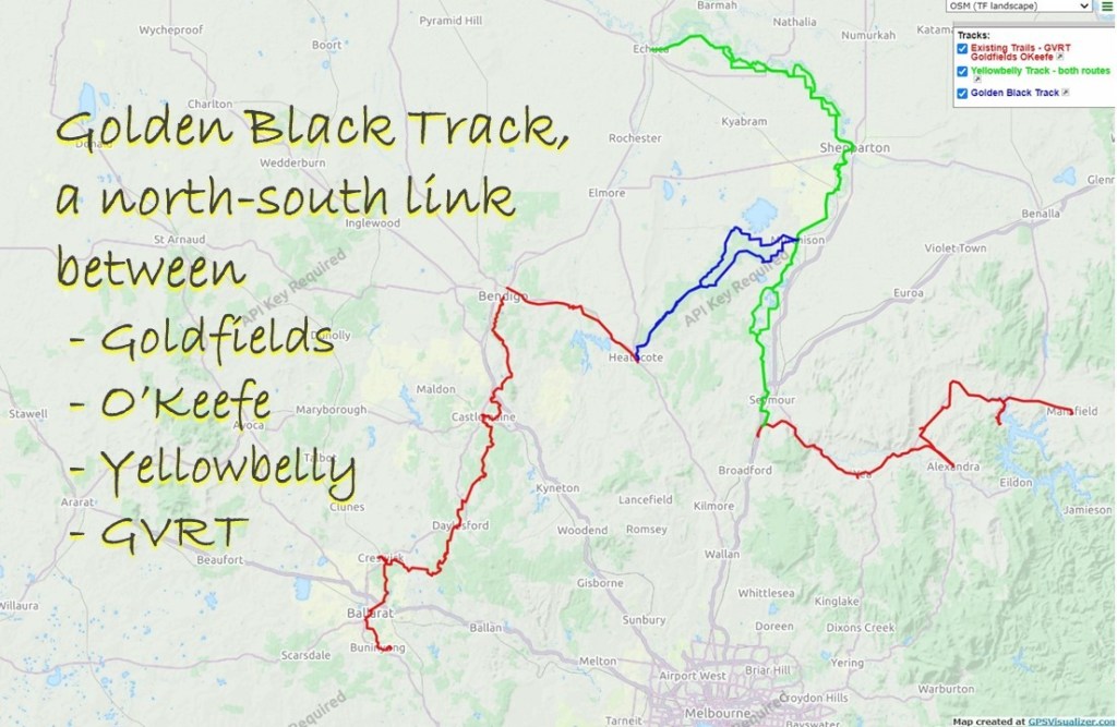
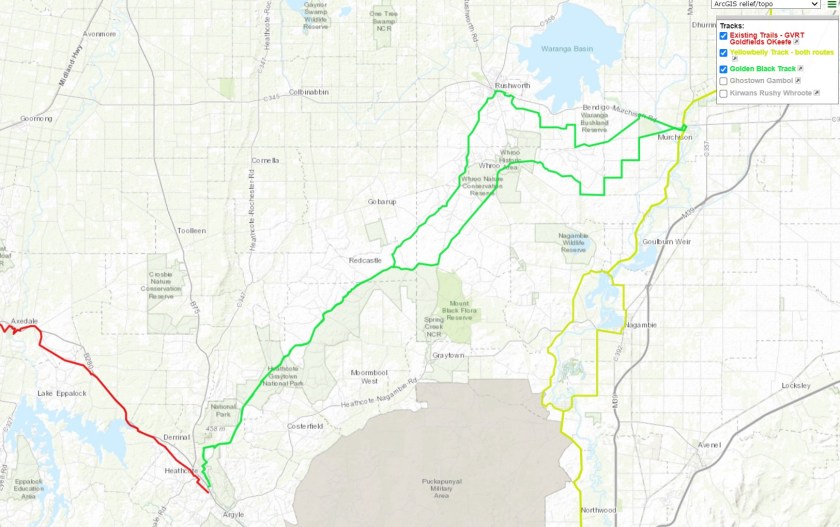
- Connects with: O’Keefe Rail Trail, Reap the Red Ridge, Ghostown Gambol, Camel Cornella, Kirwans Rushy Whroote, Lap of Local Lakes, Carag Carag Wetlands Wetlands, Waranga Whirl, Yellowbelly Track. See – GABCY Network
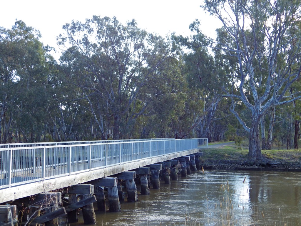
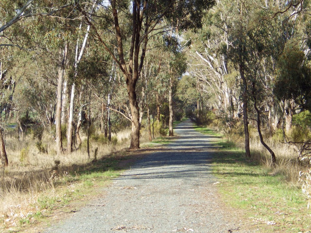
- Pics:


Original Article
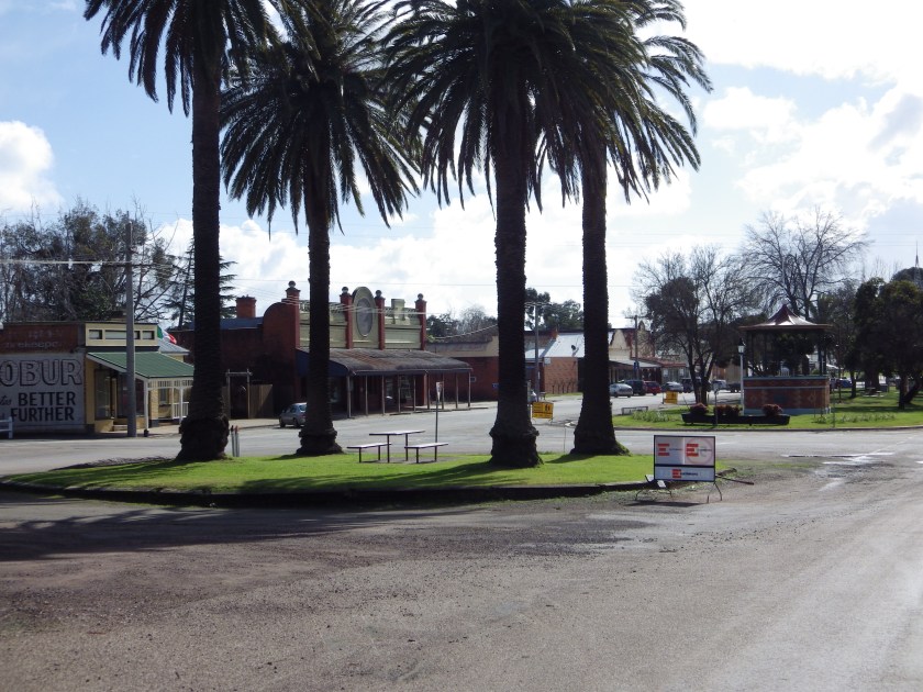
The Golden Black Track is a 152 km bike riding loop between Murchison, Heathcote and Rushworth in northern Victoria.
The ride is mostly on secluded gravel tracks, through the scenic native ironbark forests in the Heathcote-Rushworth National and State Parks. For through bikepackers the route provides a link between various existing bike routes – the Great Victorian Rail Trail, O’Keefe Rail Trail, Yellowbelly Track and Goldfields Track.

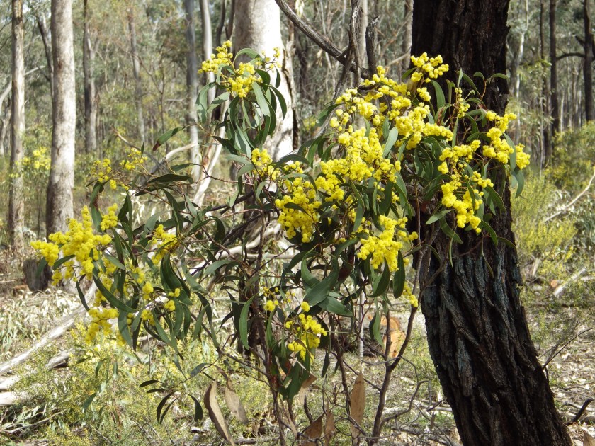
The name of the route is a reference to both the history and vegetation of the area. The forests are dotted with former gold mines and settlements that were part of Victoria’s gold rush in the 1850s. Many prospectors still visit the area now. The timber in the black trunks of the ironbark trees was another source of prosperity for the area after the gold ran out. At the base of the ironbarks a layer of scrubby 1 to 2 metre wattle bushes stretches through much of the forest. In early spring all the wattles burst into brilliant gold against the black trunks of the ironbarks.
The best time to ride the route is in early spring when you can enjoy the technicolour sensation of riding over red ground, through black and gold forest, under a rich blue sky. If you get a bright sunny spring day, you will remember it for a long time.


What will the ride be like?
The ride is mostly on secluded gravel tracks, through the scenic native ironbark forests of the Heathcote-Rushworth National and State Parks. Check out the following short ride through video to see for yourself. The video is 95 secs long and includes over 70 photos from the route.
Over 133 km (88%) of the route is on gravel roads or stabilized path, as shown in the surface distribution graph below. Less than 4 km in total is on busy sealed roads.
There are no major climbs. The route rises about 160m and then descends. However it is rolling – there are lots of short uphill sections all along the route. Total vertical metres = 1,184m.
Planning Your Ride
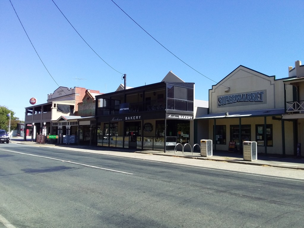
Three towns with good services are well spaced around the loop – Murchison, Heathcote and Rushworth.
No water is available in the forest sections between the towns. The gravel roads and the constant small climbs will be more tiring than you expect, especially with a loaded bike. Therefore don’t be too ambitious with the distances you expect to cover each day.
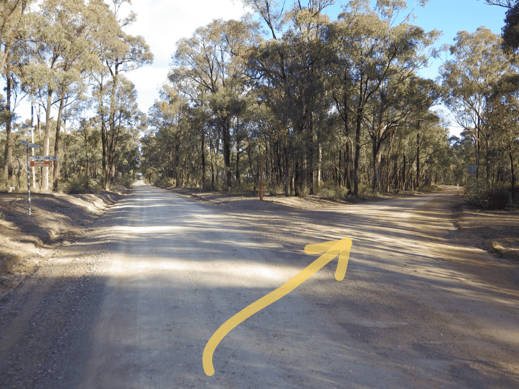
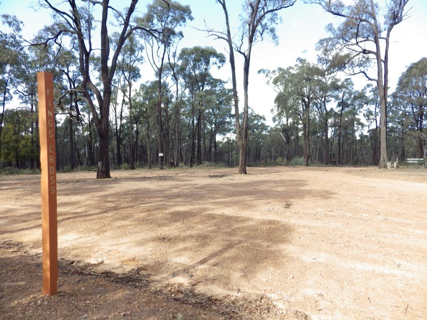
I strongly recommend you use gpx navigation. Many tracks are not signposted and some that are signed do not agree with published maps. An example is a large clearing called Kings Cross (pic below) with tracks going off in all directions – none signposted. I often take wrong turns here, even though I think I know it well, and am relieved when my tracker sounds its off-route signal to correct me.
The forest is a patchwork of different State and National Parks that join together. Free camping is allowed in most of the Park area, and there are some named camping grounds with toilets. Look at the downloadable documents below for more detail about camping areas.
The best time to ride is early spring as already noted.
If you are planning to do a 152 km overnight loop, my suggestion is to start at Murchison and do the longest continuous leg, with the most climbing, on the first day. Then overnight in or near Heathcote. The next day, although longer in total, will have more downhill and the opportunity for a rest/meal break at the very scenic town of Rushworth on the way back.
Things to See
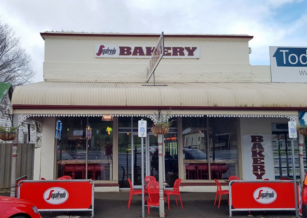
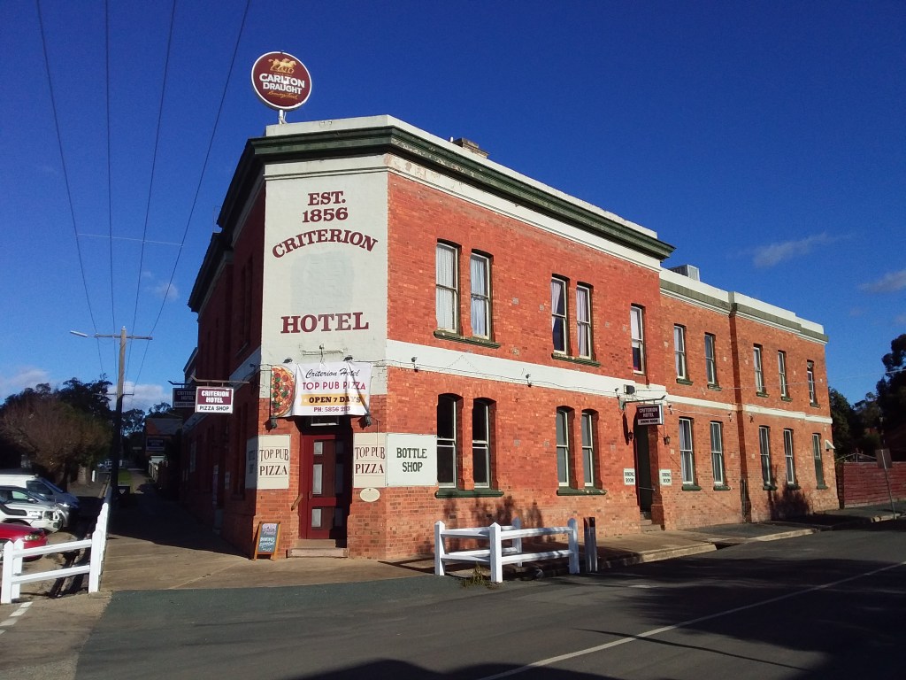
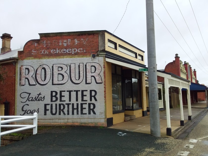
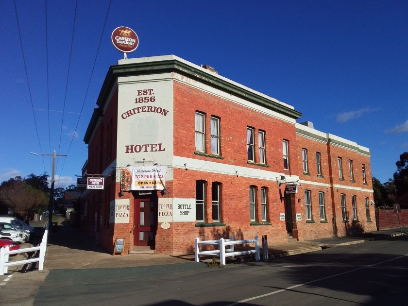
Rushworth. At its peak the gold rush town of Rushworth had a population of 40,000. Many of the buildings from this once booming town remain, although the population is now only a little over 1,000. If you like taking pics of your bike leaning against old stuff this is the town for you.

.
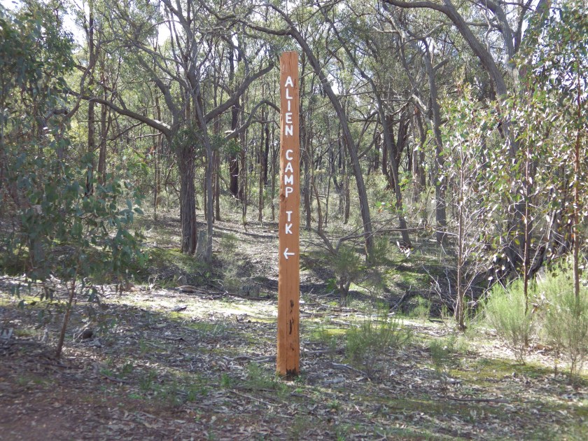
Track name signs. For your amusement, track names and signs are often very descriptive and literal.

Local Flora and Fauna:
- Ironbark trees are Eucalyptus tricarpa. European settlers named these trees ironbark because the black deeply ridged bark reminded Europeans of dried molten and cast iron (not because the bark was very hard or strong). These forests are the largest stands of ironbark in Australia (and therefore the world).
- The local wattle species (Ausfeld’s Wattle or Acacia ausfeldii) is found only in the Bendigo and Heathcote area and in the Mudgee region in New South Wales (which was also an alluvial gold rush district).
- The Austral Grass Tree, Xanthorea australis is native to this area and can live for 600 years, growing just 1–2 cm per year. The base of a Grass Tree can take 10 years to form from old leaf bases bound by resin. Fire induces production of a flower spike out the top, which can grow 4 –5 m in height.
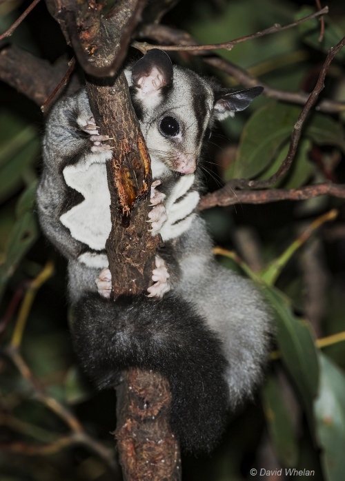
- The Squirrel Glider (Petaurus norfolcensis) is a medium-sized arboreal marsupial endangered in Victoria and unique to the Box-Ironbark forests surrounding Heathcote and Rushworth. They can glide up to 90m from tree to tree.
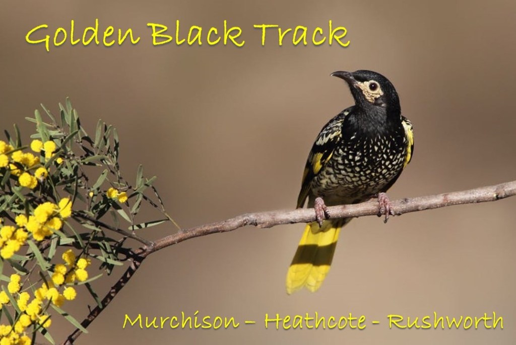
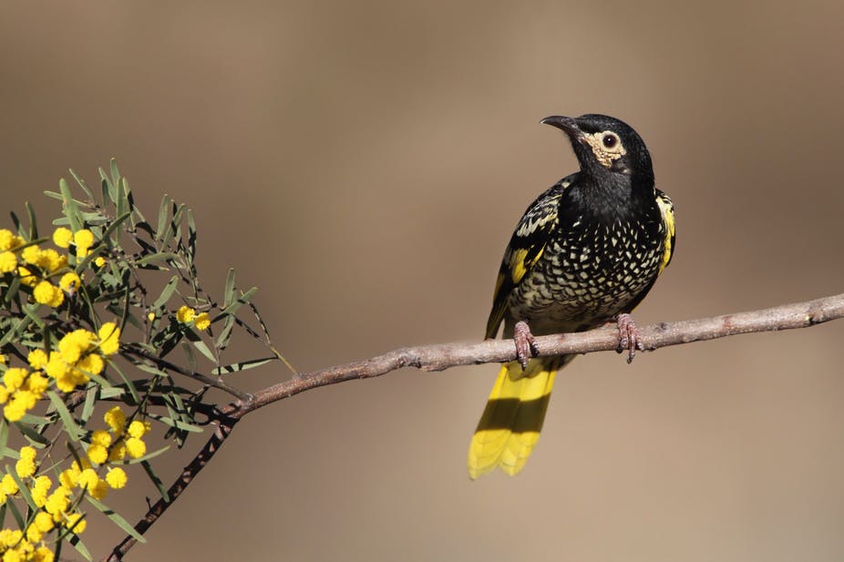
- The Regent Honeyeater (Xanthomyza phrygia) can be found in these forests. It is considered endangered in Australia. Well camouflaged here, it has a black and yellow pattern on its breast and its wings and tail feathers are black with yellow patches. Ironically one of reasons it is endangered is because those cute squirrel gliders eat honeyeater eggs.

Downloads
GPX File – The gpx file will always be available to public here, and updated to correct or adjust the route as necessary. Please do not repost to other sites such as strava or ridewithgps. I would prefer if potential riders were referred to this site to get latest version and updated ride information.
Park and tourist information – various documents, some out of date. Make your own enquiries about current situation.
- Rushworth Tourist Guide
- Heathcote and Rushworth State Forests
- Heathcote Graytown National Park Map – I find this map confusing. It only covers a limited National Park area at south end of forest, and some of the track names differ from other maps. It is useful for detail about Dargile camping area though.
- Heathcote Rushworth State Forest Map
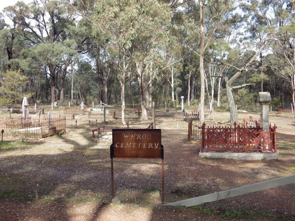
- Whroo Historic Area
.
Comments and Questions
If you have any questions or comments, post below.
Or contact me by email (nixtrader AT yahoo DOT com DOT au)
.
