John and Greg rode the Yellowbelly Track over 3 days in April 2022. This is their account …
We first heard about the Yellow Belly Track during 2021 and, having just finished a ride down the Murray River from Mildura to Goolwa, were quite interested in doing a more local ride, along one of the many rivers that run into the Murray.
Earlier this year (2022), we decided that the first week of April would be a good week to try the track (not too cold yet; winds generally not a problem; out of school holidays) so we made plans.
One of the hardest things to work out was how long to take to do the ride. We were unsure of how far we would be able to travel each day, particularly on the river tracks. Thanks to the NixTrader website, we were able to look at the distances between major stops and a suggested itinerary based on the planned number of nights on the track. We thought we would probably allow for 5 days on the track, with overnight stops in the two major towns along the way, Murchison and Shepparton.
Things actually went a lot better than we had planned!
In the last days before leaving, we decided to do the track from the South, as there was generally a southerly breeze predicted for the next week, so we caught the train to Tallarook on the Monday morning and set off from there.


The first day of riding was familiar to us, as we spend a lot of time on these roads through our involvement with the Mitchell Bicycle Users Group (MBUG: https://mbug.org.au) but it was a good opportunity to stop at some places we don’t normally stop at, e.g., the Northwood Picnic Ground (the site of the old Northwood Primary School) for morning tea and the Goulburn Weir for lunch.
By the time we reached the Weir, we realised that we would make it into Murchison easily for the night and started thinking about the lovely pub meal that awaited us. Sadly, we were informed that the pub had shut down during Covid and discovered that the few take-aways in town didn’t open until Thursday night. Thankfully, we had some home-prepared dehydrated meals, which we ate in the camp kitchen of the Murchison Caravan Park (about 2km out of town along the bike route). We set up our tents on the edge of the cricket pitch and settled in for the night.


A summary of the first day? You don’t really get to see much of the Goulburn River, except for where you cross it on Northwood Road and as you’re getting close to the Weir. This is common along the length of the Goulburn, including the upper reaches, due to the lack of State Forests and National Parks along that section of the river.
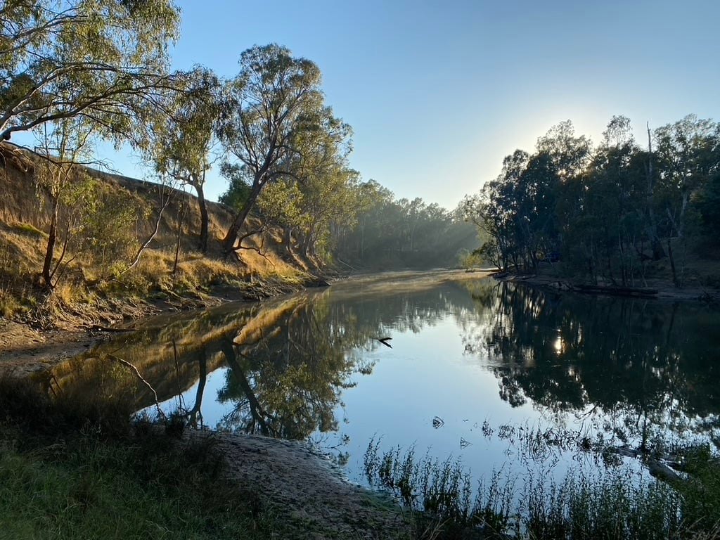
Day 2 changes all of that! Once you head north out of Murchison, the trail takes you down to the river and you have the joy of riding along rough corrugated bush tracks, and you meet some of the gullies you are warned about on the web site. With our fully loaded panniers, our bikes were quite heavy and there were two gullies that we needed to help each other across. The third gully was doable on the bikes.


Most of the time, the track keeps you away from the river, on the edge of the floodplain, with the opportunity to follow some of the side tracks to get a closer look at the river.
After a bit of fun on the river, we started seeing signs of habitation again and eventually went under the railway bridge and up to the main street of Mooroopna, where we had lunch and purchased some provisions. From there, it was a nice ride along the bike path heading towards Shepparton, until we turned off onto Cemetery Rd to follow the river north again. A short stint along the Echuca Rd proved to be the busiest part of the whole track but we were soon back on the river tracks and looking for a place to camp for the night.
We eventually found a camp spot in the Lower Goulburn National Park and settled in for a three course (dehydrated) meal and a night listening to the possums, nightjars, and Mopokes.


Day 3 started on the river’s edge with a short stint along back roads until we crossed the Murray Valley Highway and headed back into the bush again. This kept us next to the river until we reached the Yambuna Bridge, where we stopped for lunch.


The next section of the track was probably the hardest of the lot. Whoever surfaced Bangerang Rd was obviously out to get cyclists. The gravel in this section is tightly packed but the stones seem to be arranged to make it difficult to ride along. It was probably the slowest 5km of the whole track!
Once we reached the bitumen, though, we quickly forgot the rough sections and made haste to reach Echuca and the end of the Track. We camped at the NRMA Holiday Park and walked up to the Shamrock Hotel for a nice feed of fish and chips and a cold beer, satisfied that we had completed the Track and, in fact, had done it faster than expected, averaging 70km per day over three days.

Highlights
The accuracy of the GPX track for the route made it a very easy route to follow. We had no difficulty keeping to the route and were very impressed with the amount of work that has gone into the route planning, giving us the maximum distance available where we were riding along the river.
Water supplies
We carried around 3 litres of water each on our bikes, with a view to filling them along the way with water filtered from the river, as we did when we rode down the Murray River. This worked on the first day as we had easy access to water at the Major Creek boat ramp and at the caravan park at the end of the day.
The steep banks along the river made access to the water quite difficult and, where I could get down to the water, it was necessary to navigate a metre or two of mud to get to the water. I eventually worked out a way of attaching my cargo bungie cords to a drink bottle and collecting water by tossing the bottle into the water to collect it for filtering.
On the final day, we filled up our bottles at the boat ramp near Yambuna Bridge.
There are meant to be a few sandy beaches along the Goulburn that would make it easier to collect water, but we didn’t venture down enough side tracks to find them. This would be a useful addition to the track notes.
Future Rides
There are a lot of other rides listed on the website that could be done in conjunction with this ride. If I was to do it again, I would include a few of these rides in my itinerary and plan to take longer to get to Echuca. For someone new to the area, or wanting to see more of the river, I would recommend riding down the Goulburn from Eildon to Alexandra, then along the Great Victorian Rail Trail to Tallarook, before doing the Yellow Belly Track.
Return from Echuca
My wife picked us up in Echuca, and we drove home.
Another option could be to follow the Campaspe River back, which would be a nice ride as well. There could be an option to link up with the OKeefe Rail Trail at Axedale and head back to Heathcote and Kilmore. Hmm, may have to give that a go!
.
For more ride reports from the GABCY Network area – see Ride Reports