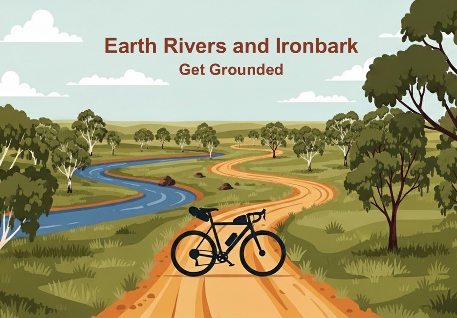
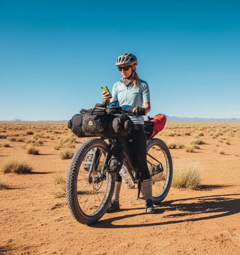
Get grounded riding quiet earth and gravel roads through scenic landscapes. The Earth Rivers and Ironbark (ERI) is a 400 km loop through northern Victoria. The route avoids traffic and prioritises river tracks, forest reserves and earthen back roads. Towns are well spaced along the route and there is easy access by train. It is an awesome getaway for riders seeking adventure and country hospitality.
- Overview
- Earth Rivers and Ironbark Planner
- Route stages and options
- Terrain and Surfaces
- Hero or Villain – Clay, Floodplains and Obstacles
- Best times to ride
- Stage 1 – Echuca to Murchison
- Stage 2A – Murchison to Heathcote via Nagambie
- Stage 2B – Murchison to Heathcote via Rushworth
- Stage 3 – Heathcote to Echuca
- GPX files
- Amenities, Services and Accommodation
- Train Access (14 Stations on or near the Route)
- Trail Access (connections to other Bike Trails)
- Risks, Hazards and Preparation
- Outro and How to get more Information

.
Overview
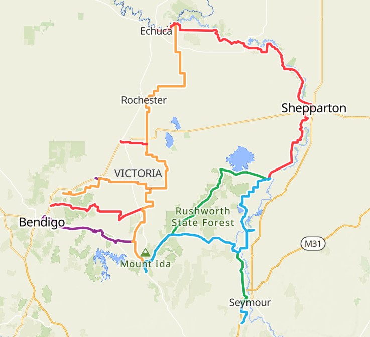
The ERI route is located in northern Victoria. It is bounded by the Campaspe and Goulburn Rivers to the west and east. The Murray River is to the north. Ironbark forests and the foothills of the Great Dividing Range form the southern boundary.
The route can be ridden in a continuous loop or broken into various stages with different options. Thirteen railway stations in the area make it easy to ride short sections on a day or weekend.
ERI is a good choice for beginner to intermediate bikepackers, or mixed social groups of varying abilities. The route is mostly flat with regularly spaced amenities and access to transport. The level of detail provided here is designed to help less experienced bikepackers and riders new to the area. Apologies to more experienced bikepackers who might find it unnecessary.
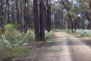
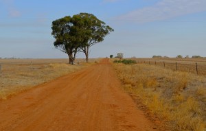
This is an adventure ride. The route seeks out earthen roads, dirt tracks and more remote scenic areas as a point of difference. Dirt is the new gravel. There are challenges to negotiate. These include gullies, steep climbs, sand patches, rough tracks, and fallen trees and branches. All these challenges are for relatively short distances. Even beginner bikepackers can negotiate them by walking for a short period.
Whether riders find it easy or hard will depend on how far and fast they aim to ride each day. On dirt and gravel roads, loaded riders often travel at only 60-75% of their sealed road speed and distance. If in doubt allow more time as a buffer, including time for possible mechanical mishaps. You will always enjoy having more relaxation time at the end of a day’s riding. However, you can never create more hours in a day. Aim to have the best time, not the fastest time.
Infographic – Key Attractions of ERI.
.
Earth Rivers and Ironbark Planner
Do you want AI to help you to sort through information and plan your ride? Use this AI Planning tool to answer questions about the Earth Rivers and Ironbark route and generate individual ride plans.
Go to the Earth Rivers and Ironbark Planner page for instructions and the link to the AI Planning tool
.
Route stages and options
Touring riders have different approaches and timeframes. The range of amenities and train stations available along the ERI route make it suitable for various approaches. For example:
- Riders doing a full loop (either 365 or 393 km).
- Day or weekend riders who want to do a short stretch of ERI at a time.
- Loaded-up, fully self-supporting free campers.
- Light-travelling tourers staying in commercial accommodation and buying prepared food along the way.
- Anyone in between, or a combination of approaches for different stages.
The time to do the full loop will vary based on a rider’s ability and intention:
- experts or riders in a hurry might take 3-4 days,
- experienced riders on a relaxed cruise might take 5-8 days.
- beginners or young families might take up to 10 days.
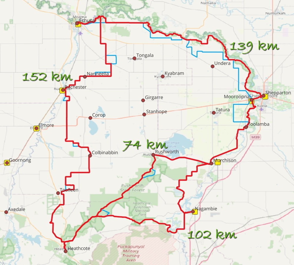
The full ERI loop is made up of 3 connecting stages. The loop or stages can be ridden in either direction. The stage between Murchison and Heathcote has two options – one via Nagambie and one via Rushworth.
- Stage 1 – Echuca to Murchison – 139 km
- Stage 2A – Murchison to Heathcote via Nagambie – 102 km
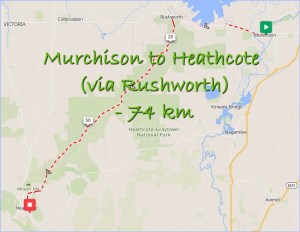
- Stage 2B – Murchison to Heathcote via Rushworth – 74 km
- Stage 3 – Heathcote to Echuca – 152 km
Use the table below to choose which route to take between Murchison and Heathcote.
| Attribute | Stage 2A – via Nagambie | Stage 2B – via Rushworth |
|---|---|---|
| Distance (km) | 102 km | 74 km |
| Climbing ratio | less | more |
| Surface and environment | More sealed road and farmland | More gravel and natural bushland |
| Development and Amenities | More development and commercial accommodation | Less development, more free camping options |
| Train access | Mid stage train station at Nagambie. | No mid stage train station. |
| Weather | Less protected | Long forest sections provide more wind protection. Slopes and loose gravel drain water away better. |
Another option is to combine both the shorter stages (i.e. Murchison – Nagambie – Heathcote – Rushworth – Murchison) as a 176 km loop.
Infographic – Who is the ERI for?.
Each of the ERI stages is covered in more detail below.
.
Terrain and Surfaces
Climbing Stats
Overall the ERI is a flat route. It does not get over 1 km climbing per 100 km riding on any stage. However, there are some short steep climbs and rolling gravel hills which will be tiring on a loaded bike. All the climbs are short enough to be walked if you need a break.
The table below shows the climbing (rising) in each of the route stages when riding in a clockwise direction. If you are riding anti-clockwise, the falling metres and gradients (in square brackets) are your climbing metres and gradients.
| Stage | Distance (km) | Vertical (m) Rising [Falling] | Ratio (km/100km) Rising [Falling] | Gradient (%) MaxRise [MaxFall] |
| Stage 1 – Echuca to Murchison | 139 | 712 [689] | 0.51 [0.49] | 4% [-3%] |
| Stage 2A – Murchison to Heathcote via Nagambie | 102 | 649 [537] | 0.64 [0.53] | 5% [-4%] |
| Stage 2B – Murchison to Heathcote via Rushworth | 74 | 635 [523] | 0.86 [0.71] | 4% [-4%] |
| Stage 3 – Heathcote to Echuca | 152 | 912 [1,048] | 0.60 [0.69] | 11% [-8%] |
| Full ERI via Nagambie | 393 | 2,274 | 0.58 | 11% [-8%] |
| Full ERI via Rushworth | 365 | 2,260 | 0.62 | 11% [-8%] |
.
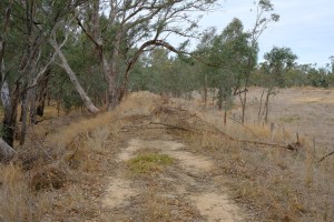
Track and Road Surfaces
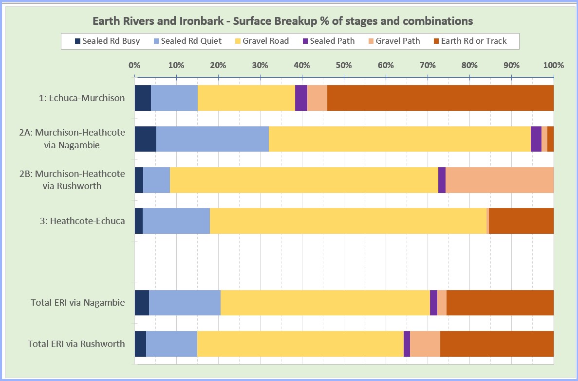
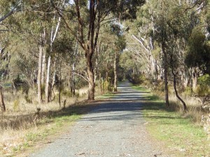
Dirt is the new gravel. An unusual feature of the ERI is the extent of dirt riding. Approximately 100 km of the ERI is earth, silt or clay roads and tracks. Irrespective of which overall route riders choose, over 25% will be on dirt.
Various forms of gravel and path make up the largest proportion of the route (over 50%).
The graphs and table below show the breakup of the various surface types. Click on either image to open slideshow.
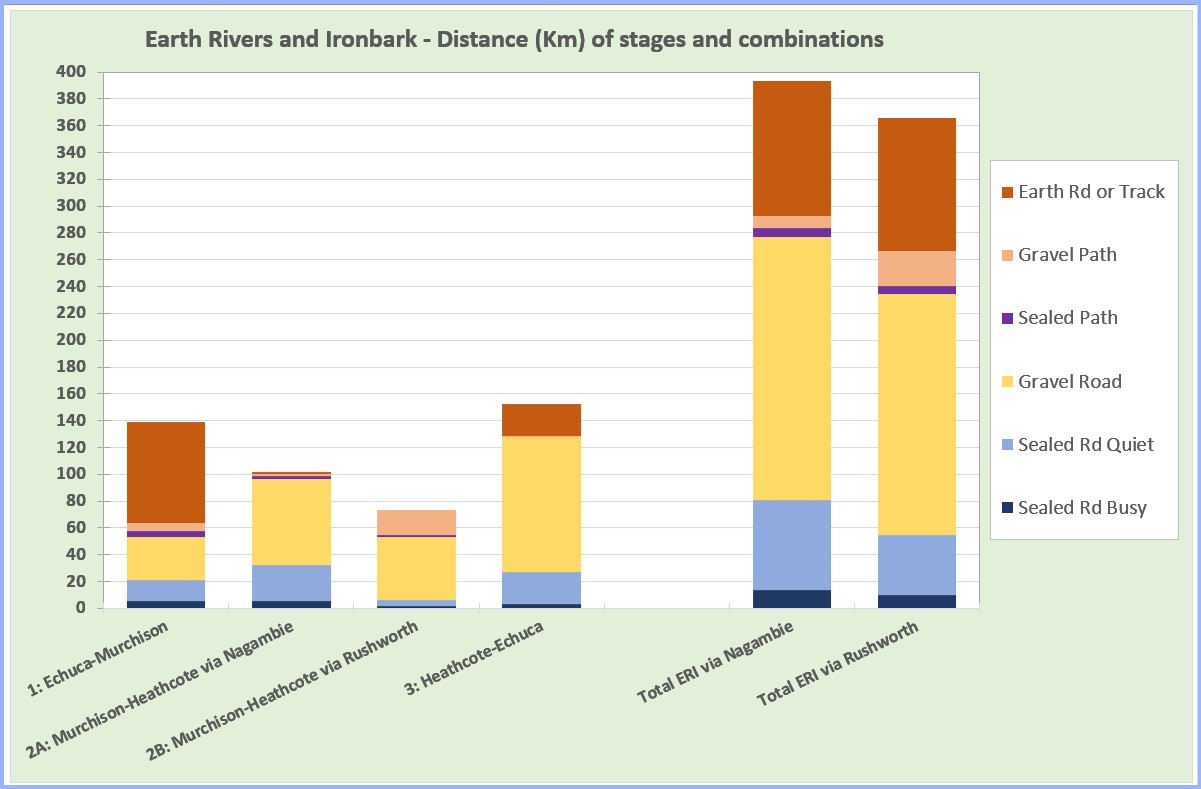
| Surfaces | Full ERI via Nagambie (km and %) | Full ERI via Rushworth (km and %) |
|---|---|---|
| Earth / Silt / Clay | 100.3 (26%) | 98.8 (27%) |
| Gravel Path | 9.0 (2%) | 26.5 (7%) |
| Sealed or Solid Path | 6.7 (2%) | 5.5 (2%) |
| Gravel Road | 196.3 (50%) | 180.0 (49%) |
| Sealed Road – Quiet | 67.2 (17%) | 44.6 (12%) |
| Sealed Road – Busy | 13.8 (4%) | 10.0 (3%) |
| Total | 393.3 (100%) | 365.4 (100%) |
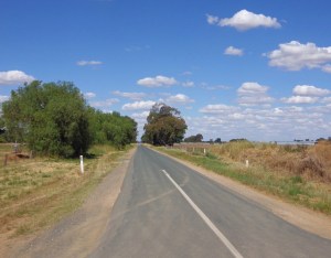
Only 15% and 21% of the ERI is sealed. Just 3-4% of the route is classified as busy sealed roads indicating significant traffic. More detail about busy sealed roads is provided below.
.
Sealed Roads with Significant Traffic
The ERI route has few high traffic sealed roads (3-4%). Even better, the busy roads included are on the low end of the “busy” spectrum.
The Department of Transport and Planning (DTP), formerly VicRoads, is the road and traffic authority in Victoria. DTP has a hierarchy of roads – Freeways, ‘M’ roads, ‘A’ roads, ‘B’ roads, and ‘C’ roads. These designations indicate a decreasing level of importance and traffic. Further down the hierarchy there are LGA or Council roads with less traffic again.
The highest categorised (most traffic) sealed road on the ERI route is 1 km of ‘B’ road. The rest are ‘C’ roads and LGA roads (see table below).
| Distance of Busy Sealed Road in each Stage (Km) | Freeway, ‘M’ or ‘A’ Roads | ‘B’ Roads | ‘C’ Roads | LGA Roads | Total Sealed Busy |
|---|---|---|---|---|---|
| ERI #1 – Echuca to Murchison | – | – | 5.5 | – | 5.5 (4%) |
| ERI #2A – Murchison to Heathcote via Nagambie | – | – | 3.8 | 1.5 | 5.3 (5%) |
| ERI #2B – Murchison to Heathcote via Rushworth | – | – | – | 1.5 | 1.5 (2%) |
| ERI #3 – Heathcote to Echuca | – | 1.0 | – | 2.0 | 3.0 (2%) |
.
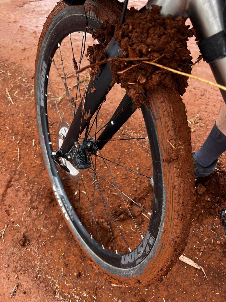
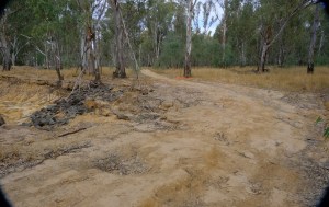
Hero or Villain – Clay, Floodplains and Obstacles
Clay – hero and villain (no.1)
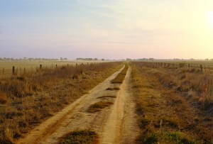
The dirt and clay roads are a highlight of the ERI route. They set it apart from other rides. In a world that is increasingly digital and electronic, opportunities to disconnect, touch earth and get grounded are valuable. The route deliberately includes earth roads and tracks where they are available and scenic. They comprise over 25% (around 100km) of the ERI.
However, this also creates a problem. Dirt is a living thing, it contains many small animals and millions of micro organisms. It changes in response to its environment. Most of the local dirt roads and tracks have a high clay content. When rain starts, dirt and silt surfaces on a clay base liquefy and become very slippery. It is difficult to stay upright.
As the rain continues, water seeps deeper. The clay turns into sticky, dark red mud which clogs wheels and will eventually stop progress.
The best option is to avoid these dirt roads and tracks in wet weather until they dry out.
- Allow 3 days of minimal rain during the warmer summer and autumn months.
- Allow around 4 weeks of minimal rain for the saturated dirt roads to dry out at the end of winter.
There may still be puddles in pot holes after those periods, but you should be able to ride around them.
Conversely, gravel roads are less affected by water so they stay rideable even when it is wet.
Therefore, it is possible to ride a version of the ERI when the earth sections are effected by water. Alternative route GPX files are provided to help riders avoid wet earth and clay sections (see below).
.
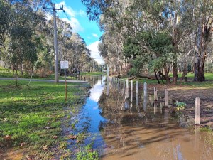
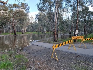
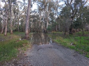
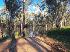
Floodplain – hero and villain (no.2)
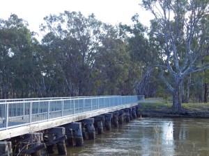
Another highlight of the ERI is the opportunity to ride on floodplains in National and State Parks. In particular, the stage from Echuca to Murchison includes long stretches of dirt track along floodplain.
The floodplains tracks provide a great ride experience. Dirt tracks and natural forest are highlights where you can enjoy river views and free camping. The area has many native animals and birds, and minimal vehicle traffic.
The river floodplain Parks also allow riders to avoid developed urban areas unless the riders want to stop for amenities.
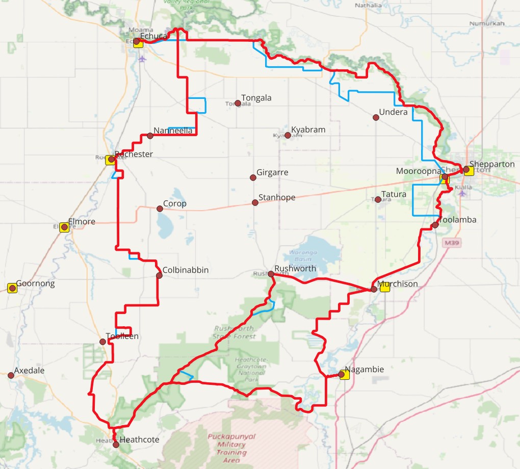
For example, the ERI route passes through the middle of Shepparton / Mooroopna. See the red line on the map to the right. This allows the ERI to avoid the traffic and urban development arising from a city of 50,000 people.

However, it is important to understand why these floodplains still exist. Floodplains are low lying natural areas along the river banks. These low areas are the first to flood as the river rises. It is expensive to build up and develop the floodplains and make the ground higher than previous flood levels. Therefore, floodplains are often left till last to develop or are only used for recreation.
Moreover, leaving floodplains open and undeveloped is a flood mitigation strategy. When a flooding river spreads out onto its floodplain, the floodplain provides an emergency storage channel for the floodwater. This prevents higher river levels and water flow speeds which would cause more damage to nearby developed areas.
The photos below show parts of the ERI route flooded in 2022 (click on any image to open slideshow).
An added complication is the Murray Darling Basin Plan (MDBP). This plan added more water into the Goulburn River for four reasons.
- Firstly, the MDBP added environmental flows into the Goulburn to raise the river level.
- Secondly, the MDBP moved water for irrigation into the Goulburn River. Previously, local irrigation had used a separate system of dedicated channels and storages.
- Thirdly, the MDBP allowed private ownership of water separate from land-holding and beyond the current year. This means more water is stored in Lake Eildon, and for longer periods. In wet years, two things happen. First, river levels are higher. Second, Eildon Dam is now more likely to fill and have to release even more water into the high rivers.
- Finally, the MDBP was developed as a plan for addressing forecasts of reducing rainfall and ongoing water scarcity. The Plan did not consider the full implications of its changes in seasons when there would be above average rainfall.
Environmental water releases from Lake Eildon are intended to raise the Goulburn River water level. Sometimes, the water level is raised high enough to overflow the river’s banks onto the floodplain. This is deliberate and often done in early spring to stimulate plant growth on the banks and floodplain. This flush also improves river water quality and encourages native fish to breed.
This means riders need to monitor local rainfall records, River levels and Dam releases when planning rides.
Use the following links to monitor Goulburn River levels:
- Water Releases from Lake Eildon. Water releases for environmental flows or irrigation can cause more flooding of Goulburn River ERI tracks than local rainfall.
- Goulburn River at Shepparton. The local floodplain ERI tracks are usually dry if the river level has not been above 6 metres recently.
- Goulburn River at McCoys Bridge. McCoys bridge is about half way between Echuca and Shepparton. The local floodplain ERI tracks are usually dry if the river level has not been above 6 metres recently.
Riders should monitor river levels themselves; do not rely on media reports. Often Media does not report inundation of floodplain (including ERI tracks) when flooding is below the “minor flood” level. The terms “minor flood” or “minor flood warning” usually refer to flood water reaching the boundaries of private properties.
See the section below – Understanding Flood Risk – for further information about when floods are more likely to occur.
.
Track Obstacles – hero and villain (no.3)
The ERI route combines sections of smooth track and gravel with more demanding trail features. Challenges include gullies, floodways, sand patches, rutted tracks, and fallen trees and branches.
The first thing to understand is that these features exist and riders should expect to have to negotiate them. Think of the challenges as Type 2 fun waiting to become a good story and photo. See pics below for examples (click on any pic to open slideshow).
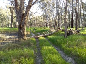

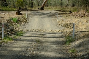
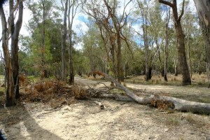
Riders who enjoy a challenge will find these moments add to the adventure rather than slow it down. All the challenges are for relatively short distances. Even beginner bikepackers can negotiate them by walking for a short period.
The majority of the obstructions will be in National Parks on the stage between Echuca and Murchison. However, they can occur anywhere. The low traffic usage on much of the ERI route means obstructions are frequently not reported or cleared. Parks Victoria staff may even leave trees across tracks to deter 4WD drivers from accessing more fragile sections of track.
For more information about negotiating the 4 gullies south of Shepparton see this link – Shepparton Regional Park Gullies.
.
Best times to ride
Part of the Get Grounded philosophy is to align cycling to our surroundings. One of things I like about this approach is it makes us much more aware of the local environment. Travelling in a car or some form of mass transport we move in a separate, sealed, controlled space. Whereas, on a bike we are open and very exposed to the local surroundings, whether natural, constructed or human. To make great ride plans we are forced to understand what is around us and how that changes over time. I think this is a good thing.
In short the ERI can be ridden all year. Although, in SE Australia there is usually less riding everywhere during the colder winter months. However, some times are more attractive than others. Also some riding approaches and stages are more suited to different situations.
When is the Weather Best?
Echuca and Heathcote are two towns on the route. Echuca is at the north end, Heathcote is at the south end. Together they represent the range of weather conditions over the route.
The following graphs show the weather for Echuca and Heathcote over the year. Click on either image to open slideshow.

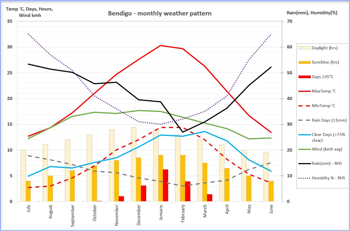
The table below looks at various weather conditions by month and the best options for riding that month.
| Month | Normal Weather Pattern | Implications for Ride Plans |
|---|---|---|
| July | Higher rainfall and number of rainy days. Short days, with cloud cover, low temperatures and high humidity. Dirt tracks and earth roads likely to be saturated. | Better for short stages, avoid dirt and earth sections. |
| August | Higher rainfall and number rainfall days. Short days, with cloud cover, low temperatures and high humidity. Dirt tracks and earth roads likely to be saturated. | Better for short stages, avoid dirt and earth sections. |
| September | Slight decrease in rainfall and number of rainy days. Increasing day length, sunshine duration, wind and clear days start to dry out the dirt tracks and earth roads. | Better for short stages, avoid dirt and earth sections. |
| October | Drier now. Less rainfall and rainy days. Longer days with more sunshine, clear days and higher temperatures. Start of windiest period in year. Highest risk of occasional floods. | Good for short stages. Possible to do full loop if no flooding. Consider forecast wind direction. Check Goulburn River level if riding Echuca-Murchison stage. |
| November | Drop in rainfall and temperature into 20s. Daylight, sunshine, clear days all increasing. Occasional days in 30s, but low humidity. Winds continue. Highest risk of occasional floods. | Good for short stages. Good for Full loop if no flooding. Consider forecast wind direction. Check Goulburn River level if riding Echuca-Murchison stage. |
| December | Rainfall and rainy days continue to decrease. Daylight, sunshine and clear days still increasing. Occasional days in 30s, but low humidity. Winds continue. | Good for short stages. Good for Full loop if no flooding. Consider forecast wind direction. |
| January | Lowest rainfall and highest temperatures in the year. Several days over 35’C, but with low humidity. Sunshine and clear days still increasing. Wind speeds start to decrease. | Good for short stages. Good for Full loop if moderate temps forecast. Consider forecast wind direction. |
| February | Lowest rainfall and highest temperatures in the year. Several days over 35’C, but with low humidity. Sunshine and clear days at peak. Wind speeds still declining. | Good for short stages. Good for Full loop if moderate temps forecast. Consider forecast wind direction. |
| March | Rainfall and rain days are still low. Max temperatures moderating and humidity still low. Peak of clear days and wind speeds still decreasing. | Start of best period for planning the Full loop. Also excellent for short stages. Check forecasts for wind direction and rare hot spells. |
| April | Rainfall and rain days are increasing but still low. Max temperatures moderating and humidity still low. Daylight, sunshine and clear days all deceasing, but still good. Wind speeds continue to decrease. | Best period for planning the Full loop. Also excellent for short stages. Check forecasts for wind direction and rain spells. |
| May | Rainfall and rain days are increasing. Max temperatures in high teens. Daylight, sunshine and clear days continue to deceasing. Average wind speeds at lowest level for year. | Cusp of season end, weather is more variable. End of period for the Full loop. Good for short stages but important to check forecasts for cold and rain spells, and wind direction. |
| June | Higher rainfall and number of rainy days. Short days, with cloud cover, low temperatures and high humidity. Dirt tracks and earth roads likely to be saturated. | Better for short stages, avoid dirt and earth sections. |
As suggested above, the weather in some months is better suited to doing the full 400 km loop. The weather in other months is better suited to riding shorter individual stages.
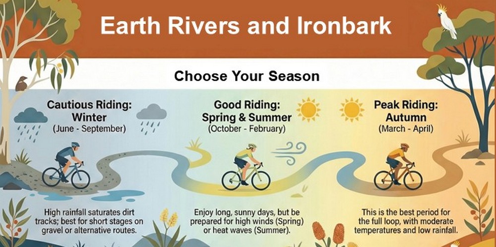
Infographic – Best Times to Ride.
Taking this further, different stages of the route are affected by weather variations in different ways. Use the following table to choose individual stages that will be less affected by adverse weather months. See the table below
| Impact on individual stages by weather condition | 1 Echuca to Murchison | 2a Murchison to Heathcote via Nagambie | 2b Murchison to Heathcote via Rushworth | 3 Heathcote to Echuca |
| Rainfall | Most affected because it has the most dirt and earth tracks | Less affected because mostly gravel or sealed road | Least affected because mostly gravel on rolling hills slopes | Affect varies because stage is a mix of some earth roads with less affected surfaces |
| High winds | Trees provide some shelter in national parks | Some shelter in parks and forests | Some shelter in parks and forests | Most exposed stage. However, wind speeds are lower at the Echuca end of ERI in Autumn. |
| Flooding | Most affected because tracks run along Goulburn River floodplain. | Less affected. | Less affected | If Murray River floods, river tracks may be inundated at the Echuca end. If Campaspe River floods, Rochester township may not be accessible. |
| High temperatures | Shade from trees. No amenities available between Echuca and Shepparton (approx 100km) | Shade from trees. No amenities available between Nagambie and Heathcote (approx 60km) | Shade from trees. No water available between Rushworth and Heathcote (approx 55km). | Less shade, more exposed. Longest stretch between amenities is about 45km. |


.
Be Aware of Regular Festivals, Plant Seasons, Community Events and Markets
Some riders might be attracted to specific events that occur along the route. It adds the immersive experience if you are aware of what is happening in the environment around you. Towns are often busier at major event times. Riders should be aware they may have to book earlier for meals or accommodation at these times.
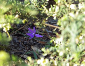
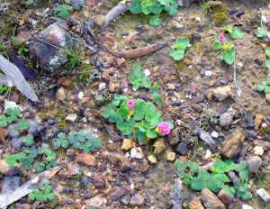
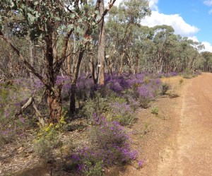
Seasonal plant changes offer scenic interest at different times of the year as shown in the examples below. Click on any image to open slideshow.


See the table below for the timing of some events, and the stages and locations most affected.
| Month | 1 Echuca to Murchison | 2a Murchison to Heathcote via Nagambie | 2b Murchison to Heathcote via Rushworth | 3 Heathcote to Echuca |
|---|---|---|---|---|
| July | Echuca Winter Blues Festival. | Vines bare | Echuca Winter Blues Festival. Vines bare. | |
| August | Vines start to grow new leaves. | Bright yellow Wattle bloom in Ironbark forest | Vines start to grow new leaves | |
| September | Vines covered in bright green leaves. New Grain crops are emerald green. | Wildflower season in Ironbark forest. Wet years have more wildflowers | Bright yellow Canola fields. Vines covered in bright green leaves. New Grain crops are emerald green. | |
| October | Heathcote Wine and Food Festival | Wildflower season in Ironbark forest. Heathcote Wine and Food Festival | Heathcote Wine and Food Festival | |
| November | Shepparton Springnats Warning car hoons about! | |||
| December | ||||
| January | Grain crops – now golden, are harvested. | Grain crops – now golden, are harvested. | ||
| February | Echuca Riverboats Music Festival | Nagambie on Water Festival | Echuca Riverboats Music Festival | |
| March | Grape harvest. Nagambie – several Rowing events on lake. | Easter – Rushworth Heritage Festival | Grape harvest | |
| April | Easter – Rushworth Heritage Festival | |||
| May | Autumn – vine leaves change colour and fall. | Colbinabbin Silo Art Picnic & Wine Festival Autumn – vine leaves change colour and fall. | ||
| June | Vines bare | Vines bare. |
If your ride visit coincides with a local Farmers Market there may be extra food and drink choices available. Towns are also busier at market times so you may have to book earlier for meals or accommodation. See the list of Markets along the ERI route below.
| Town | Site | Date | Times |
| Echuca | Aquatic Reserve, 2 Heygarth St. | 1st and 3rd Saturdays of month | 8:30 am – 12:30 pm |
| Mooroopna | WB Ferrari Park | last Sunday of month | 9:00 am – 1:00 pm |
| Nagambie (Town) | Lakeside, Jacobsons Outlook. | 1st Saturday of month | 9:00 am – 1:00 pm |
| Nagambie (Tahbilk Winery) (4 km off route) | Tahbilk Winery, O’Neils Road, Nagambie. | 4th Sunday of month | 10:00 am – 2:00 pm |
| Rushworth | Village Green | 3rd Saturday of month | 8:30 am – 1:00 pm |
| Heathcote | Barrack Reserve | 1st Saturday of month | 8:30 am – 1:00 pm |
Infographic – Flexible Adventure.
Do you want to research some short ride ideas on the ERI? The Earth Rivers and Ironbark Planner is very good for this. The Planner uses AI to answer your questions and generate detailed ride plans for proposals.
.
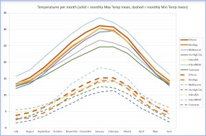
Ride the ERI when it has better weather than other riding areas?
We’ve considered at the best times and the best approaches to ride the ERI relative to the full year. There are also times when ERI has a better riding environment than the environment available elsewhere in SE Australia. These weather advantage times are also good times to come to the ERI.
I’ve compared weather in the ERI region compared to weather in 5 other potential riding areas in SE Australia. The comparison locations are:
- Victorian High Country (represented by Bright)
- Southern Victoria (represented by Melbourne)
- Inland South Australia (represented by Nuriootpa in Barossa Valley)
- Inland New South Wales (represented by Dubbo)
- Tasmania (represented by Launceston)
A ‘ride window’ is the period when an area’s conditions would be rated good to great. Weather data shows the ERI area has a longer ride window than other popular ride destinations in SE Australia.

For example:
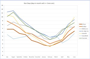
- Rain Days: Inland Australia has fewer Rains Days in every month of the year.
- Rain Days: The ERI area has the lowest, or equal lowest, Rain Days from October through to April.
- Monthly Rainfall: Only Inland SA has less monthly Rainfall than the ERI area from October to April.
- Cloud: The ERI area has the highest number of Clear Days from December through to May.
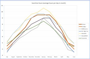
- Sunshine: Inland SE Australia has more Sunshine Hours each day all through the year.
- Wind: The ERI area has less average wind speed all year than other inland plains areas (i.e. Inland SA and Inland NSW).
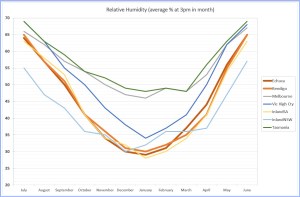
- Humidity: The ERI area has the lowest, or equal lowest, Humidity from November through to March.
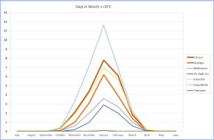
- Very High Temps: The ERI area and InlandSA have comparable number of days above 35’C. InlandNSW has the most days with very high temperatures. The very hot days on the inland plains areas coincide with very low humidity.
- Daily Temperature range:
- During the cool season, from April to September, the ERI and Melbourne have similar daily max temps. Melbourne has warmer overnight min temps.
- During the warm season, from October to March, the ERI has higher daily max temps and warmer overnight minimums.
To verify these claims, click on any graph below for a slideshow showing a comparison of weather variables between regions.


The ERI route also has other advantages beyond the weather. When compared to other potential riding regions in SE Australia, the ERI route offers:
- Better access by train – 6 stations directly on the route, and 8 other stations within riding distance.
- Great placement of regional towns and locations with commercial accommodation and food along the route.
- Regular opportunities for both free camping and commercial camping all along the route.
- Good linkage to other riding routes. Potential riders can bundle the ERI with these other routes to create a more epic riding adventure.
.
Be Aware of the Risk for Irregular Floods
The ERI river tracks are not going to flood every year. However, when planning to ride the ERI, riders should be aware of flood risk and know how to mitigate it. In short –
- The MDBP has changed the Goulburn River level pattern. The most likely time the stage 1 tracks will flood is now spring – particularly October and November.
- However, this won’t happen every year. At worst it will probably happen every 4th year or more.
- Riders should check Goulburn River levels online in advance when they are planning their ride. If levels look like going to 6m or have been above that level recently, be very cautious.
- Rainfall in the ERI area itself does not have much impact on Goulburn River levels. The area is too flat. Instead, riders should focus on Toolangi region rainfall to get an early warning of flood risk.
- When there is a risk of stage 1 being flooded riders can still ride the ERI.
- Ride other stages as single stages or combine them.
- Use the wet weather alternative route to avoid the flood prone areas of stage 1.
For more detail about Understanding Flood Risk see the detailed section below.
.
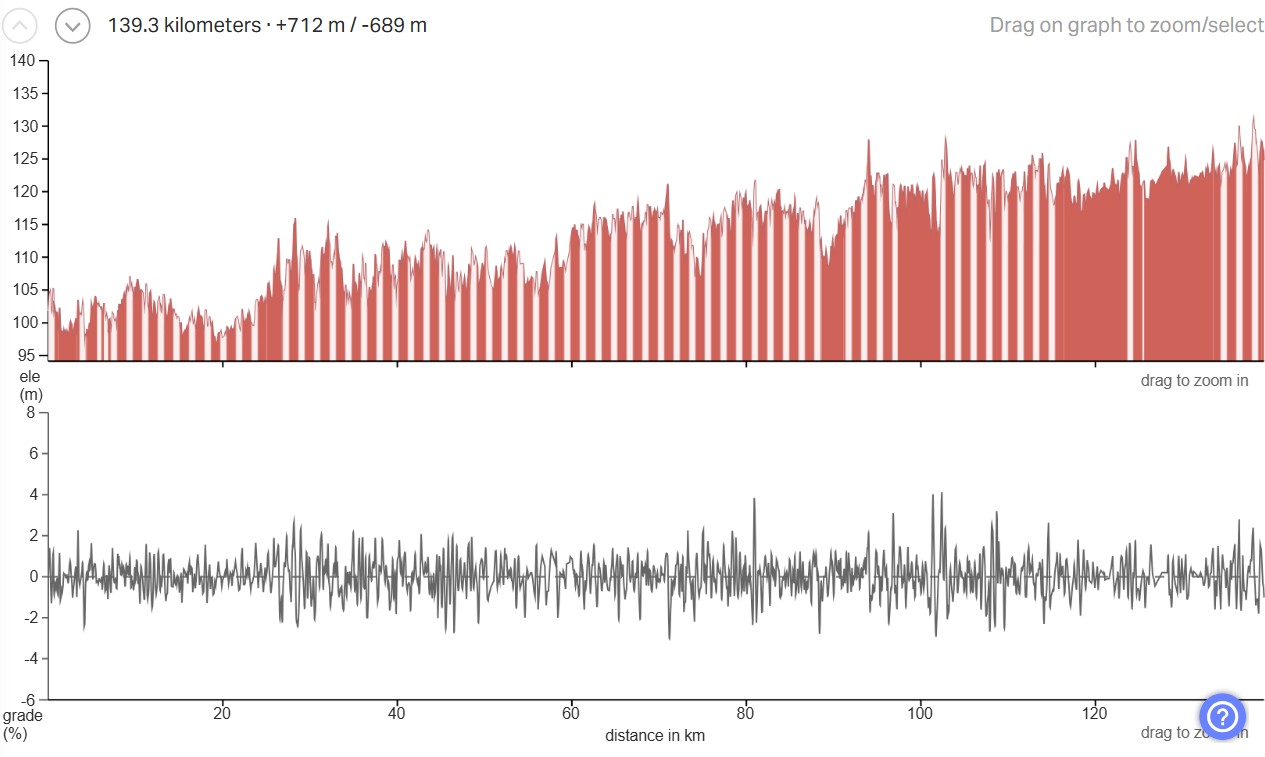
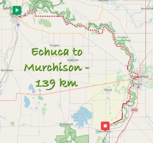
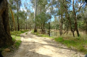
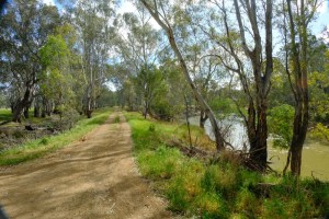
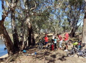
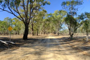
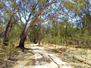
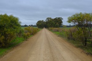
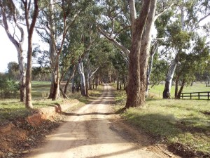
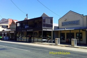
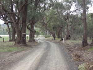
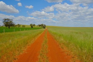
Stage 1 – Echuca to Murchison
Stage 1 is all about long stretches of river tracks. From Echuca, the ERI travels east along the Murray, then follows the Goulburn south east all the way to Murchison.
- Distance:
- 139 km
- Highlights:
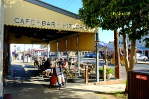
- Echuca historic port district.
- River track sections near Echuca, and from Yambuna to Toolamba.
- Long stretches through State and National Parks along these Rivers with lots of native birds and animals.
- Junction of Murray and Goulburn Rivers.
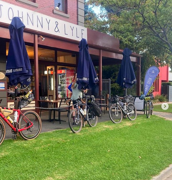
- Scenic country roads. Towns with bakeries, cafes, pubs and country hospitality.
- Surface breakup:
- Earth / Silt / Clay (54%).
- Gravel Road (23%). Gravel path (5%). Sealed path (3%).
- Quiet sealed road (11%). Busy sealed road (4%).
- Terrain:
- Flat. There is only 25m variation in elevation over the whole stage.
- Train Stations on route:
- Echuca, Shepparton, Mooroopna, Murchison East.
- GPX file:
- See GPX File section below
- Best Time to Ride:
- March, April
- Amenities, Services and Accommodation:
- For full details see the Amenities, Services and Accommodation section below.
- Ride Planning Suggestions:
- Suggested ride time – 2 to 3 days.
- Take advantage of Train Stations at both ends.
- The stage can be ridden in either direction.
- Avoid riding when it is raining, extreme heat or strong northerly winds.
- Monitor fire danger, rainfall and recent flood reports.
- Monitor river levels of Goulburn River (as detailed in Floodplains section above).
- Have a plan to deal with stretch between Echuca and Shepparton. This 100 km section has no shops or amenities on the route.
- If you are free camping in the bush Parks, plan to set your camp about 5-10 km away from Shepparton. Travellers and homeless people sometimes set up camps in the bush close to Shepparton.
- Carry enough equipment and supplies to survive overnight in case of mishap on isolated tracks.
- Specific Hazards and Risks for this stage:
- Long sections of this stage are in Parks and Reserves without amenities or drinking water. River banks are steep and muddy. It is usually easier to carry your water than get water from the river.
- You are unlikely to see any other people during the long stretches in the Parks along the river. You need to be capable of looking after yourself and your bike. You should have an emergency plan that does not rely on a mobile phone connection.
- Avoid rain and flood periods – 54% (75 km) of this route is earth roads and clay tracks. Earth roads and tracks are not rideable when wet. Use the alternative wet weather route instead.
- There are 4 gullies on this route between Mooroopna and Toolamba. For more information on how to deal with the gullies see this page – Technical: Yellowbelly Track Gullies.
- See Hazards and Risks section below for risks that are common for all stages.
- Connections to Other Bike Trails:
- Nil at present.
- Distance between potential supply locations:
| Point A | Ride Distance A to B (Kms) | Point B | Comments |
|---|---|---|---|
| Echuca | 98 | Shepparton | Isolated tracks through National Park. Off-route options: – Wakiti Creek Resort (shop) – Undera town (pub and general store) |
| Shepparton | 4 | Mooroopna | |
| Mooroopna | 16 | Toolamba | Isolated tracks through State Park. Toolamba: – Public rest area with water and toilets. – Hotel with limited days and hours. |
| Toolamba | 21 | Murchison |
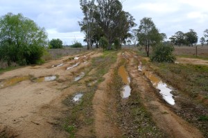
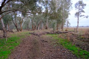
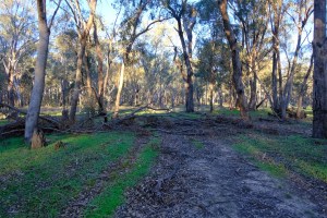
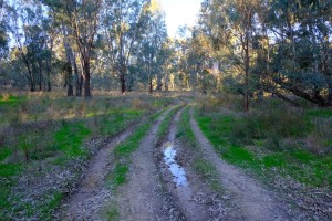
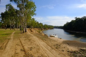
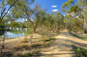
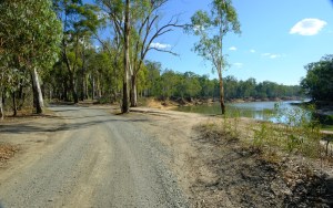
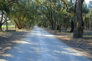
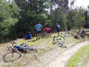
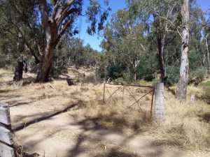
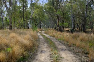
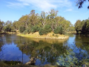
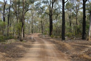
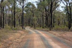
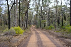
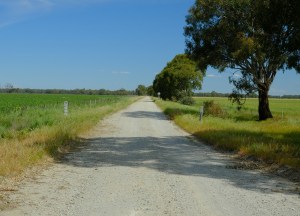
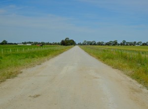
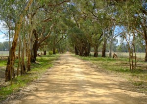
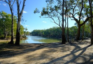
Photos: Some pics from this route are below. Click on any thumbnail to open slideshow


.
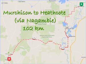
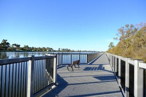
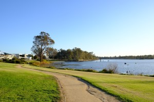
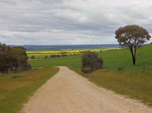
Stage 2A – Murchison to Heathcote via Nagambie
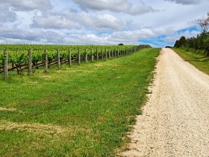
Stage 2A is mixed. There are sections through the outer edges of the Ironbark forest. But also sections with agricultural development – farms, vineyards and horse studs. Gravel is the major road surface.
- Distance:
- 102 km
- Highlights:
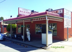
- Scenic country roads and small towns with bakeries.
- Nagambie lakeside path
- Potential for Winery stops with food options.
- Ironbark forest with native birds and animals.
- Surface breakup:
- Earth / Silt / Clay (1%).
- Gravel Road (63%). Sealed path (2%). Gravel path (1%).
- Quiet sealed road (27%). Busy sealed road (5%).
- Terrain:
- The Heathcote end is higher. There is only about 150 m of total change in elevation. But it will feel like more climbing due to regular small rollers.

- Train Stations:
- Murchison East, Nagambie.
- Off-route – Avenel, Seymour and Tallarook.
- GPX file:
- See GPX File section below
- Best Time to Ride:
- September to December
- March to May
- Amenities, Services and Accommodation:
- For full details see the Amenities, Services and Accommodation section below.
- Ride Planning Suggestions:
- Suggested ride time – 1 to 2 days.
- The stage can be ridden in either direction.
- Avoid riding when it is raining, extreme heat or strong northerly winds.
- Monitor fire danger, and forecasts for wind, temperature and rainfall
- Hazards and Risks:
- Rolling gravel hills with a loaded bike will be tiring if you are not experienced.
- There is a short section in the forest where rainfall and creek runoff can pool across the track. Take the alternative wet weather GPX with you to detour around this if needed.
- See Hazards and Risks section below for risks that are common for all stages.
- Connections to Other Bike Trails:
- Great Victorian Rail Trail (GVRT) – Connect to GVRT from Nagambie using Yellowbelly Track route.
- O’Keefe Rail Trail runs from Heathcote to Bendigo where it connects with Goldfields Track.
- Curve Border Run route connects to Melbourne from Heathcote.
- Distance between potential supply locations:
| Point A | Ride Distance A to B (Kms) | Point B | Comments |
|---|---|---|---|
| Murchison | 36 | Nagambie | Although no shops between towns, there are occasional farm houses for emergency support. |
| Nagambie | 66 | Heathcote | Although no shops between towns, there are occasional farm houses for emergency support. |
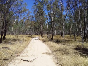
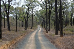
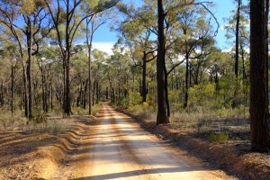
Photos: Some pics from this route are below. Click on any thumbnail to open slideshow


.
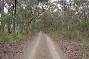
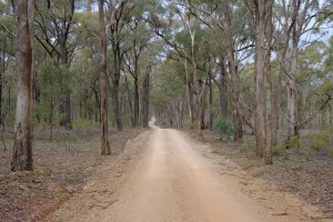
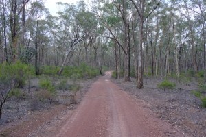
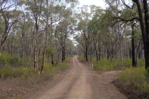
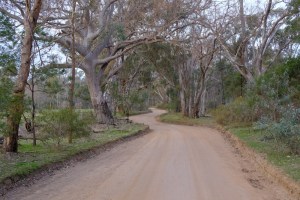
Stage 2B – Murchison to Heathcote via Rushworth
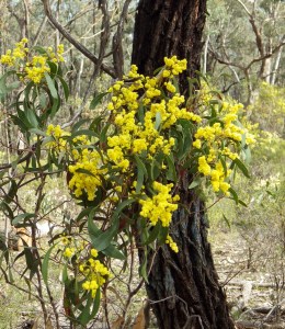
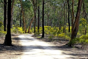
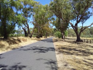
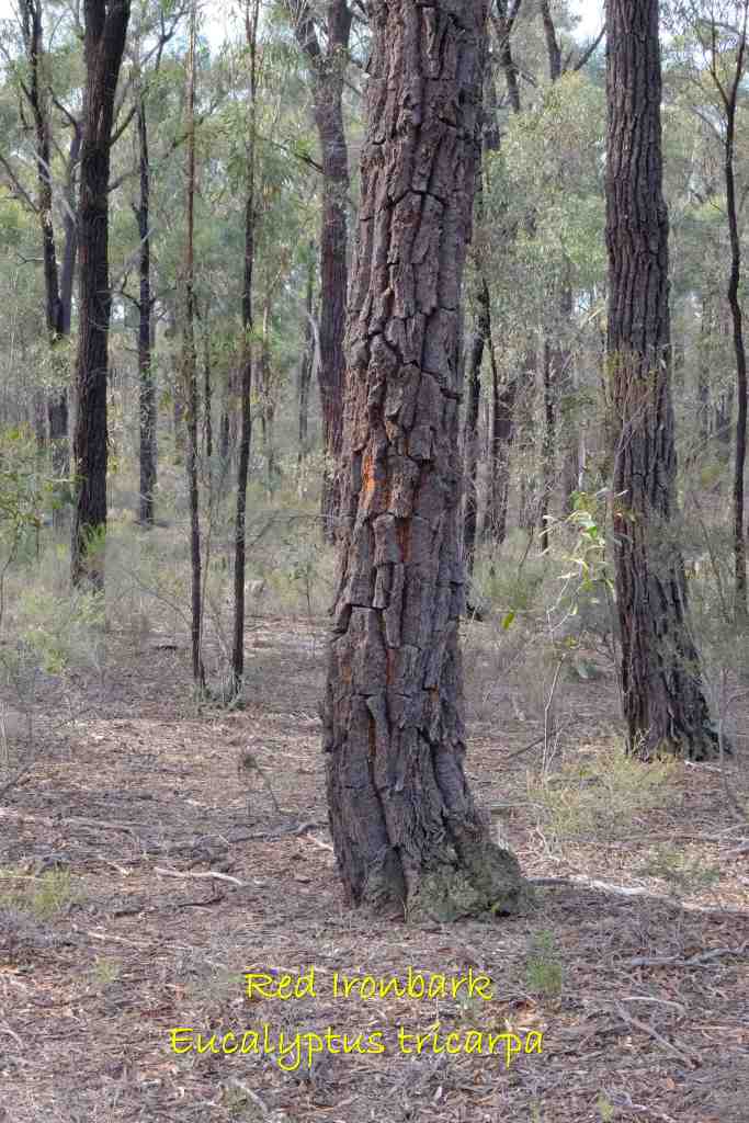
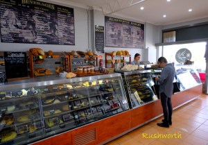
Stage 2B has 2 sections – 20 km on a gravel rail trail and 54 km through the Ironbark Forest. The historic gold rush town of Rushworth sits where the sections change. The Rushworth-Heathcote Ironbark forest is the largest stand of Ironbark trees in the world.
The main species in the forest is Red Ironbark (eucalyptus tricarpa), a hardwood with a reddish colour. Young trees are very thin and dark, often black. As the trees mature the trunks broaden and turn more grey.
European settlers named the trees Ironbark because the black deeply ridged bark looked like dried molten cast iron. Despite its name, the bark is not particularly hard or strong. It is formed by sap running down the trunk though.
Local wallabies evolved to be black to match the trees. You won’t see them until they move, often very fast and erratically.
- Distance:
- 74 km
- Highlights:
- Murchison Rushworth Rail Trail
- Rushworth historic town.
- Ironbark forest – largest in the world.
- Rosé Gravel (a step up from champagne gravel).
- Spring flowering seasons of wattle and wildflowers.
- Surface breakup:
- Earth / Silt / Clay (0%).
- Gravel Road (64%). Gravel path (26%). Sealed path (2%).
- Quiet sealed road (6%). Busy sealed road (2%).
- Terrain:
- The Heathcote end is higher. There is only about 150 m change in overall elevation. But it will feel like more climbing due to constant small rollers.

- Train Stations:
- Murchison East.
- Off-route – Bendigo (via O’Keefe Rail Trail).
- GPX file:
- See GPX File section below
- Best Time to Ride:
- Late August to December.
- March to May
- Amenities, Services and Accommodation:
- For full details see the Amenities, Services and Accommodation section below.
- Ride Planning Suggestions:
- Suggested ride time – 1 to 2 days.
- Carry enough water and food to complete the isolated section between Rushworth and Heathcote.
- Carry enough supplies and equipment to survive overnight in case of a mishap on isolated tracks.
- Avoid riding when it is raining, extreme heat or strong northerly winds.
- Monitor fire danger, and forecasts for wind, temperature and rainfall
- The stage can be ridden in either direction.
- Hazards and Risks:
- Plan for the long forest section between Rushworth and Heathcote. No water or food is available on this section.
- Riding constant rolling gravel hills on a loaded bike will be tiring if you are not experienced.
- You are unlikely to see any other people during the long stretch in the forest. You need to be capable of looking after yourself and your bike. You should have an emergency plan that does not rely on a mobile phone connection.
- There is a short section in the forest where rainfall and runoff can pool across the track. Take the alternative wet weather GPX with you to detour around this if needed.
- See Hazards and Risks section below for risks that are common for all stages.
- Connections to Other Bike Trails:
- O’Keefe Rail Trail runs from Heathcote to Bendigo where it connects with Goldfields Track.
- Curve Border Run route connects to Melbourne from Heathcote.
- Distance between potential supply locations:
| Point A | Ride Distance A to B (Kms) | Point B | Comments |
|---|---|---|---|
| Murchison | 20 | Rushworth | Rail Trail runs parallel to highway. Scattered houses and farms along the section. |
| Rushworth | 54 | Heathcote | No drinkable water between the towns. Dams are likely to have mining residues. Route goes through middle of State Forest. You are unlikely to meet other people. |
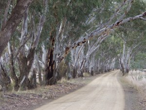
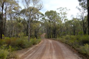
Photos: Some pics from this route are below. Click on any thumbnail to open slideshow.


.
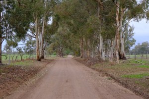
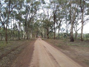
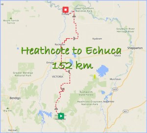
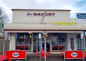
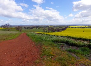
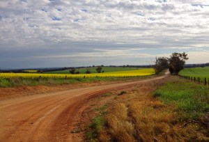
Stage 3 – Heathcote to Echuca
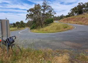
The south end of this stage runs parallel to the Mt.Camel range for 70 km and crosses the range 3 times. The rich red soil of the Mt.Camel range is the home of the Heathcote wine region. The rest of the stage crosses the flat plains mostly on quality gravel or sections of double track. The northern end has dirt river tracks along the Murray River.
- Distance:
- 152 km
- Highlights:
- Mt Camel range running north out from Heathcote.
- Vineyard stops with food options.
- 3 short steep scenic climbs crossing the Mt.Camel range.
- Scenic country roads and small towns with pubs, cafes, bakeries or general stores.
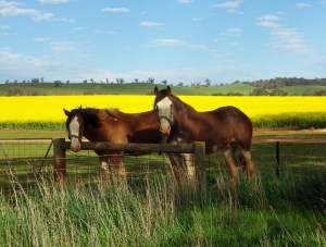
- Bright yellow canola fields in September
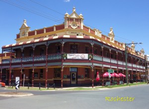
- Painted silos at Colbinabbin and Rochester
- Double track segments, including a continuous 10 km stretch.
- River tracks along the Murray River.
- Echuca historic port district.
- Surface breakup:
- Earth / Silt / Clay (15%).
- Gravel Road (66%). Gravel path (1%). Sealed path (0%).
- Quiet sealed road (16%). Busy sealed road (2%).
- Terrain:
- The total climbing on the stage is about 1 km, which is not huge over a 152 km ride. However, the climbing comes in 3 short bursts with slopes up to 11%.
- These hills might be too steep for some riders with loaded bikes. However, they are short enough to be walked, and an opportunity to snag some postable scenic pics.

- Train Stations:
- Rochester, Echuca
- Off Route – Bendigo, Epsom, Huntly, Goornong, Elmore.
- GPX file:
- See GPX File section below
- Best Time to Ride:
- September for Canola fields.
- October to April, but avoid heat and wind spells.
- Amenities, Services and Accommodation:
- For full details see the Amenities, Services and Accommodation section below.
- Ride Planning Suggestions:
- Suggested ride time – 2 to 3 days.
- Stage can be ridden in either direction.
- Avoid riding when it is raining, extreme heat or strong northerly winds.
- Monitor fire danger, and forecasts for wind, temperature and rainfall
- Hazards and Risks:
- Avoid rain extreme heat.
- See Hazards and Risks section below for risks that are common for all stages.
- Connections to Other Bike Trails:
- O’Keefe Rail Trail runs from Heathcote to Bendigo where it connects with Goldfields Track.
- Curve Border Run route connects to Melbourne from Heathcote.
- Distance between potential supply locations:
| Point A | Ride Distance A to B (Kms) | Point B | Comments |
|---|---|---|---|
| Heathcote | 30 | Toolleen | Route is through farmland. Toolleen town is 1 km off route. |
| Toolleen | 28 | Colbinabbin | Route is through farmland. |
| Colbinabbin | 37 | Rochester | Route is through farmland. |
| Rochester | 12 | Nanneella | Route is through farmland. |
| Nanneella | 45 | Echuca | Route is through farmland, except for the last few kms through River Murray Reserve. |
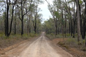
Photos: Some pics from this route are below. Click on any thumbnail to open slideshow.


.
GPX files
There are no sign posts marking the ERI route. The route avoids traffic and more developed areas. Often the roads and tracks used by ERI don’t even have road signs at intersections. Further, some ERI roads and tracks are not marked on google maps. Others are not marked in the correct location. Parts of the route travel through mobile phone and internet black spots. On much of the route you will not meet anyone to give you directions.
There is only one way to find your way around the ERI.
To avoid getting lost, it is essential riders navigate using GPX files – with local files on your device. You will not find your way otherwise. You should not try this route if you can’t navigate with GPX files and pre-download the files to your device.
If you need to improve your navigation and technical skills see this page – Navigating with GPX files.
The route GPX files are available for free on RWGPS in a collection (links are below). The files are marked private, but are available to users who have been given the link.
To access the files, all users will have to have or create a RWGPS account (there is a free option). In the past I distributed files via google drive which did not require users to create an account. However, Apple users had trouble getting files from google. Plus google has recently started requiring all users to have a google account to access files from google drive. So I will move to distributing GPX files via RWGPS and we will see how that goes. Please read the guidelines for how you can use the GPX files.
Please let me know if anyone has problems getting access to the collection or routes.
Known issues:
- If you want to send a route to your ride companions, send the Collection link. Do not send a link to an individual route. The access permission is via the Collection level. Users can only access individual routes if they start with the whole Collection.
.
ERI Collection on RWGPS
Link to ERI (Collection on RWGPS)
This collection includes:
- The 4 Routes that make up ERI.
- Suggested ride links between ERI and off-route train stations and other well known bike trails.
Once you “view” or open a route you can download the GPX file from there. Click on the big orange “Export GPX file” button and select a save location.
.
ERI – Wet Alternative Collection on RWGPS
There is also a collection of wet weather alternative routes. These routes exclude dirt roads and tracks and areas most likely to be inundated. As discussed above it is best to avoid the dirt roads and tracks in wet weather until they dry out.
- Allow 3 days of minimal rain during the warmer summer and autumn months.
- Allow around 4 weeks of minimal rain for the dirt roads to dry out during winter, or after winter.
There will still be puddles after those periods but you should be able to ride around them.
The map below shows both the ERI route and the alternative routes. Blue lines show where the alternative routes detour around the earth sections.
Use the wet alternative routes during wet weather or the drying out periods. Use this link – ERI – Wet Alternative Routes (Collection on RWGPS).
It is not possible to exclude every floodway though. There may be occasional short term flash flooding even on the wet alternative ERI routes. However, it will be easier to negotiate floodways and wet gravel, rather than long stretches of sticky mud.
.
GPX file usage and control
I expect experienced GPX users will download the GPX files for personal use. They will circulate the GPX files to their ride companions. They might make changes to the GPX files to suit their immediate ride plans. I am OK with all of this.
However, there are serious issues around version control and trying to help riders stay safe, particularly newer bikepackers.
Please understand and follow these GPX file guidelines:
- Do not re-publish the ERI gpx files. Do not upload the ERI gpx files to other sites. Do not mark the ERI gpx as public. Do not make changes to the ERI gpx files and re-publish them as ERI files or similar.
- Potential riders should be referred to this website to learn about issues, hazards and changes to amenities as they arise. They can access the link to the GPX file RWGPS Collection from this page.
- I expect the ERI gpx files will change. I will get feedback from riders, discover new tracks or expand the route. Potential riders will be much better off coming back to the master ERI file collection link on RWGPS. Multiple versions of ERI routes circulating will cause a lot of confusion, and perhaps lead to accidents.
- I do not inspect the route regularly. Circumstances change. There is no guarantee the GPX file route will be rideable when you ride. Please do your own research and expect the unexpected.
.
Amenities, Services and Accommodation
Bikepacking is not just about the riding. It is also about the stops. The towns, the food and the recovering. The new people and experiences along the way.
The ERI has many regular and interesting stopping locations along the loop. These are listed in the table below.
Locations are listed in order starting from Echuca and riding clockwise taking the Nagambie (2A) route option. The right column shows cumulative distance in kms.
| Town or Location | Food and Drink | Commercial Accom. | Camping | Train Stations | Km |
| Echuca | Many options | Many options | Commercial Parks | Echuca Station | 0 |
| River Murray Reserve | Free camping along Murray River | 8 to 12 | |||
| Wakiti Creek Resort (4 km off route) | Park shop | Commercial Park | 33 (off) | ||
| Lower Goulburn National Park (see info link below) | No Amenities. River banks are steep. Easier to carry water than forage for it. | Free Camping all through Park. Main bush areas: 27 – 48 km, 52 – 54 km, 60 – 73 km, 76 – 88 km. | 27 to 88 | ||
| Undera (7 km off route) | Undera Hotel + Undera General Store (see store details below) | Hotel (but rarely available) | Sometimes Camping near rest stop (see details below) | 81 off | |
| Shepparton / Mooroopna | Many options | Many options | Commercial Parks | Shepparton + Mooroopna Stations | 98 to 102 |
| Shepparton Regional Park (see info link below) | No Amenities. River banks are steep. Easier to carry water than forage for it. | Free Camping (1) | 92 to 114 | ||
| Toolamba | Junction Hotel. Public rest area. | Free Camping nearby in Shepparton Regional Park | 118 | ||
| Murchison | Bakery, Hotel, General store, Longleat Winery | Some | Commercial Park | Murchison East Station | 139 |
| Rushworth State Forest (see info link below) | Free Camping in forest | 151 to 155 | |||
| Nagambie | Many options | Many options | Commercial Parks | Nagambie Station | 175 |
| Major Creek Reserve | Free camping (with toilets) | 192 | |||
| Ironbark Forest (State Parks). (see info link below) | No drinkable water anywhere. *Dams have mining residues* | Free camping all through Forest Parks. Dargile site has toilet. | 203 to 208 & 219 to 231 | ||
| Town or Location | Food and Drink | Commercial Accom. | Camping | Train Stations | Km |
| Rushworth | Bakery, Cafes, Supermarket. | Limited | Commercial park. | (2B) 159 | |
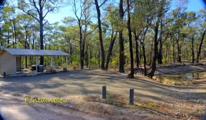
| Ironbark Forest (State Parks). (see info link below) | No drinkable water anywhere. *Dams have mining residues* | Free camping all through Forest Parks. Greens and Fontainbleau sites have toilets. | (2B) 160 to 203 | ||
| Heathcote | Many options | Many options | Commercial Park | 241 | |
| Winery Cellar Doors (1-5 km off route) | These vary a lot, research beforehand. | Some have accommodation (usually expensive). | |||
| Crosbie Nature Conservation Reserve | Free camping | 260 | |||
| Toolleen (1 km off route) | Toolleen Hotel and Store | Toolleen Hotel + some local wineries | Free Camping area in front of hotel | 271 (off) | |
| Colbinabbin | Hotel + General Store | Hotel | Camping area at Hotel | 299 | |
| Elmore (10 km off route) | Several options | Some | Commercial Park | Elmore Station | 326 (off) |
| Aysons Reserve on Campaspe River (5 km off route) | Free Camping, with facilities. | 327 (off) | |||
| Rochester | Hotels, Cafes, Supermarket | Several Options | Commercial Park | Rochester Station | 336 |
| Nanneella | General Store | 348 | |||
| Tongala (10 km off route) | Hotel, Bakery, Cafe, Supermarket | Hotel | Commercial Park | 371 (off) | |
| River Murray Reserve | Free Camping along Murray River | 381 to 385 | |||
| Echuca | Many options | Many options | Commercial Parks | Echuca Station | 393 |
| Town or Location | Food and Drink | Commercial Accom. | Camping | Train Stations | Km |
Notes to table:
- Distances (Kms) are measured taking the 2A option around the loop unless noted.
- For off-route locations the Kms include the distance from the loop to the off-route location.
- (1) If you free camp in the bush Parks near Shepparton, set your camp about 5-10 km away from town. Travellers and homeless people sometimes set up camps in the bush close to Shepparton.
.
Information Resources:
For further information on some of the locations above, see the links in the table below.
| Lower-Goulburn-National-Park | Shepparton Regional Park |
Undera General Store (not on internet) | Undera Rest Stop Sometimes Camping is available near rest stop. Call Alan to check if available. |
| Rushworth town (not up to date) | Ironbark forest notes. Ironbark forest map. |
| Wineries: For more info on Wineries and Cellar Doors along Mt.Camel range from Heathcote to the Toolleen area, see this ride – Red Ridge Ride – Heathcote Wineries Tour. | Infographic – ERI Amenities. Infographic – ERI Camping. |
| National Public Toilet Map Australian Government app. It uses your location to show nearest public toilets with details about open hours etc. | CamperMate app includes a map that shows where amenities are located in towns. CamperMate link The page includes links to download the app to your mobile. |
.
Bike Shops:
| Location | Bike Shops |
|---|---|
| Echuca | Ash Hall Cycles Echuca |
| Echuca | Giant Echuca |
| Shepparton | My Ride Shepparton |
| Shepparton | Leading Edge Cycles Shepparton |
| Off Route Towns | Bendigo – has several bike shops Seymour – Total Sports has some spares |
.
Train Access (14 Stations on or near the Route)
Three separate train lines offer access to the ERI:
- The Melbourne-Echuca line on the west side of ERI, along the Campaspe River
- The Melbourne-Shepparton line on the east side of ERI, along the Goulburn River.
- The Melbourne-Albury line connecting to NE Victoria and New South Wales.
There are 14 train stations in the vicinity of ERI. Riders from Melbourne or riders who can access the train lines have exceptional access. It is easy for them to plan rides of the full ERI loop, or just a section of it.
The Melbourne-Echuca line
On the west side, following the Campaspe River, the Melbourne-Echuca line provides stations at:
- Echuca
- Rochester
- Elmore (off route)
- Goornong (off route)
- Huntly (off route)
- Epsom (off route)
- Bendigo (off route)

Trains at the southern end of this line, between Epsom / Bendigo and Melbourne, are more frequent.
See timetable below.
.
The Melbourne-Shepparton line
On the east side, following the Goulburn River, the Melbourne-Shepparton line provides stations at:
- Shepparton
- Mooroopna
- Murchison East
- Nagambie
- Seymour (off route)
- Tallarook (off route)
Again trains at the southern end of this line, between Tallarook / Seymour and Melbourne, are more frequent.
See Timetable below
.
The Melbourne-Albury line
The Melbourne-Albury line does not intersect with the ERI directly. However, it serves a different catchment area to the other 2 lines. This line allows potential riders from NE Victoria or New South Wales to catch a train south to the ERI.
Avenel is the nearest station on the Melbourne-Albury line to the ERI. Avenel is 15 km from the ERI route.
See timetable below.
.
Train Timetables
| Line | ERI Relevant Stations (o) = off route | V/Line Link (live but V/Line often breaks the links) | PDF file (static) (might be out of date) |
|---|---|---|---|
| Echuca | Echuca, Rochester, Elmore(o), Goornong(o), Huntly(o), Epsom(o), Bendigo(o). | Melbourne-Echuca timetable | Melbourne-Echuca |
| Bendigo | Epsom(o), Bendigo(o). | Bendigo-Melbourne timetable | Melbourne-Bendigo |
| Shepparton | Shepparton, Mooroopna, MurchisonEast, Nagambie, Seymour(o), Tallarook(o). | Melbourne-Shepparton timetable | Melbourne-Shepparton |
| Seymour | Seymour(o), Tallarook(o). | Seymour-Melbourne timetable | Melbourne-Seymour |
| Albury | Avenel(o), Seymour(o). | Melbourne-Albury timetable | Melbourne-Albury |
Timetables change – sometimes temporarily because of track work or conditions. Check here for the most current timetables – V/Line Regional Timetables.
.
Use AI to Research Train Information
The Earth Rivers and Ironbark Planner has access to local train timetables. It also knows the types of carriages and booking practices on each line. It will probably provide faster and more thorough solutions to train questions than looking up timetables yourself.
.
Connections to Train Stations
The map below shows locations of the 14 train stations near the ERI route. The Train Stations are marked with a yellow square.

Not all of the 14 train stations are on the ERI route.
- 6 of the stations are in towns along the ERI route
- Echuca, Shepparton, Mooroopna, Murchison East, Nagambie, Rochester.
- The other 8 stations are within 50 km of the ERI route.
- Seymour, Tallarook, Bendigo, Epsom, Huntly, Goornong, Elmore, Avenel.
- GPX files are provided for riders to ride from these other 8 stations to the ERI route. See this Collection – ERI (Collection on RWGPS)
.
Trail Access (connections to other Bike Trails)
Some riders want to combine the ERI with other bike trails in the region. A map showing the location of other trails relative to the ERI is below.
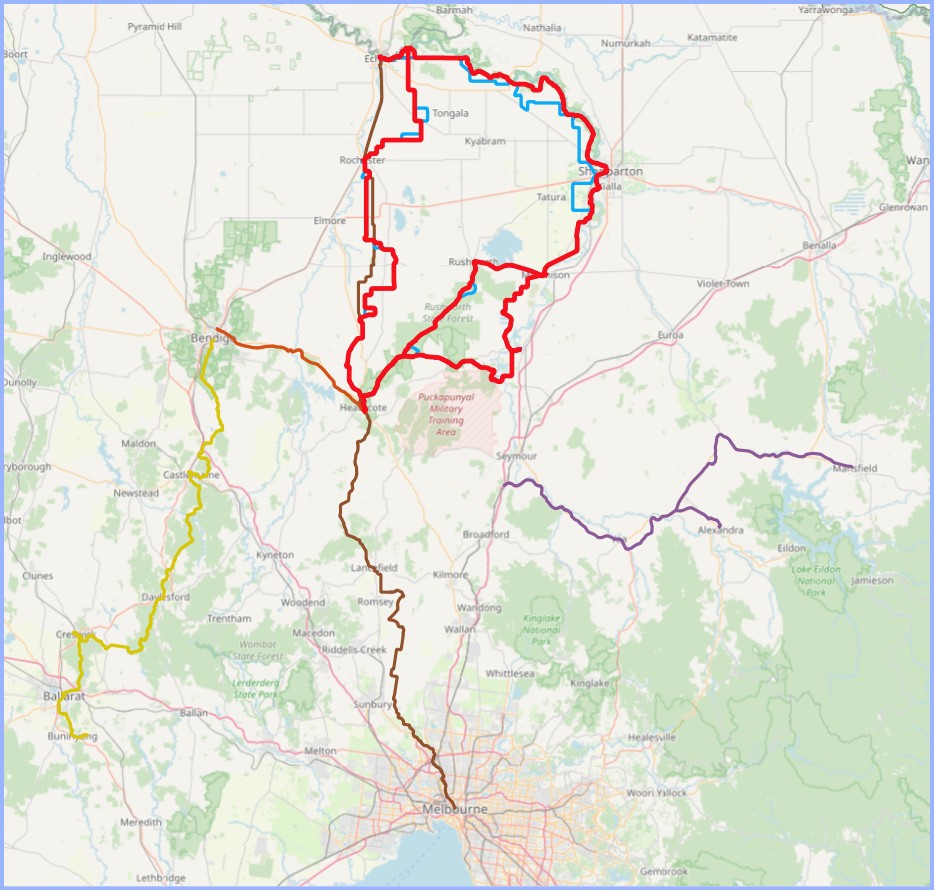
Great Victorian Rail Trail (GVRT) – purple line………………….Curve Border Run – brown line. O’Keefe Rail Trail – tan line………………………………………………Goldfields Track – gold line.
Connections between the ERI and each of these trails are detailed below.
Great Victorian Rail Trail (GVRT)
The GVRT is located south east of the ERI. It runs from Tallarook to Mansfield and Alexandra. To connect between the ERI and GVRT, riders should use the ERI Link – Tallarook Station and GVRT gpx file in this collection – ERI (Collection on RWGPS)
O’Keefe Rail Trail
The O’Keefe Rail Trail is located at the south western end of the ERI. It runs between Heathcote and Bendigo. The ERI and O’Keefe Rail Trail can be joined together in Heathcote. There is no need for a link file.
Goldfields Track
The Goldfields Track is located south west of the ERI. It runs between Buninyong and Bendigo Station. To connect between the ERI and Goldfields Track, riders could use:
- The O’Keefe Rail Trail between Heathcote and Bendigo.
- The ERI Link – Bendigo Station and Goldfields Track gpx file in this collection – ERI (Collection on RWGPS). This is a shorter connection.
Curve Border Run
Curve Cycling is a bike manufacturer based in Melbourne. They encourage bikepacking and adventure cycling. In March or April Curve promote an event called the Curve Border Run. The aim being to ride from Melbourne GPO to the NSW border at Echuca (240 km).
The Curve Border Run route passes through Heathcote. Then it uses some of the same roads as the ERI to get to Echuca. Therefore, riders can use the Curve Border Run route to connect between Melbourne and the ERI.
See this link for information about the Curve Border Run. See this link for the Curve Border Run RWGPS file.
Mountains to Murray Rail Trails
The Melbourne – Albury train line also connects the ERI to the Mountains to Murray Rail Trails. See map below.

For example, riders could ride from Bright to Wangaratta on the rail trail. Then catch a train to Avenel and link onto the ERI to make an epic adventure ride.
.
Risks, Hazards and Preparation
Some specific hazards were discussed in the individual stages above. This section deals with risks and hazards for the whole ERI route.
However, this section is only for the ERI route specifically. There are many other risks and preparation issues that are generic to bikepacking – both to the rider and bike. These are very important issues and you should spend time considering and planning bags, clothing, food, water, tech, tools etc. But I won’t cover them here because they are highly individualistic and there are many other good resources available.
If you are completely new and don’t know where to start:
- Watch beginner videos on Youtube or bikepacking.com.
- Seek out other bikepackers or adventure riders and go on short rides with them.
- Do an initial test ride. Pack your bags and kit onto the bike. Ride a short distance (10 – 20 km) to a caravan park and stay overnight. Then ride home the next day. You will learn a lot about which things you should try to improve.
OK, on to risks and hazards specific to this route.
Hazards and Preparation
| Risk or Hazard | Suggested Preparation |
|---|---|
| Lack of focus. You waste time every day working out what to do. | The key thing is to have plan, and to include a buffer. Your plan for shelter overnight and where and to source food or meals there should be researched carefully. Most of the planning should be done in advance. This makes a huge difference to what you have to carry each day. It also frees up time on ride days to enjoy the actual ride experience. |
| Vibration on earth and gravel roads becomes tiring over long distances. This is worse in terrain with recurring climbs on rolling hills. | Include shorter daily distances in your ride plan. Tyres should be wide and under inflated. You will survive with 28 – 33 mm tyres. But you will be more comfortable with 40 – 50 mm tyres. Tyre width is more important than a big tread pattern. A pronounced tread pattern will increase the vibration. Tyre Pressure: Use an online calculator as a guide to a good air pressure depending on your situation. If you are not already using one, try this SRAM Tyre Pressure . |
| Sand and loose material on unsealed roads and tracks. Wet or waterlogged dirt surfaces. | Tyre width is your friend here. Most of the ERI roads and tracks are hard without much loose surface material. There aren’t any long steep windy gravel downhills where you would be concerned about sliding off on a bend. If you come to a sand patch on a loaded bike, it is probably safest to just walk through it. Again, on the ERI, tyre width is more important than tread. When the silt and clay tracks are wet even slow moving 2WD cars lose control and slide into trees. No amount of tread will save you on a bike. Gravel is Ok. The best option is to detour around wet dirt sections using the wet weather alternative routes. |
| Extreme heat and strong winds. Fire risk. | Monitor weather and fire warnings continuously – while planning, before riding and during rides. Put the VicEmergency App on your mobile. If high fire risk don’t ride at all, or only do short rides in populated areas. Don’t venture into the long isolated stretches of bush when there is a high risk of fire. If you do ride short distances, carry excess water and protective clothing. |
| Navigation | Download the set of GPX files – including the wet alternative routes and any connecting links. Ensure these are on your local device so you don’t have to rely on the internet. This will also extend your battery life. Ensure you can operate your navigation devices well and have batteries and chargers. |
| Occasional black spots without mobile and internet service. Calling in Emergency Assistance. | There are a few short black spots in the long stretches of park and forest. But there could be occasional short term outages anywhere. This would be a problem for online gpx navigation, but I’ve recommended using local gpx files to avoid that issue. However, loss of mobile connection is a big problem in an emergency situation. The best option is to carry a Personal Locator Beacon (PLB). Upload details of your ride plan before your ride to provide potential rescuers with advance information about your situation. If calling for assistance on your mobile you will have to give rescuers your location. This might be difficult if you are in the bush. Install something like EmergencyPlus App which tells you your location. |
| Flood risk | Monitor river levels using the resource links on this page. If the roads and tracks are likely to be inundated, use the wet weather routes or delay your ride plan. |
| Vehicle Traffic | Most of the backroads and tracks have minimal vehicle traffic. When you meet a rare vehicle on a one-lane track it is often easiest to stop and let them pass. Have a drink while the dust settles. If you stop, the driver sometimes pauses to have a chat which is a useful way to get local information. Always be friendly and polite to the locals. Eventually some ERI riders will have to seek help from local farms or passing cars. Don’t poison the well for other riders in a critical situation. For busy sealed roads see the advice for each individual road in the table below. |
| Native animals: kangaroos, emus, snakes, spiders, mosquitoes, magpies etc. | Startled kangaroos and emus rush around erratically. They do crashed into cyclists. Watch them carefully and stop if necessary until it is safe to proceed. Snakes like basking on warm paths although this is more likely on sealed paths than dirt. In river park areas there are a lot of snakes. But also a lot of large birds that hunt fish, or snakes out in the open. Snakes and humans get on best when they avoid each other. Look carefully at every stick on the track, especially the sticks that look more smooth and shiny than other sticks. You should carry snake bandages and know how to use them. If bitten stay where you are. Call in emergency assistance. Let help come to you. Spiders and stinging insects should also be avoided. Be very wary of putting your bare limbs anywhere that you cannot see. Mosquitoes are dangerous. In the ERI area they have been known to carry diseases, although actual cases are rare. Do whatever you can to avoid being bitten. Cover up, take repellents. Magpies swoop in spring. They also make beautiful sounds all year round. Be a lover not a hater. Send out good vibes. I’ve never been swooped on any ERI road or track. Although I have been swooped elsewhere in the region on busier roads and in areas with more people about. This might be a coincidence and is not a guarantee. But it also may be that magpies are less stressed and threatened by humans in more remote areas. Or it might be they pick up my “I love magpies” vibe. |
| Track obstacles | Most bike accidents where the rider is at fault occur because the rider is going too fast or too slow. Ride to the conditions safely. Doing otherwise isn’t worth the risk in isolated areas. First – for small obstacles ruts, sticks, rocks that you can easily ride around. Slow down, pick a line where you want to ride early and keep staring there. Don’t look at the obstacle. Your bike will take you to where you are looking. Second – big barriers that you can’t easily ride around. If you are approaching stall speed to ride around obstacles best to get off and walk. Have a drink. Your muscles will thank you for the stretch out and reduced heat. |
| Punctures | I ride with tubes in tyres with extra puncture protection. I have never had a puncture on an ERI road or track. I am not aware of anyone ever reporting they got a lot of punctures on these roads and tracks. This isn’t a guarantee. But it probably indicates the ERI does not require a step up in bikepackers’ usual puncture protection approach. |
| Bike security | Bike theft seems to be increasing every year, even in country towns. This includes bikepacking bikes. Your plan should consider how you will secure your bike at every stop in your plan. The more you use locks, keep your bike close and in-sight the less likely you are to lose it. |
| The information provided here might be incorrect or incomplete for your situation. Plus the situation can change | The route is not monitored. There is no guarantee the information provided here is complete or will be correct for every rider when you ride. In the end you are responsible for your own ride and ride plan. Do your own research, risk assessment and evaluation of whether the ride is suitable for you. |
Infographic – Risk Assessment.
.
Dealing with Busy Roads
The table below details each of the busy sealed road sections along the ERI. You can click on the pic in the right hand column to get a bigger view. Right click on the thumbnail, then “open image in new tab”. This opens the photo so you can see each road for yourself.
| No. | Name | ERI Stage | Kms on ERI | Speed Limit | Comment | Pic |
|---|---|---|---|---|---|---|
| B400 | Murray Valley Highway | #1 | 0 | 100 | This is an offset crossing. You don’t travel on the Highway for any significant distance. Be aware of fast traffic coming off McCoys Bridge at the north end. You can’t see this until it comes around the bend. Suggest you ride along the gravel shoulder and cross straight across the road when you can. |  |
| C355 | Echuca Rd | #1 | 1 | 100 | Continuous traffic especially during am and pm peak periods. It has good sealed shoulder – 1m wide on both sides. | 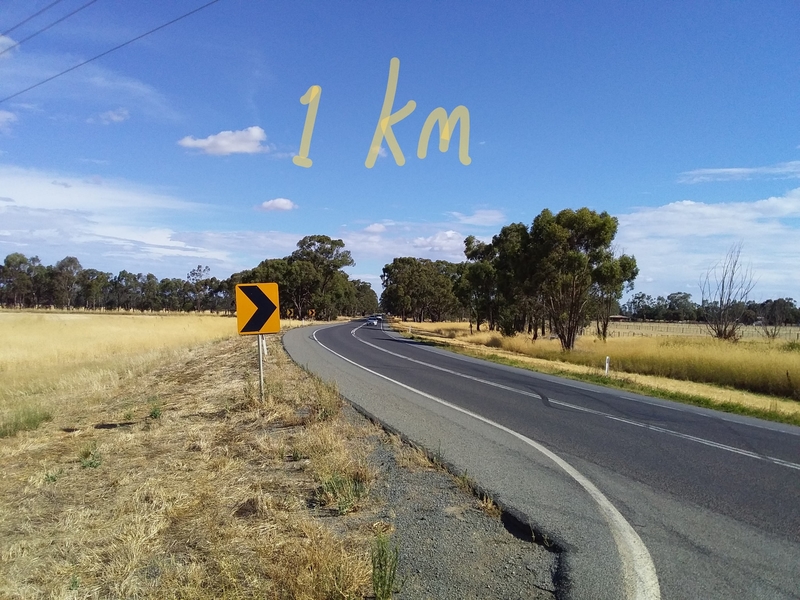 |
| C369 | Toolamba Rd | #1 | 2 | 100 | This section passes through a small town so traffic may slow down slightly. There is no sealed shoulder. It is possible to ride on the nature strip border for much of the way if concerned. | 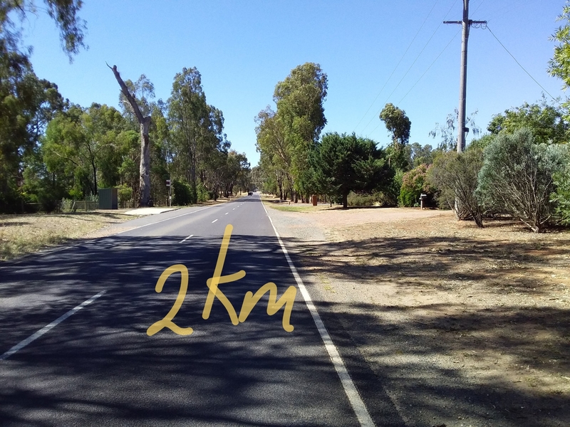 |
| C369 | River Rd | #1 | 2.5 | 100 | This road has no sealed shoulder. It is busier during am and pm peaks. | 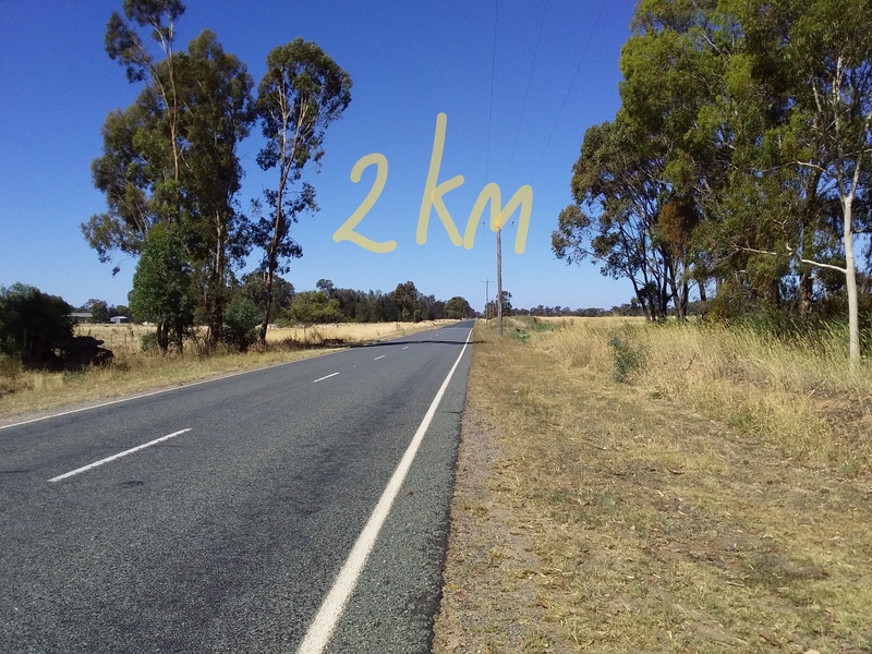 |
| C344 65 | Heathcote-Nagambie Rd | #2A | 1.5 | 100 | This road does not have significant sealed shoulder. The gravel shoulders are rideable if you are concerned. | 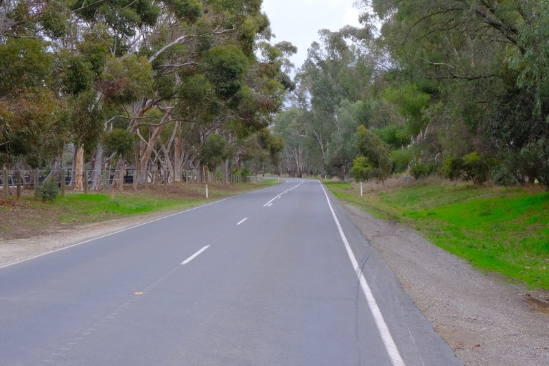 |
| C344 65 | Heathcote-Nagambie Rd | #2A | 2 | 100 | This road does not have sealed shoulder. The gravel shoulders are rideable if you are concerned. | 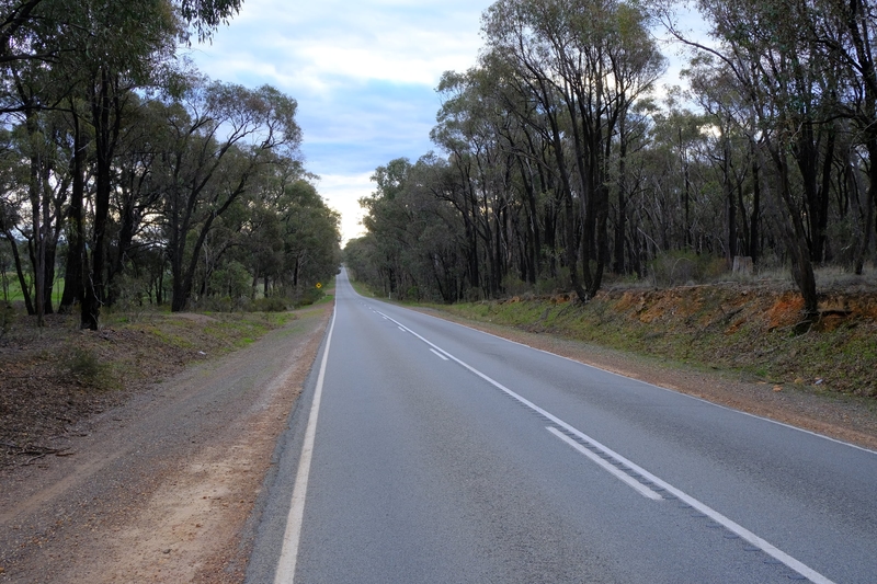 |
| C344 | Heathcote-Nagambie Rd | #2A | 0.4 | 100 | This road does not have sealed shoulder. The gravel shoulders are rideable if you are concerned. | 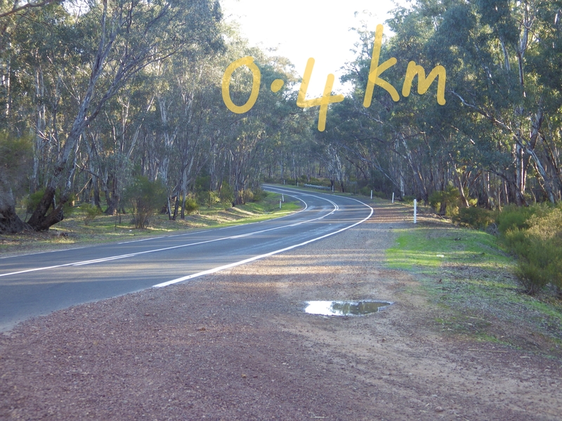 |
| LGA road | Heathcote-North Costerfield Rd | #2A, #2B | 1.5 | 100 | This road does not have shoulder, either sealed or gravel. It is a Council road, not a Vic Govt DTP road. | 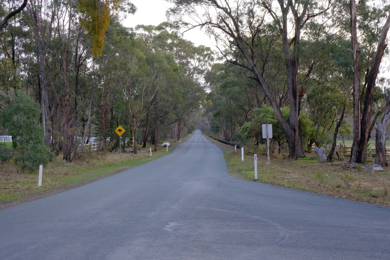 |
| B75 | Northern Highway | #3 | 1 | 100 | This is a busy Highway with regular fast moving traffic. There is good sealed shoulder on both sides (1m+). | 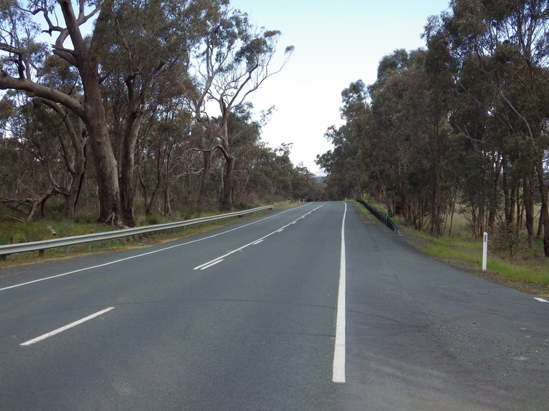 |
| LGA road | Bonn Rd | #3 | 2 | 100 | This road does not have shoulder, either sealed or gravel (shoulder stops soon after the pic was taken). It is a Council road, not a Vic Govt DTP road. | 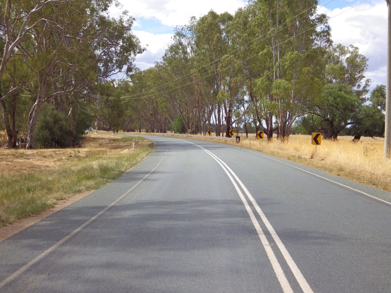 |
These roads are all connector roads between regional towns. They all have am and pm peak traffics periods. The peaks are caused by tradies going to jobs, commuter flows and school runs. If possible avoid these peak periods.
.
Outro and How to get more Information
Thanks for reading and your interest!
The Nix-Tracks.com website hosts ride reports about the routes. If you ride the ERI please consider writing a report with pics to help other users with their plans.
The fastest way to contact me and get a response is to make Comments here. I get a personal message email whenever anyone posts a Comment here and try to respond quickly. Access to the comment section is set so anyone can use it. You don’t have to login or give any personal details. Just type your thoughts.
You could send me an email using this email address (nixtrader AT yahoo DOT com DOT au). However, this email address is rarely used and I don’t monitor it frequently.
.

Leave a comment