Update March 2026: Kirwans Bridge is open again for walkers (with bikes). It may still close intermittently for construction to repair the bridge for car traffic.
Summary
- Distance: 47 km loop
- Description: A scenic backroad route around Nagambie Lake, with opportunity for winery stops.
- Amenities: Nagambie, Tahbilk Winery, Michelton Winery.
- Accommodation: Nagambie, Michelton Winery, Major Creek Reserve (camp).
- Ride surfaces: Approx 40% gravel roads, 55% quiet sealed roads, 5% busy sealed roads.
- Terrain: Flat, 1 small 3% hill.
- Suggested Ride: Start at Nagambie, ride anti-clockwise.
- Highlights: Kirwans Bridge, Tahbilk Winery and eco trails.
- Link to gpx file: Download gpx file from this link – Nagambie Meander
- Connects with: Yellowbelly Track, Ghostown Gambol, Kirwans Rushy Whroote.
.
Original Article (from 2015)
My aim to organise more 1-day mixed-terrain touring rides over the 2015/2016 season was set back a bit when I bingled my gravel bike frame and had to find and build a new bike.
Now I have built another bike, I can’t think of a better way to start the new year than a mixed-terrain micro adventure on bikes, in good company. My proposed ride is a gentle re-starter – short and flat, through a rural area with lakes, creeks, a river, billabong wetlands and vineyards. It is a good ride on which to invite partners or friends who are yet to discover the joys of riding gravel and mixed-terrain day-touring. As usual I have planned some quality noshing at scenic food stops during the day.
Contents
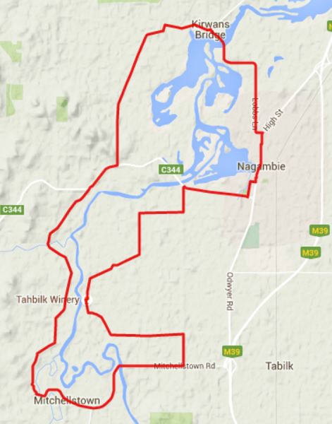
Route: Approx 47km loop starting and finishing in Nagambie, central Victoria.
Aim: This is not a race or sponsored event; there are no timings, rankings or prizes. Your individual experience will make you a winner. There is no entry fee, but it will require lots of time and energy. Spend your money in a rural Victorian community instead.
Self-Supported: The ride is self-supported and passing through remote areas. There will not be a sag-wagon, refreshment tent or mechanical or first-aid support vehicle or personnel. Shops for food and drink are likely to be 2 hours from the start. Riders will need to carry their own food, drink and mechanical and first-aid supplies.
Date, Time, Start Location and Route Documents: The ride is on Sunday 3rd January 2016. Further details – start time, start location, detailed route instructions and gpx file – will only be sent to those riders who register by email. There is a maximum limit of 29 registrations for the ride on 3/1/16 to take place without an ‘event’ permit.
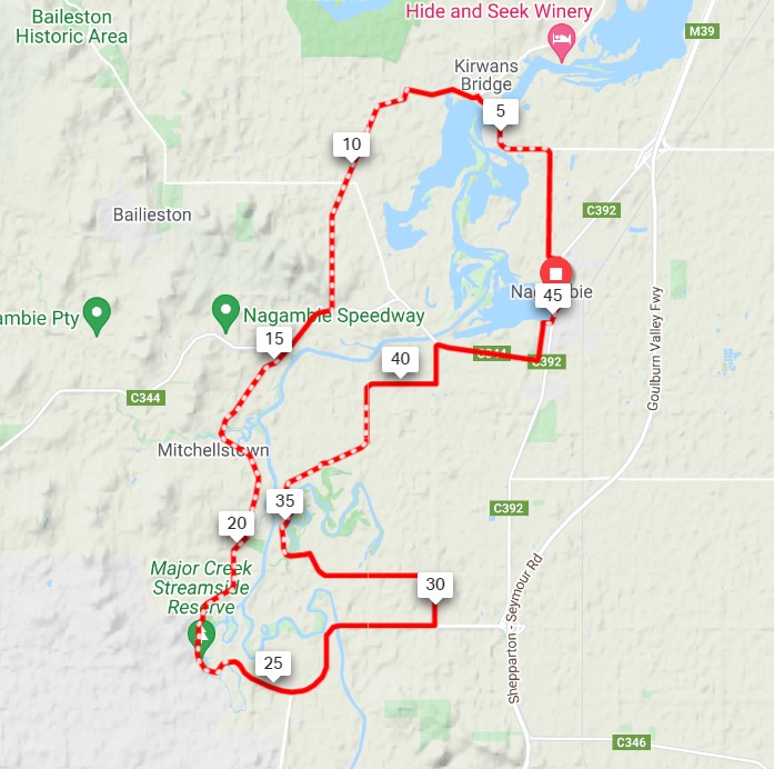
Map and Profile: The rough route is shown below. The ride starts and finishes in Nagambie; it progresses in an anti-clockwise direction.
The ride profile is shown below.
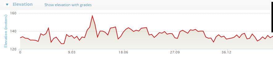
The ride is flat. The maximum variation over the whole ride is less than 40m. The steepest hill has a slope of 3% and is less than 1 km long.
You can download gpx file from this link – Nagambie Meander
Transport: The start and finish is in Nagambie. Riders are to arrange their own transport to and from Nagambie. Nagambie is on a train line; it is possible to for riders to catch a train to and from Melbourne and participate in the ride. The Sunday train arrives at Nagambie Station at 11:16am, and departs 5:48pm. See Train timetable
Weather: The ride is in the middle of the day and in the middle of summer. This is one of the reasons I have kept this ride short. The day is likely to be hot and dry. Riders should carry lots of water and protect themselves from the sun. This area is susceptible to hot northerly winds at this time of the year and has had fires in the past. Riders should have the Victorian Fire Ready app on their mobile phones to keep up with any emergency developments during the day.
Difficulty Level and Risk: This is not a ride for novice riders and I don’t know anyone who has ridden it before. Hence I can’t vouch for the route’s safety or what is required to ride it. Riders who choose to ride all or part of this route do so entirely at their own risk and are responsible for their own investigation and preparation before the ride, and their own support during the ride. This is a ride I am planning for myself and I invite others to participate at their own risk if they wish.
No Event Permit or Infrastructure: This ride isn’t an organised ‘event’ and won’t have any fees, permits, route signs, marshalls, sponsorship, support infrastructure, closed roads or public liability insurance. As there are less than 30 riders in the group, the ride does not require permission from any public authority. This is old-school, self-supported touring. Bikes have always been about liberation and seeking new experiences, and both the growth and risk that comes with that.
Ride Report
This ride has been completed. See ride report here
Road surfaces and bike tech choices
In general bike choice is up to you; ride whatever bike you like.
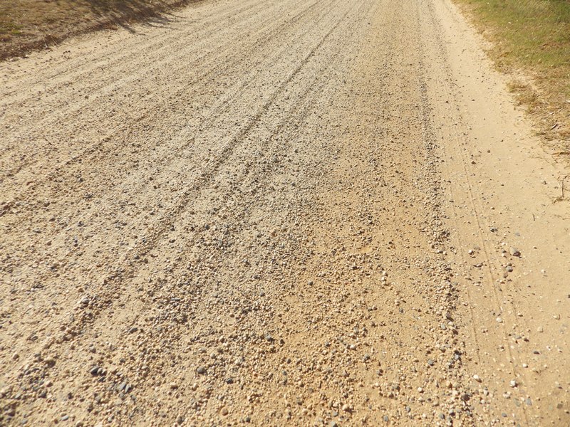
Approximately 19kms (40%) of this ride are on unsealed gravel roads. Normally bikes with minimum tyre width of 28mm are OK for unsealed roads with a hard base.
However, the sections of gravel road around Tahbilk Winery are soft, with a thick layer of small loose gravel pellets over the whole road. So I think the best option for this ride is wider tyres (towards the mid 30s), with a flat middle file section for the sealed and hardpack road segments, but with outer nobby paddles for the when the tyre sinks into the loose sandy gravel. Something like the photo below –
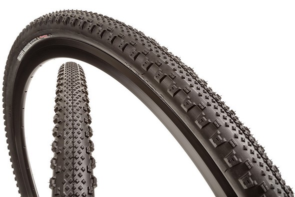
Riders of bikes with narrower tyres or a smoother profile will still be able to complete the ride, you will just have to work harder and at worst might have to walk over some of the soft gravel around Tahbilk (but it is a pretty walk on a bright white gravel path passing rows of very green grape vines).
The above comments assume dry roads. If it is wet … well …. Hopefully we won’t have to worry about that!
Unless you intend to seek out holes to ride through, or roots and rocks to jump over, I don’t see any advantage in having wheel suspension on this ride.
A final tip for those who have old tech crank sets and like to swap around chainrings to match their planned ride. On my current gravel bike, I have a 38T biopace eliptical chainring as the middle chainring. I think switching to a biopace ring on gravel gives the back wheel more constant driving traction all the way around the pedal stroke and this makes the bike feel more stable and able to hold a line better. As a result I feel more in control and am more confident going faster on gravel. I still have a round outer chainring for the sealed roads though. (If you have no idea what this paragraph means, don’t worry you can still come and enjoy the ride).
Photos of route, a virtual ride through.
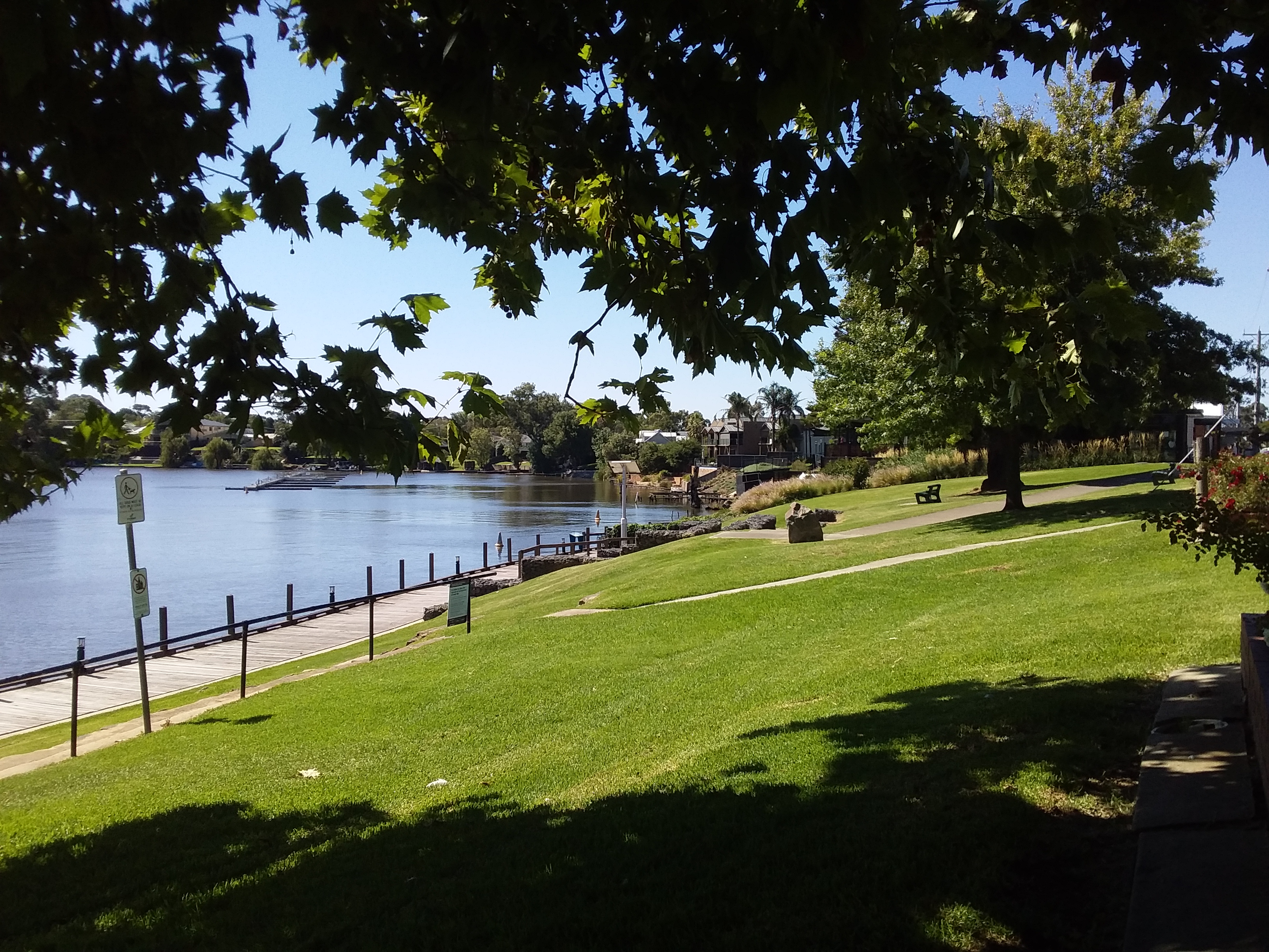
Nagambie, home of lakeside statue of Black Caviar.
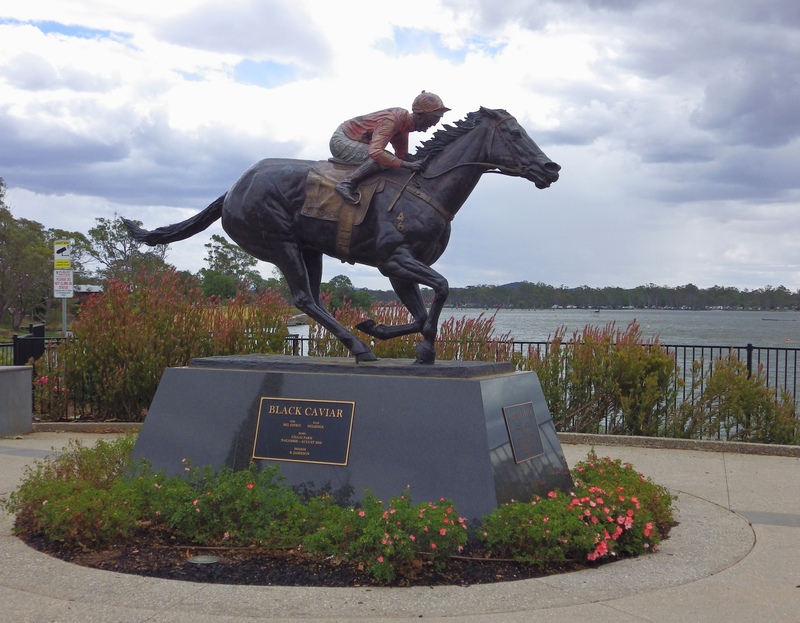
For information about visiting Nagambie see Nagambie Lakes Tourism site
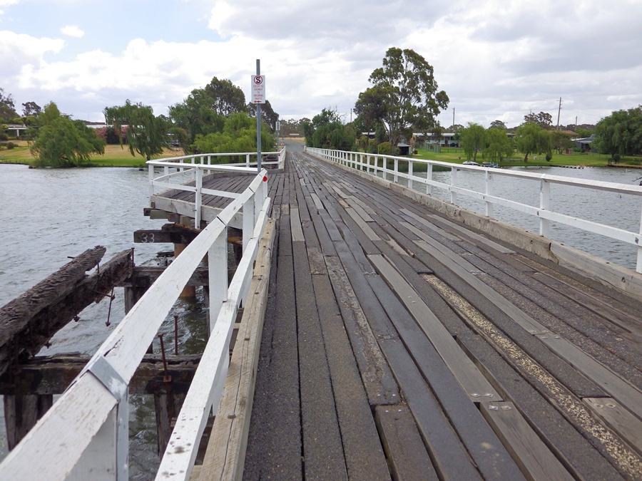
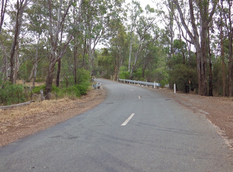
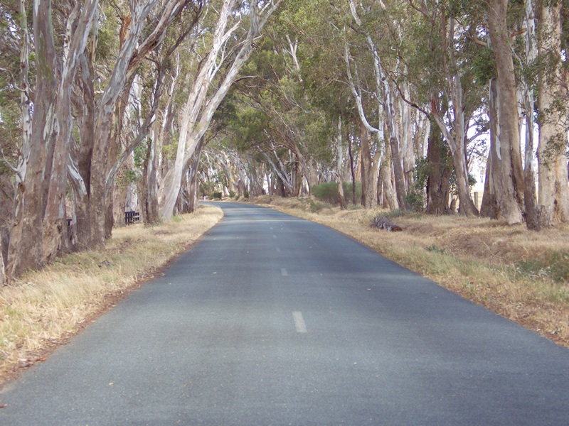
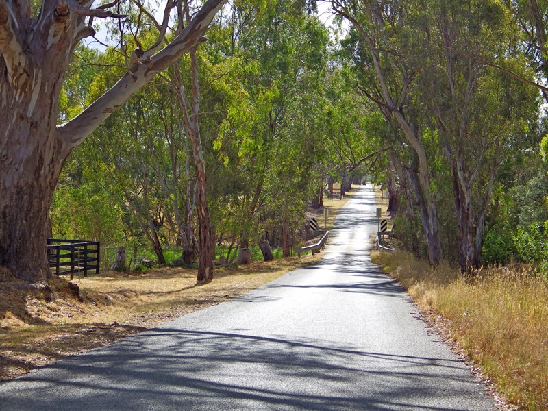
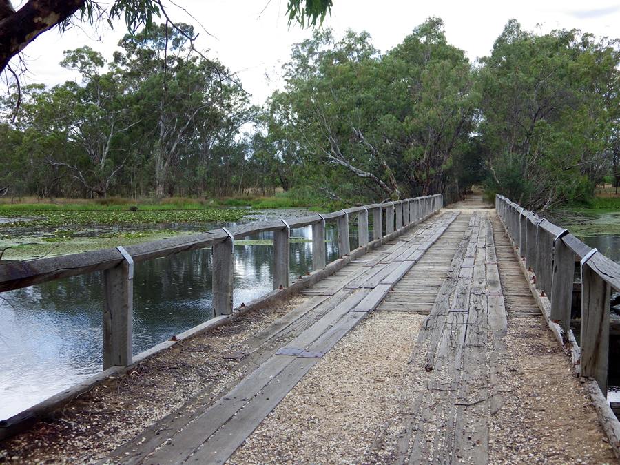
Ride north from Nagambie around the top of the Nagambie Lakes. Then use Kirwens Bridge to cross the Goulburn River.


At 310m long, Kirwens Bridge is the longest continually operating timber bridge in Victoria. It is unusual because of a large bend in the middle of the bridge, and it has two passing bays along its length.
Nagambie Lakes were created when Goulburn Weir was built on the Goulburn River in 1891. This weir was the first major structure to divert and hold water for irrigation purposes in Australia.
The timber planks on the bridge often have gaps between them and also a few centimetres difference in road level from plank to plank. Because of this, cyclists are requested to dismount and walk their bikes across the bridge.
Continue around the top of the lakes, crossing various watercourses.
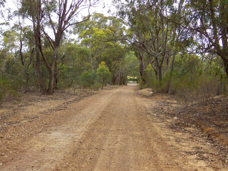
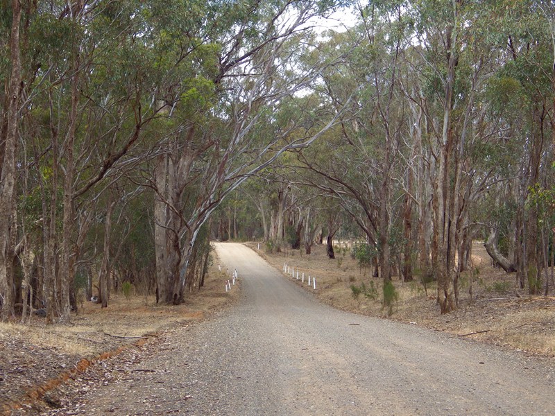
Eight kilometres into the ride, the first gravel road.
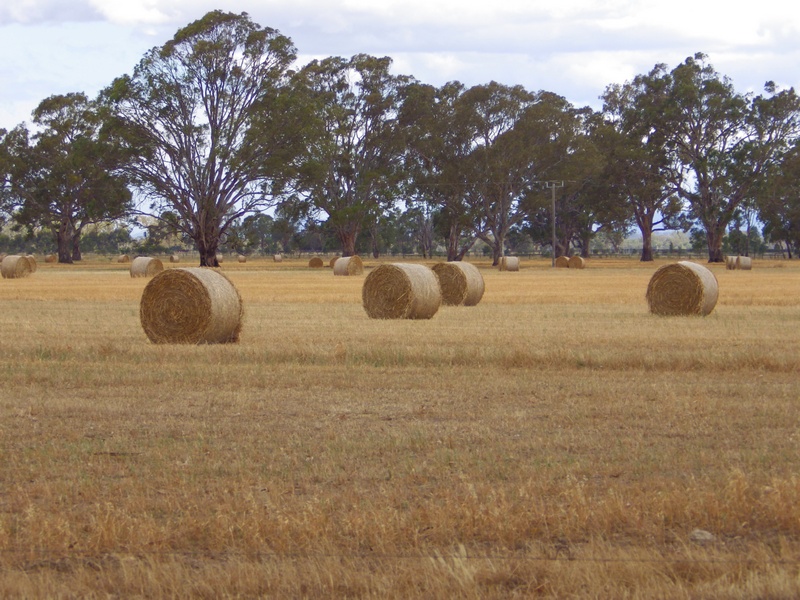
The road veers right, away from the river, across open plain for a while.
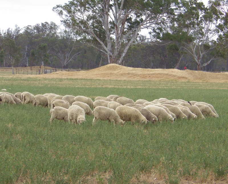
Passing some economic units of production hard at work.
Carefully cross the main road, onto an even narrower gravel road. The low hill in the background creates the biggest climb of the day.
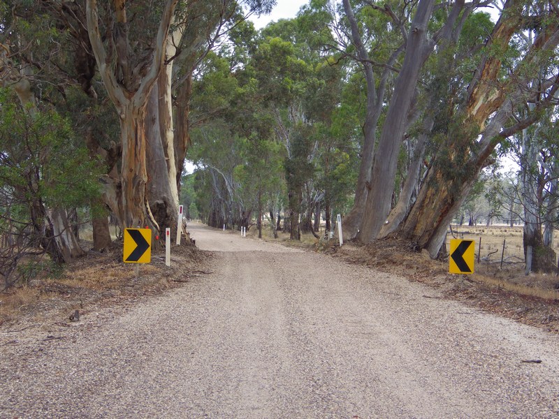
The narrow road soon becomes a track picking its way through the trees. The ground is hard, so it is still easy to ride.
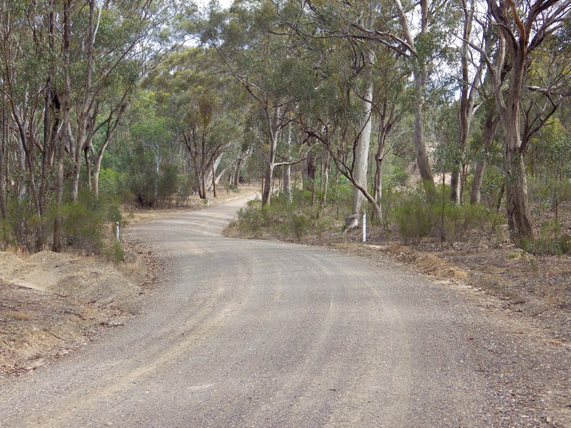
This is the biggest climb of the day. It is 3%, but a good surface and quite scenic. I doubt it will cause any issues.
The descent on the other side is more of a concern. The road drops away at 4% but because it is straight that should be OK for all the riders. What concerns me is that the track ends in T-intersection with a main road at the bottom of the hill. This is not well marked or very visible to riders (who will be only looking at the 20m of gravel immediately ahead of their front wheel). Riders should have their bikes under control and be able to stop well before the bottom. Also keep a good distance back from riders in front, as they are likely to stop suddenly in the middle of the road when they get to the main road.
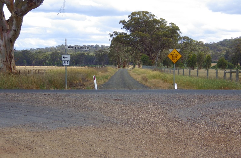
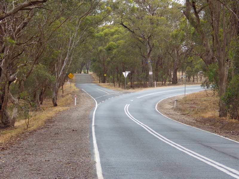
Turn right onto the main road. Expect more traffic on this road, although we only stay on it for a short distance.
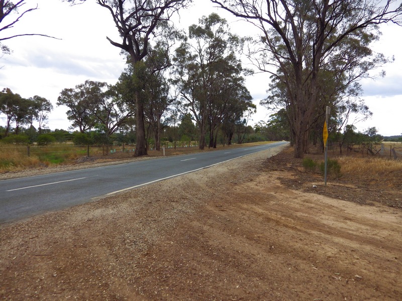
After 1.3km on the main road, veer left on this bend. The left fork is another gravel road. Don’t miss this turn off; Heathcote is a long way in the wrong direction.
The gravel road is sealed for a short distance when it bridges Sandy Creek. From the current bridge you can see the remains of a former bridge.

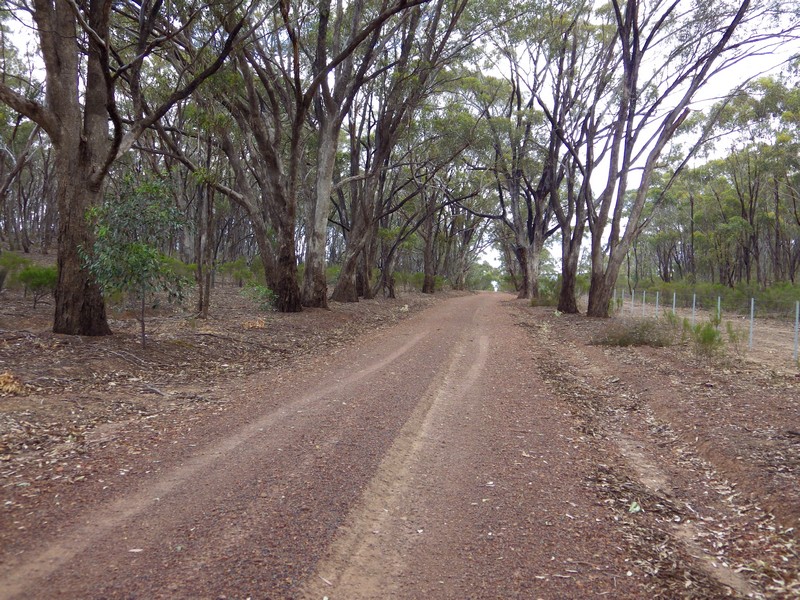
Continue south on the gravel road. Where the road surface turns whiter, sections of the road become corrugated for a few kms.
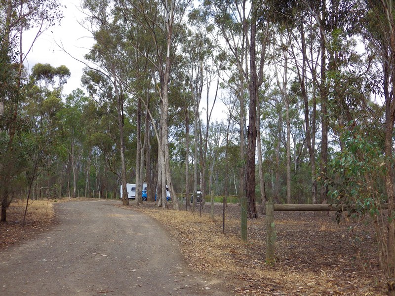
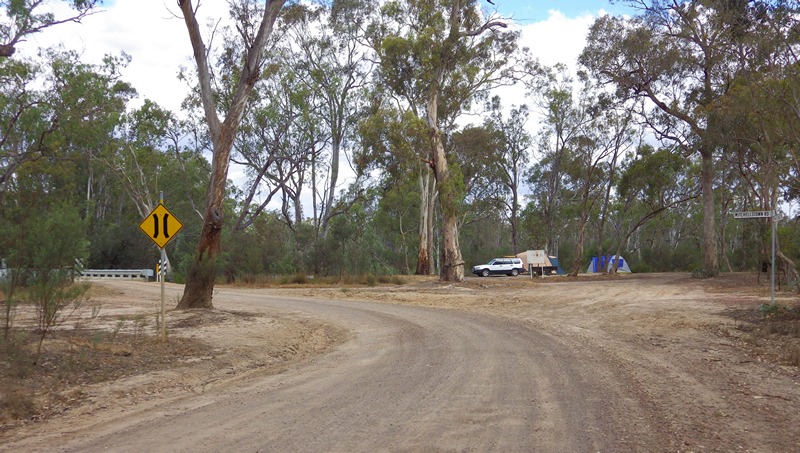
After a few more kms you will start to notice the Major Creek camping area. This is crown land with basic camping infrastructure and water access. It will probably be busy over the New Year period. As a result this gravel road will probably have more car traffic than usual.
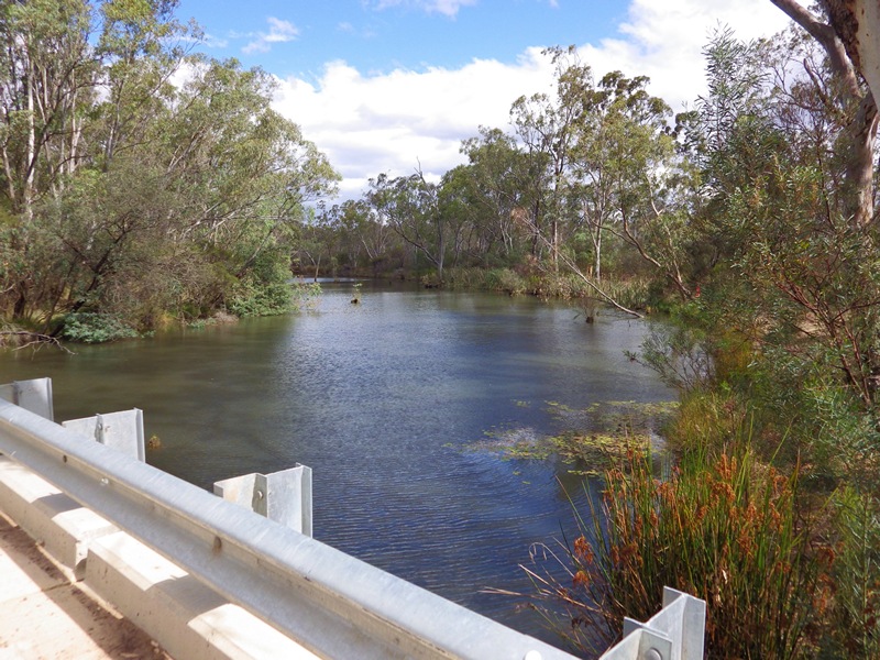
Eventually turn left into Mitchellstown Road and cross Major Creek. This point is roughly the half way mark of this ride. The southern leg of the ride is now complete and the route turns east. This corner is also very close to the northern boundary of Puckapunyal Army Training Base so you may hear some gunfire or explosions.
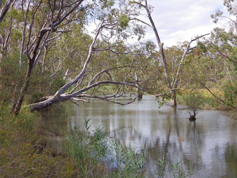
Major Creek is bigger than I expected, and allows campers to swim, fish or mess about in small watercraft.
Mitchellstown
Crossing the Major Creek takes riders close to the old township of Mitchellstown which was one of the first settlements in Victoria. Mitchellstown was named in honour of explorer Major Thomas Mitchell.
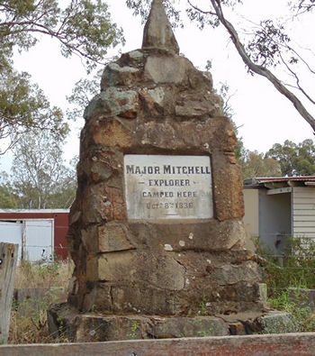 Mitchell camped and crossed the Goulburn River near here in October 1836, on his 3rd expedition. This expedition started in Sydney, came down the Lachlan River, then travelled along the Murray to confirm the junction of the Darling River with the Murray. Then Mitchell turned back up the Murrary, crossed the River near Swan Hill into Victoria and headed south to investigate what he thought were fertile plains there. He passed the Grampians and reached the south coast at Portland and was surprised to find the Henty brothers settlement and whaling boats working there.
Mitchell then turned back towards Sydney. On his return leg he climbed and named Mt. Macedon and was able to see Port Philip Bay from the top. It was on this return leg he camped here and crossed the Goulburn River.
The release of Mitchell’s glowing reports about the land he found caused a rush of settlers into Victoria (Mitchell called it “Australia Felix”). These settlers retraced Mitchell’s return leg as the best information they had – and therefore also camped and crossed the Goulburn River in this location, and the town of Mitchellstown sprang up. However, eventually better overland routes were found to the various new settlements in Victoria and Mitchellstown declined and virtually disappeared.
Mitchelton Winery
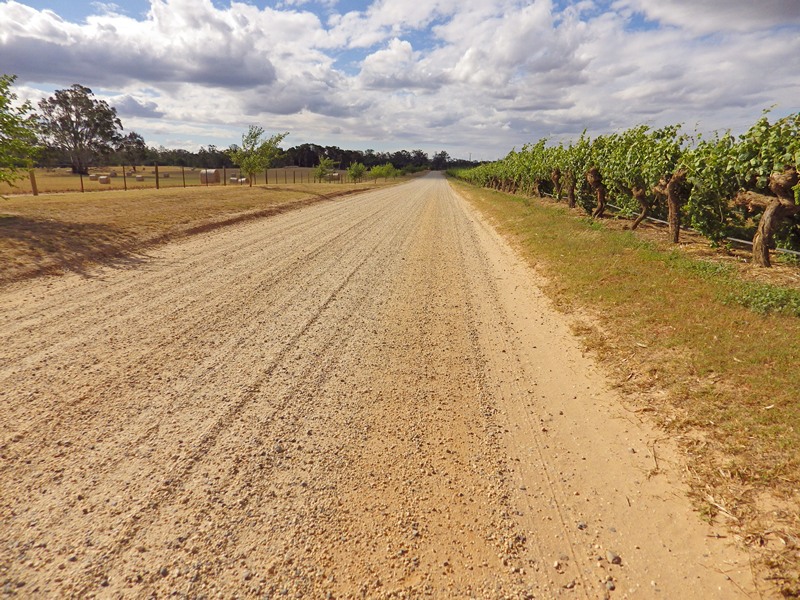
Meanwhile, the ride route continues east. After a short distance the gravel ends and riders are back on sealed road. This road becomes a 3km long wooded arc, sweeping around the bottom of the large Michelton vineyards and turning north.
The entrance to Mitchelton Winery will be on the left. It is hard to miss. Turn in here for a drink and food stop.
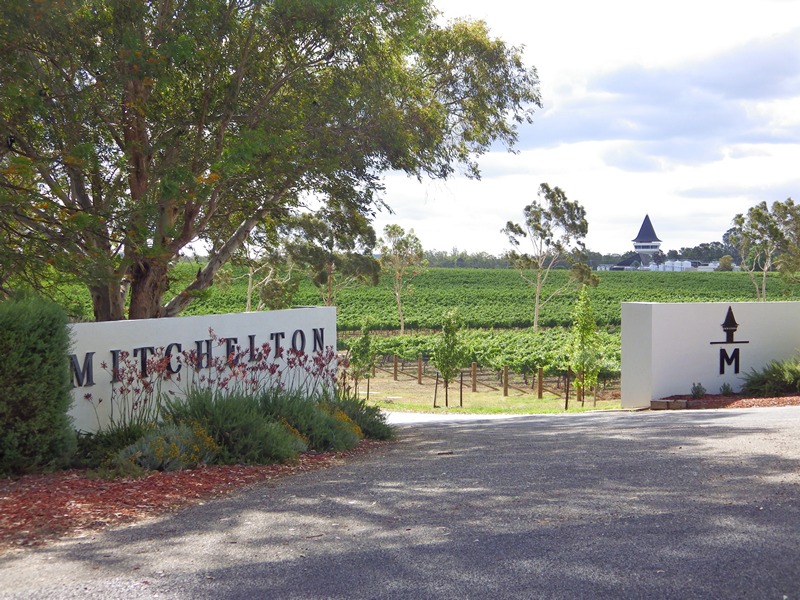
A new cafe is being built at Michelton. It is expected to be open by Christmas, so should be open when this ride takes place. However, remember this is a short drink and snack stop. The main lunch stop is at Tahbilk.
There is a cellar door for anyone who wants to check out the wine available here. Located just inside the cellar door is this bike which may provide some inspiration for your cargo bike fantasy. Fold out front legs as a stabiliser stand, there’s a thought.

For more information about Michelton Winery
When resuming the ride, head east across the Goulburn River over a single lane bridge. After 3km, turn left at a sign to Tahbilk.
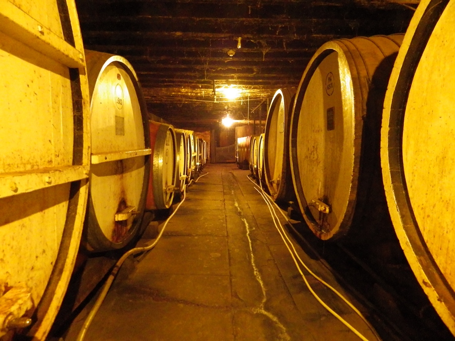
Tahbilk Winery
After 1 km turn left again back towards the river.
After 2.4 kms, the road veers right. More significantly the road surface changes to the deep loose gravel mentioned above.
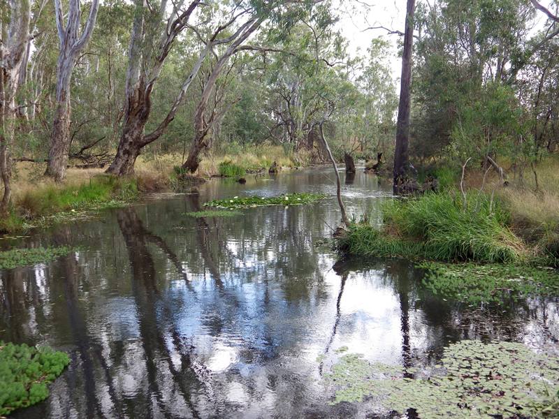
Cross a scenic creek feeding the Tahbilk wetlands.
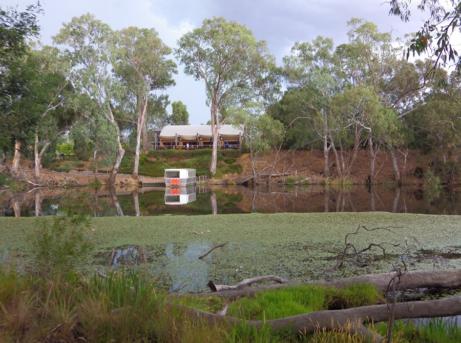
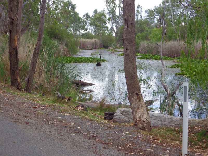
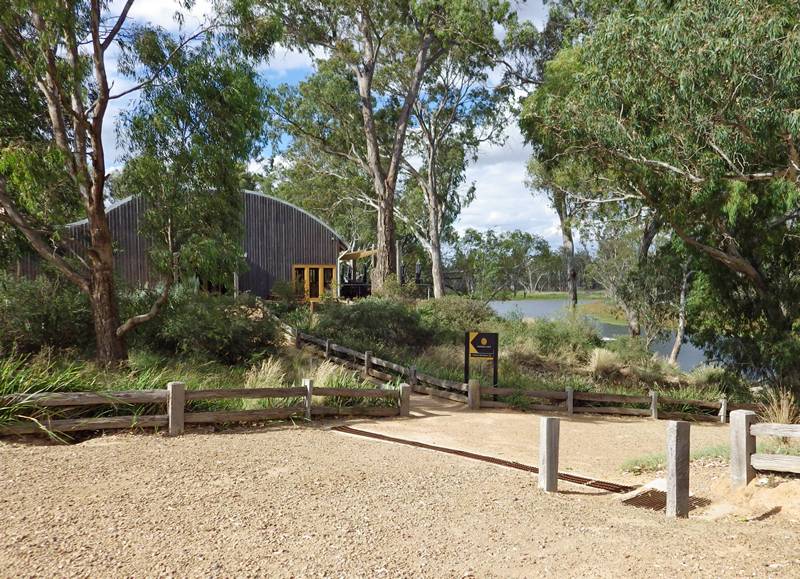
 After 1.5km on the gravel, riders arrive at Tahbilk Cafe. The cafe looks over the wetlands.
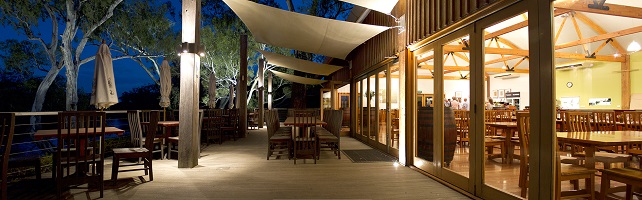
The menu for the cafe is here – Tahbilk Menu A couple of things worth noting:
- This is probably a bit more expensive than a normal ride stop.
- They don’t split bills, so it would be handy if everyone has cash including small change.
- Last orders for lunch is at 3pm, the cafe closes at 4pm.
- The dress code is casual; clothing must be neat, clean and in good repair.
After the lunch food break there should be time for additional activities. For more information about Tahbilk Winery
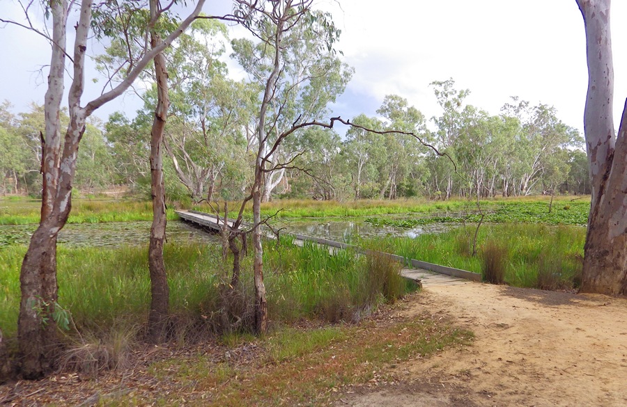
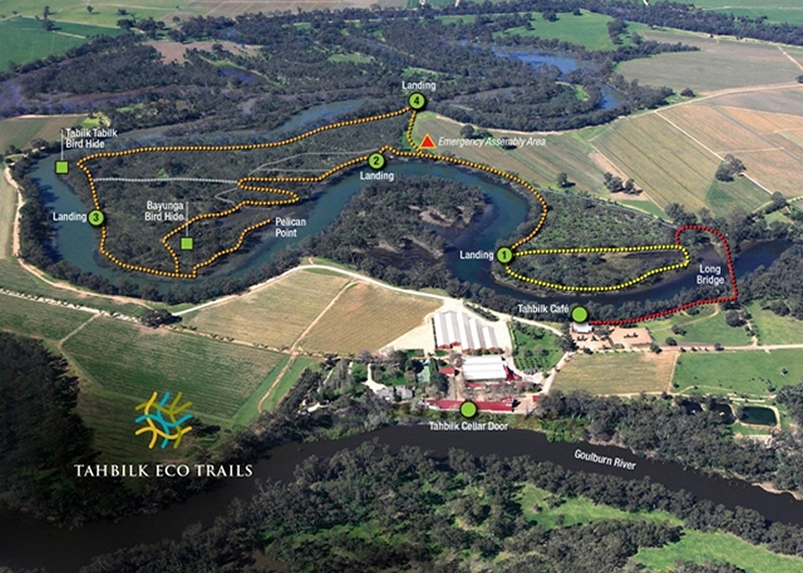
Wetland Eco Trails
There are 4 kms of walking trails through the Tahbilk wetlands. You are supposed to register at the cafe to enter and I think there is a gold coin donation box somewhere. Walking only, no bikes.
The path to enter the eco trails starts from the cafe and leads to the ‘long bridge’ into the wetlands.
There is a rough map for the Eco Trails.

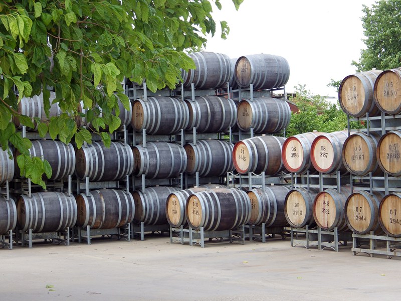
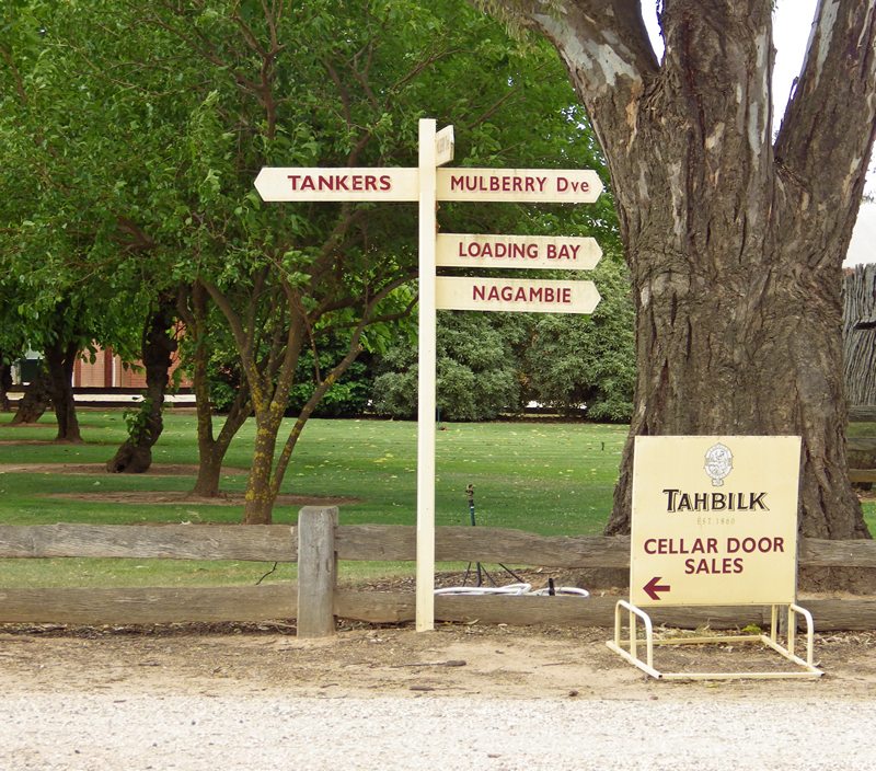
Cellar Door
For those interested there is also a Cellar Door for wine tasting. Plus information to guide yourself around the various historic wine making areas in the old buildings, cellars and in the cellar yard.

Back to Nagambie
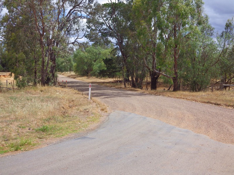
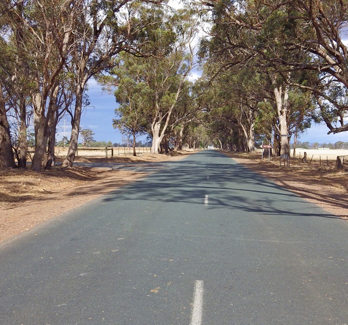
When ready to leave, follow the sign to Nagambie and take the road on the right.
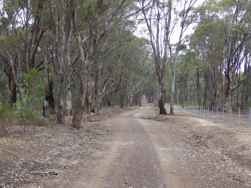
The good news is the exit road is this pretty avenue. The bad news is it is still the soft sandy gravel. Nevermind it is only 3km.
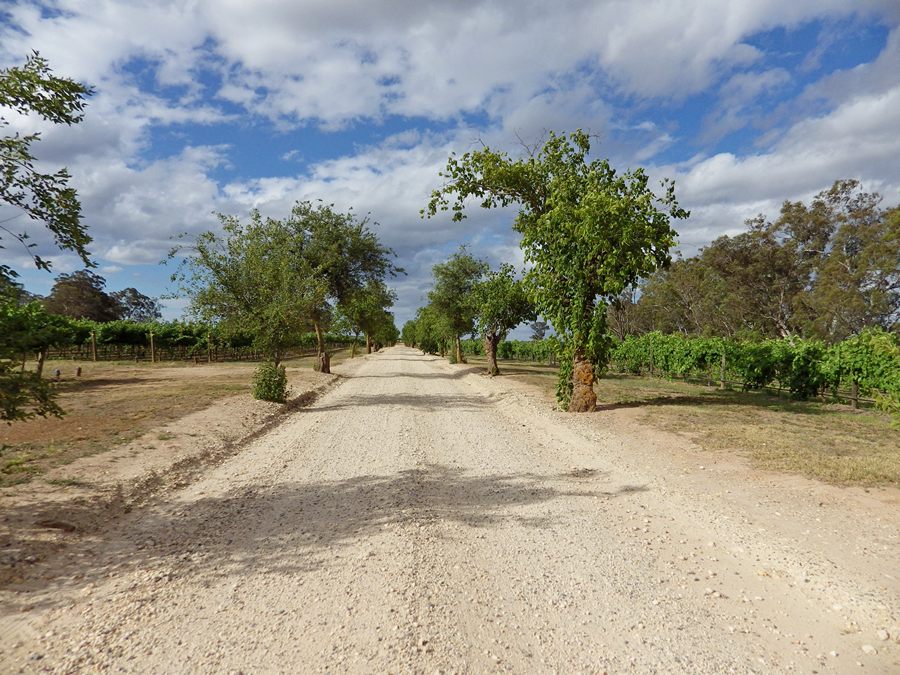
This gate marks the end of the Tahbilk drive. The route is sealed from now on.
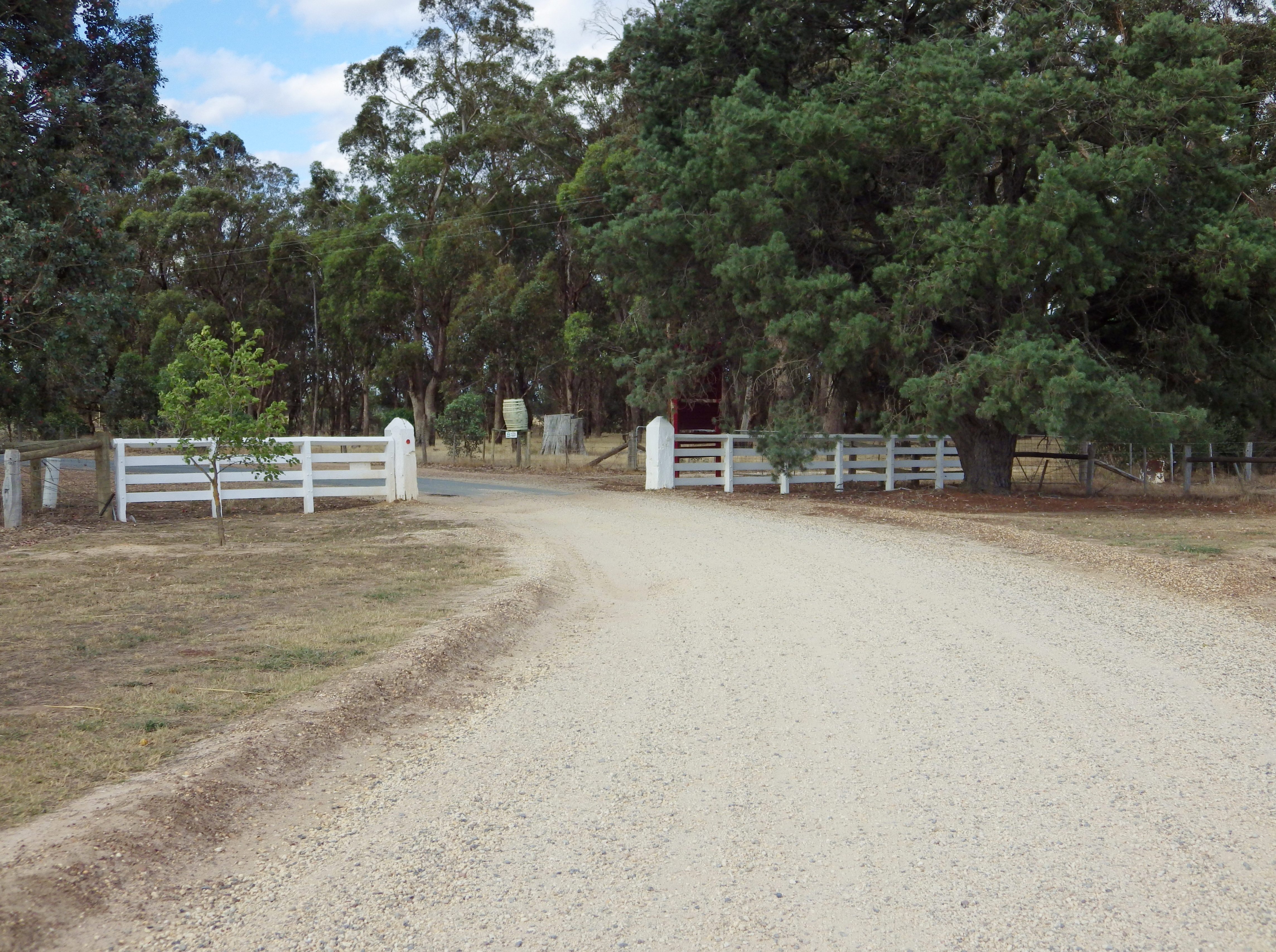
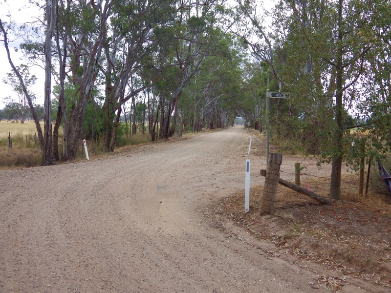
From here there is just over 7 km back to Nagambie. The first 4.7 km is on quiet back roads. Then turn right onto a main road to get back to Nagambie.
Ride Report
This ride has been completed. See ride report here
I will only send the links for detailed route information files (i.e. start time, start location, road map, gpx file and printable cue sheet with distances and required actions) to those riders who provide an email address. There is a maximum limit of 29 riders; priority will go to earlier responders.
Email me with your email address, send to – nixtrader AT yahoo DOT com DOT au.
If you do not have an email address, or are confused, make a comment below.
If you have any questions or comments, post below. Or contact me on twitter (@NixTrader), or by email (nixtrader AT yahoo DOT com DOT au)

Leave a comment