Many Victorians have a Grand Cycling Parade public holiday on Friday 23rd September. I plan to use mine riding the Camel Range canola fields. Other riders are welcome to join me.
- Date and Time: Friday, 23rd September 2022. Start 9:30 am.
- Distance and Duration: There are 3 route options 81 km, 69 km and 57 km (see maps and profiles below). The expected ride duration will depend on the route you choose and the number of stops you make.
- Start and Finish location: Cornella Brewery (Shiraz Republic Winery), Cornella.
- Amenities and Accommodation: Start – Shiraz Republic won’t have much at the start as it does not open until 11 am. So pack and bring anything you need pre-ride. Middle – Colbinabbin a small town along the route has a pub (open all day) and cafe (open until at least 2 pm). End – Shiraz Rupublic has a bar with a few food options. Both Shiraz Republic and Colbinabbin Hotel also have accommodation if you a planning a bigger trip.
- Terrain: See profiles for each route below. In general, the route is very flat with a few short steep climbs (8-10%).
- Roads and Ride Surfaces: The surface breakups are detailed for each route below. There are some ruts, potholes and rougher gravel sections, but you can ride around these, or ride through them slowly. There will be puddles of water on the roads, but you can ride around these. There are no earth or clay roads in the routes; these will be too wet to ride.
- Traffic: Vehicle traffic will be light everywhere except for the Chinamans Bend climb in the last 10 km of all rides. There will not be many cars even there, but the drivers are likely to be distracted by the views and tight switchbacks so be very cautious there.
- Best Bike: No need for suspension as most of the surfaces are fairly smooth. But riders will probably find the jarring and vibration from the gravel roads uncomfortable on tyres less than 30 mm wide. To be comfortable you should have tyres wider than 40 mm if possible.
- Navigation and Communication: Riders will have to self-navigate using gpx files available below. There will not be any route markers or marshalls to direct you. I do not know if the whole ride area has mobile and internet coverage. I believe adventure riders should always carry personal locator beacons for emergency situations.
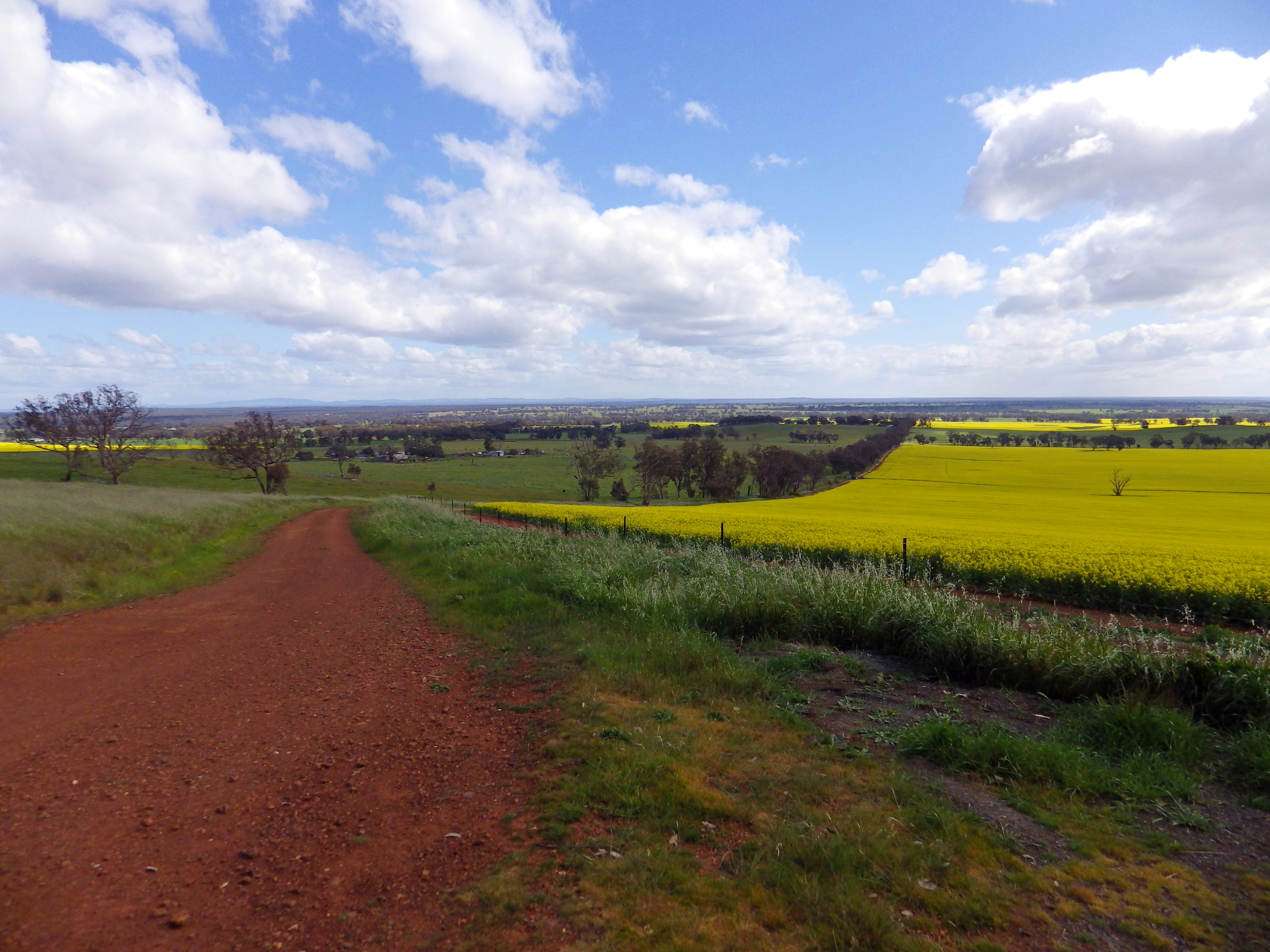
- Highlights: Bright yellow canola fields. Relaxed riding on quiet roads through changing landscapes. Colbinabbin township with painted silos. Scenic climbs of Mt Camel Range ridgeline. Relaxed beer from Cornella Brewery afterwards.
- Cost and Support: It costs nothing and for that you get to ride completely self-supported, self-navigating and at your own risk. There will be no marshalls, no route markings and no physical or mechanical support people or vehicles. Please do your own research and risk assessment to determine if this is a suitable ride for you.
- Seasonal Ride Series: This route is part of the GABCY Seasonal Ride Series – a set of monthly rides that are in harmony with local weather patterns and natural environments. The aim is to showcase the most suitable and scenic time to ride in each location, as well as show the wide variety of rides available across the GABCY Network.
- Connections with other Routes: The routes also link to other routes in the GABCY Network – Camel Cornella, Reap the Red Ridge, Nabbin My Booty, and Lap of Local Lakes.
Some pics of the ride area last year.


Opportunity for a better view: Peregrine Ridge Winery sits on top of the ridge at Chinamans Bend climb. This is about 5 km from the finish of all 3 routes (and it is all downhill from there). At the crest of the climb, riders have the option to turn off to the right to visit the Peregrine Ridge Cellar Door building to experience stunning 180 degree views out over the area. The owner requests that cyclists remove cleated and hard-soled cycling shoes to protect his polished timber floors.


What Even Is Canola? This is a great article with lots of information about the canola plant, including how best to photograph it – Victoria’s Amazing Fields of Gold by Bevlea Ross.
Route Options
The three route options are shown below. All three have the opportunity for a snack or lunch stop at Colbinabbin (which has a Cafe and Hotel plus painted silos).
Option A – 81 km, with 618 vertical metres, 79% gravel and 21% sealed.


Click this link to download the Cornella Canola Roller – 81 km gpx file.
.
Option B – 69 km, with 468 vertical metres, and 77% gravel and 23% sealed.


Click on this link to download the Cornella Canola Roller – 69km gpx file.
.
Option C – 57 km, with 456 vertical metres, and 82% gravel and 18% sealed.


Click on this link to download the Cornella Canola Roller – 57 km gpx file.
.
The map below shows all three routes so you can see where the shorter routes cut across. This map also shows the Mt.Camel Range ridgeline running north through the area and providing the climbs on these routes.

.
If you want to make a longer or multiday ride, there are lots of connecting route ideas on this site – https://nix-tracks.com/gabcy-network

More Information
If you have any questions about the ride:
- Please make comments below, and I will respond. You may need to click on the title of this post to open it as a separate page, and then you will see the comments area.
- Contact me directly by email (nixtrader AT yahoo DOT com DOT au).
- The ride is listed as an event on Gravel Grinders Victoria facebook page so you can also post there with questions.
Leave a Reply