
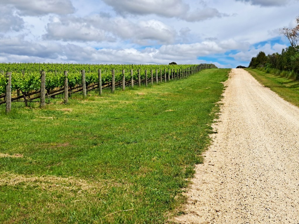
We are finally getting some spring weather; the Mt Camel range grape vines are bursting into a new cloak of bright green leaves.
Firstly, I’ve driven or ridden all of this route this month to check the condition after recent rain and surface flooding events. It is all rideable!
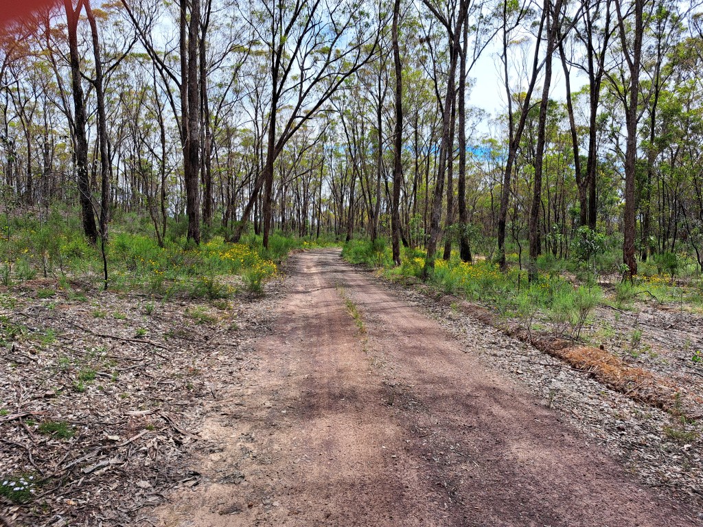
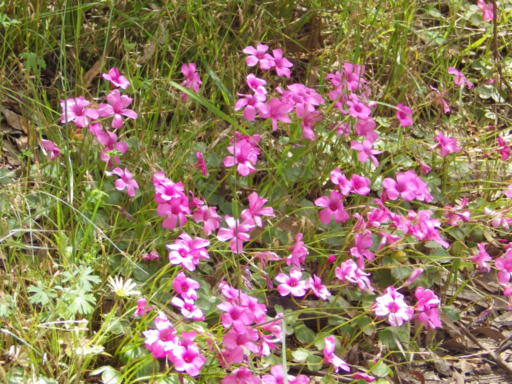
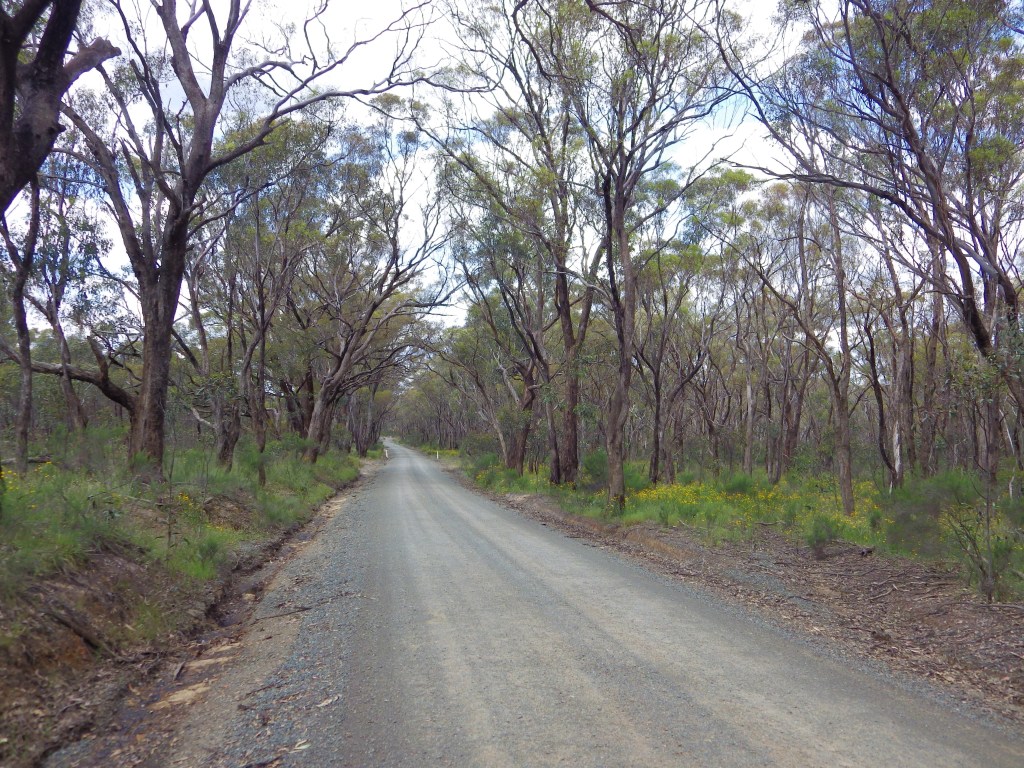
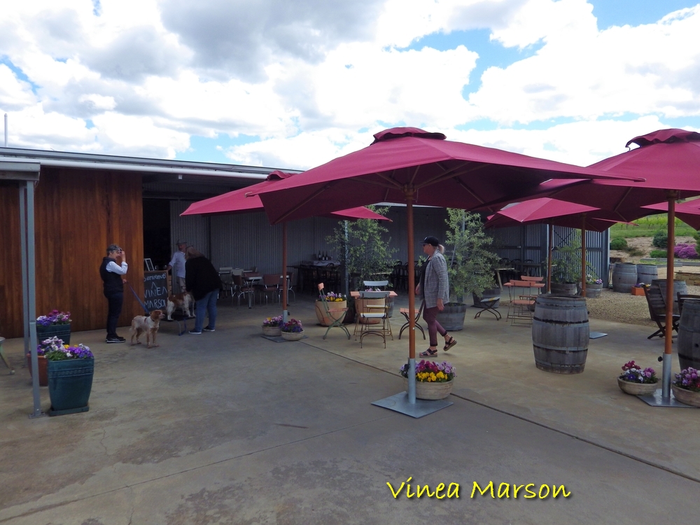
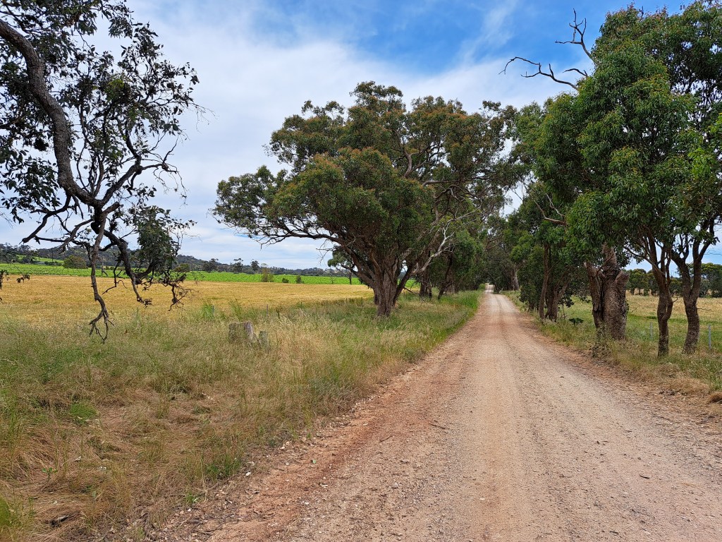
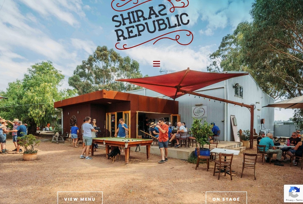
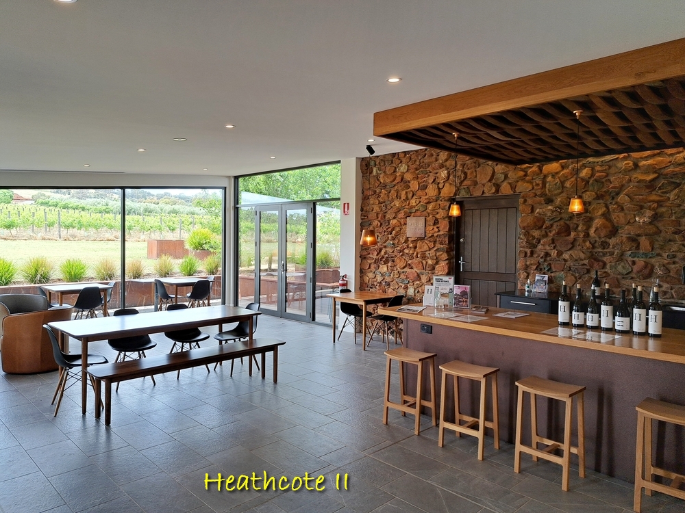
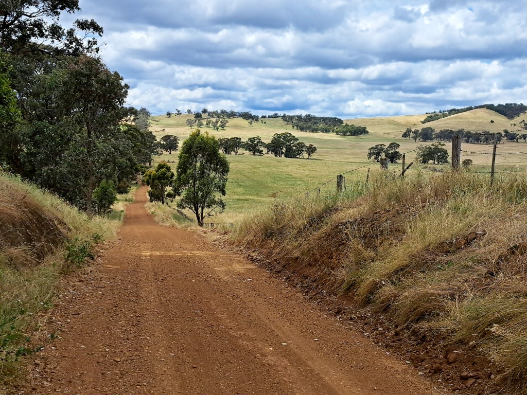
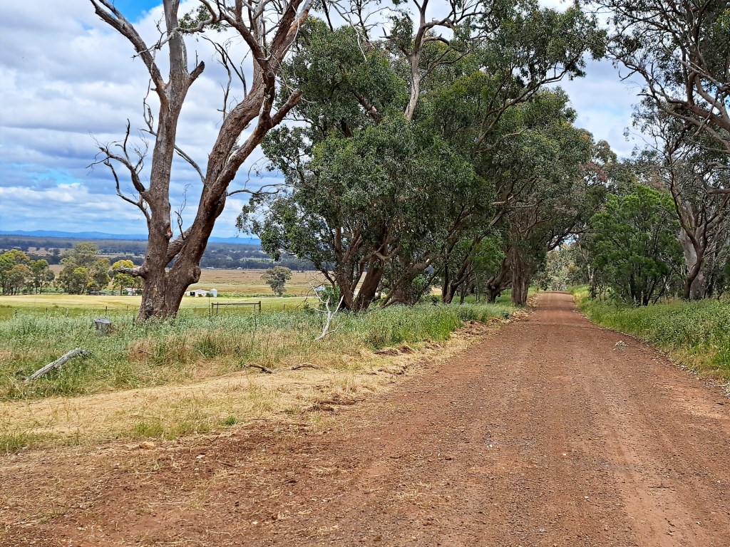
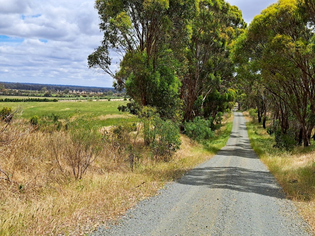
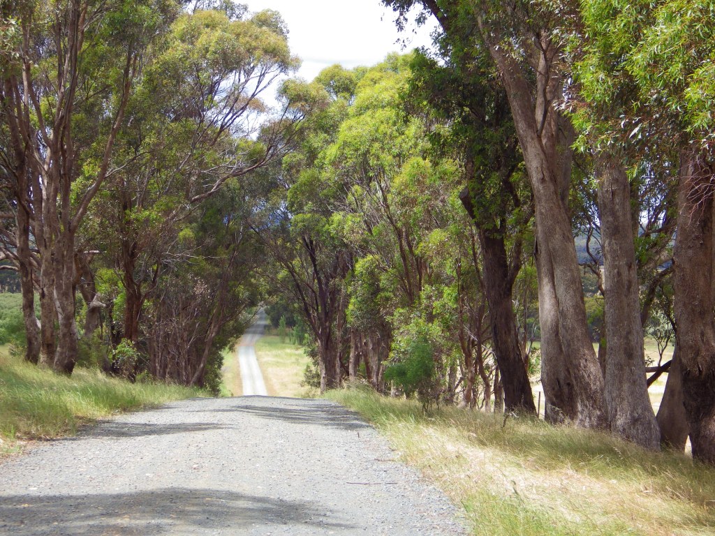
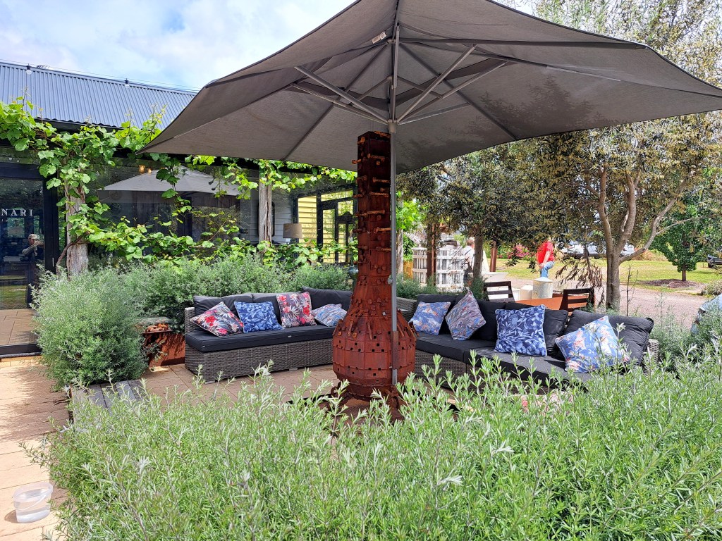
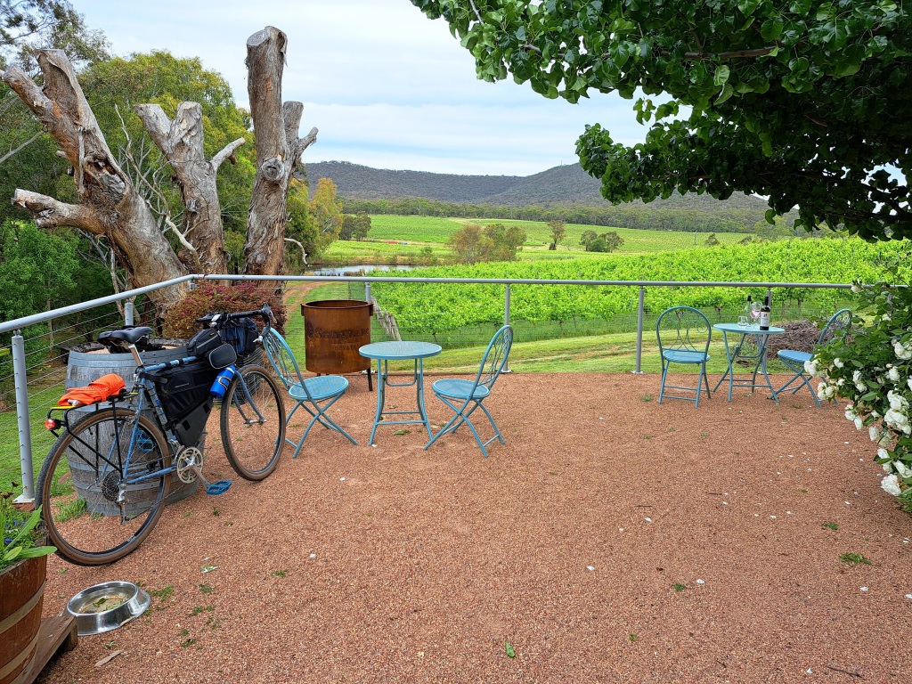
Summary pics for a ride-through guide


.
—————- Original pre-ride post ——————-
- Date and Time: Saturday 26th November 2022. Start at 9:00am.
- Distance and Duration: Around 70 to 95km depending on how many wineries you visit. Personally, I’m planning a relaxed all-day ride, stopping for a while at some of the 12 Cellar Doors and along the way. More detail on route options is provided below.
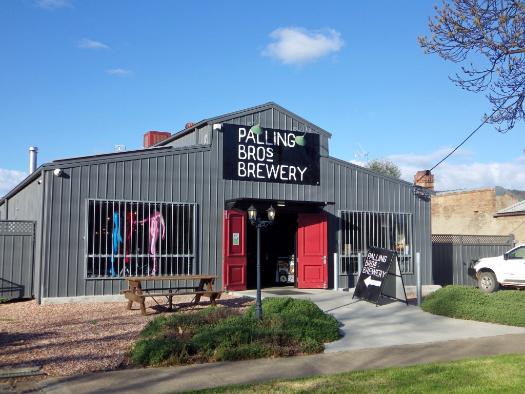
- Start and Finish Location: Palling Bros Brewery, 168 High Street, Heathcote. Assemble in Chauncey Street on the corner of High Street.
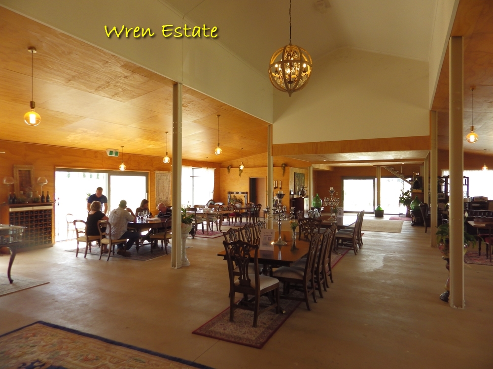
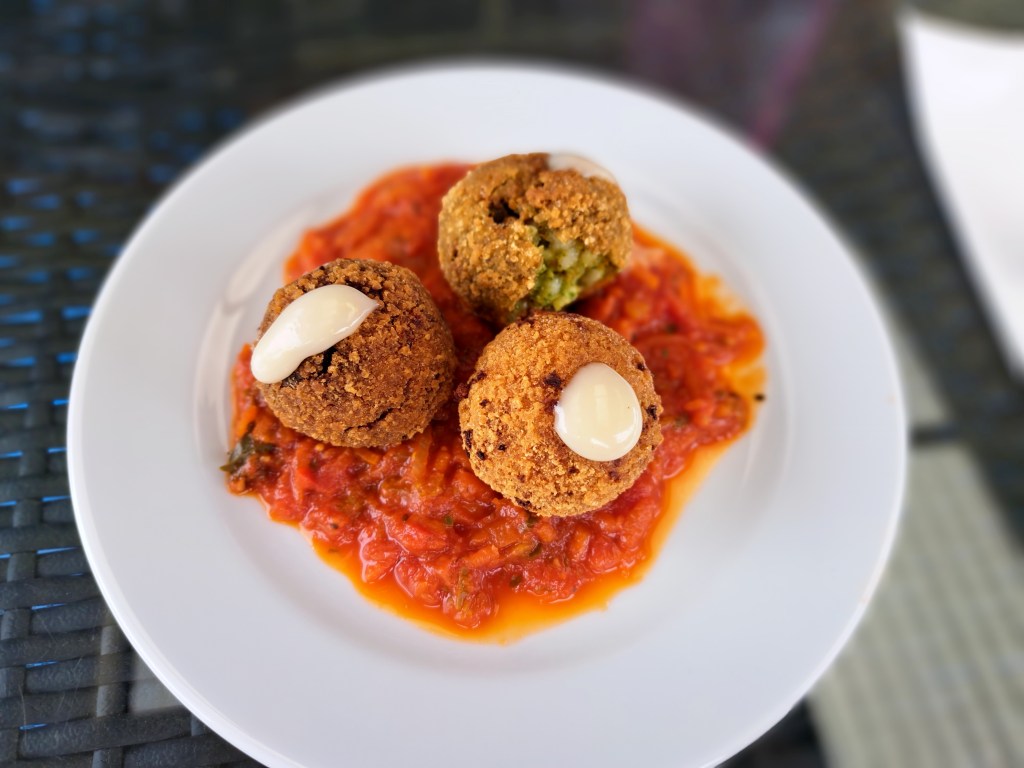
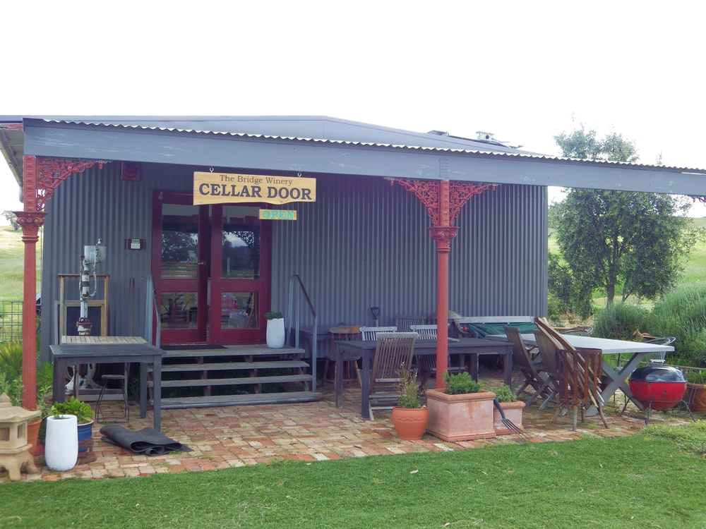
- Amenities: Heathcote at start and finish. Up to 12 Cellar Doors and a brewery along the way. Be aware that while wine tastings are often free at cellar doors, food is usually relatively expensive. There are more details and maps of how to get to all 12 wineries and the brewery below.
- Accommodation: There are accommodation options at both the north and south ends of the loop. So it is easy to do this ride as an overnighter with 2 days riding, which will also allow more time at winery stops. At the south end, Heathcote has more accommodation options (and a central booking service). At the north end, Heathcote II and Shiraz Republic offer accommodation, although these are relatively expensive and rooms may only be available for 2 nights minimum. Nearby Toolleen Hotel is more suitable for bikepackers; this has basic rooms although they are not listed anywhere, you have to contact the hotel directly. There is also a free campsite opposite the Toolleen Hotel and general store. This campsite has toilet facilities, but it may also have some noise from the main road nearby.
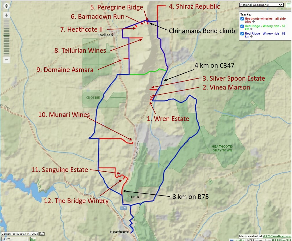
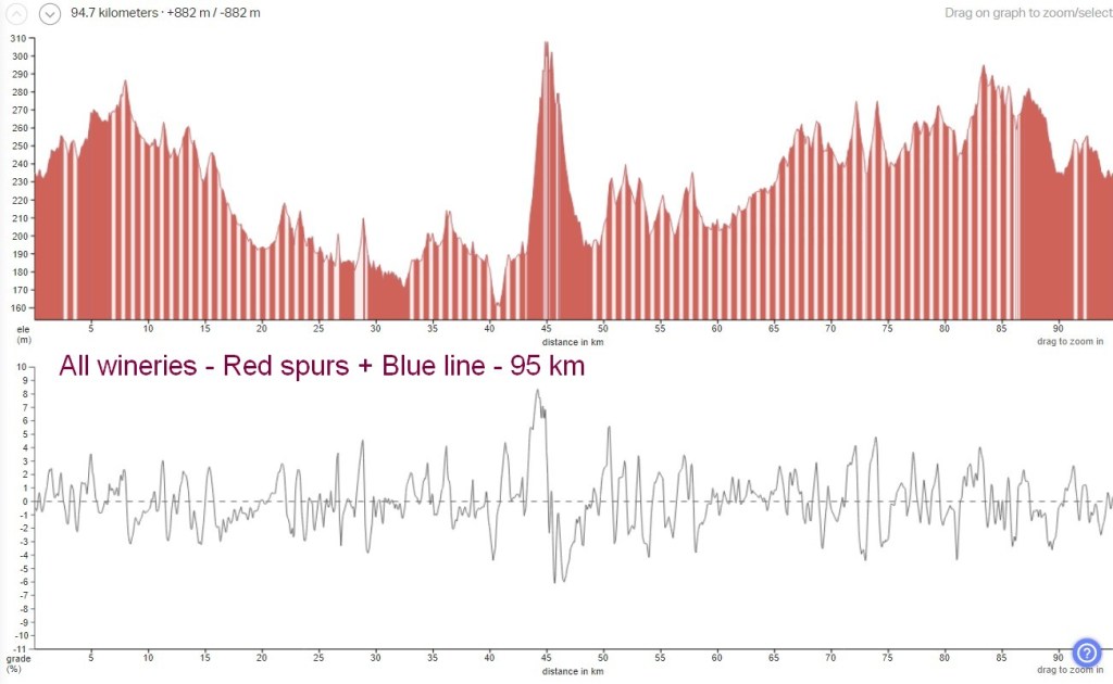
- Terrain: There is one significant climb – Chinamans Bend (about 1.5km at 8%). The remainder of the route is rolling. Expect 600 to 900 vertical metres depending on how many side trips to wineries you make. See profiles below for more detail.
- Less capable riders should not be deterred by the Chinamans Bend climb. It is short enough to hike-your-bike on the steepest sections if necessary, and most riders will stop at the hairpin bend half-way up to take pics looking out over the scenic vineyards, so you will get a rest.
- There are also some short, steep climbs of only a few hundred metres on the western side of the route, and on driveways spurs into wineries.
- Roads and Ride Surfaces: Irrespective of route choice the surface information is the same. About 75% gravel, mostly in good condition although there are occasional gouges and potholes. Watch out for a few full-width transverse ditches across the road caused by recent heavy rain runoff. These ditches are only about 30-40 cm wide and 15-30 cm deep, but you don’t want to hit them at speed. I’m planning to stop and lift over these ditches. The remaining 25% of the route is sealed road. The only clay / dry weather road is the short-cut road option (about 4 km on Hagans Lane) and this was rideable when I checked it earlier this month.
- Heavy Traffic Sections: Three sections of sealed road are busier and more risky than I’d like but there are no other options. These are 4 km on C347 (Heathcote-Rochester Rd), 3 km on Chinamans Bend climb where drivers could be distracted by the hairpins and views, and probably 3 km on B75 (Northern Highway) near the end of the day. These locations are marked on the map below. Please do your own research and make sure you are prepared to ride on these roads. Lights and high-visibility clothing are recommended.
- Bike and Tyres: No need for suspension as most of the surfaces are fairly smooth. But riders will probably find the jarring and vibration from the gravel roads uncomfortable on tyres less than 30 mm wide. To be comfortable you should have tyres wider than 40 mm if possible.
- Navigation and Communication: There will not be any signs or marshalls. Parts of the ride are on very quiet forest tracks and un-signed back roads. Riders are unlikely to stay in large groups. Every rider should be able to navigate by themselves using gpx files and appropriate devices. Adventure riders should always carry personal locator beacons for emergency situations.
- GPX Files: GPX files are below and available to download. I expect riders will need to use more than one gpx file. I suggest using a mobile phone app that allows multiple gpx files to be loaded at the same time in different colours to distinguish between the through-loop, and out-and-back spur rides to cellar doors. I use GPX Viewer which can load and track against multiple differently coloured gpx lines at the same time in its free version.
- On Bike or in Day Bags: As well as navigation and emergency communication devices, riders should plan to support themselves for a full day on the road in changing road and weather conditions. Some suggestions – food, water, sunscreen, insect protection, lights, puncture management, bike tools and spare parts, first aid including a snake bite kit, and clothing options for hot, cold, wet and low-visibility conditions.
- Highlights: Gravel roads in mostly good condition with low traffic. Scenic views of vines in new season’s leaf. A wide variety of winery cellar doors with relaxed ambience, a range of food choices and some live music. Conviviality – everyone I met was relaxed, friendly and happy to chat. And great wines!
- Costs and Support: It costs nothing. For that you get to ride completely self-supported, self-navigating and at your own risk. There will be no marshalls, no route markings and no physical or mechanical support people or vehicles. Please do your own research and risk assessment to determine if this is a suitable ride for you.
- Alcohol: Drinking too much alcohol will impair your ability to ride safely and also cause dehydration which increases health risks further. Please drink in moderation and drink lots of water during the ride.
- Seasonal Ride Series: This route is part of the GABCY Seasonal Ride Series – a set of monthly rides that are in harmony with local weather patterns and natural environments. The aim is to showcase the most suitable and scenic time to ride in each location, as well as show the wide variety of rides available across the GABCY Network.
- Route also connects with: If you want to incorporate this ride into a longer multi-day ride trip, this route has connections with O’Keefe Rail Trail, Leen Down the Dale, Camel Cornella and Golden Black Track. See – the GABCY Network.
Route Options
Please refer to the map below to understand the various route options.
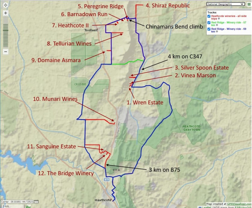


- Blue line – this is the basic loop. It is 69 km without visiting any cellar doors. The loop is rolling with one significant climb (1.5 km at 8% on sealed road), and approx 600 vertical metres total.
- Green line – a shorter route using a short-cut across the loop to avoid doing the northern section. Riding this loop is 57 km without visiting any cellar doors. This loop is rolling with a longer, shallower climb (2.8km at 3 to 5% on clay and gravel road), and approx 470 vertical metres total.
- Red spur lines – these are connecting roads or driveways to all the cellar doors. These are all out-and-back extensions; they add distance to the ride. If you decide to ride all the red spur lines to every cellar door shown, as well as the blue route, you will ride 95 km in total. This ride option is rolling with one significant climb (1.5% at 8% on sealed road), and approx 880 vertical metres total.
This route setup allows individual riders or small groups to tailor their ride to their own interests and capabilities. Riders can choose which cellar doors they wish to visit and how far off the base loops they want to venture. This will determine the total distance each person rides.
To continue reading about this ride, including downloading the gpx files and seeing detailed information about all the wineries click this link – Red Ridge Ride – Heathcote Wineries Tour.
.

Leave a comment