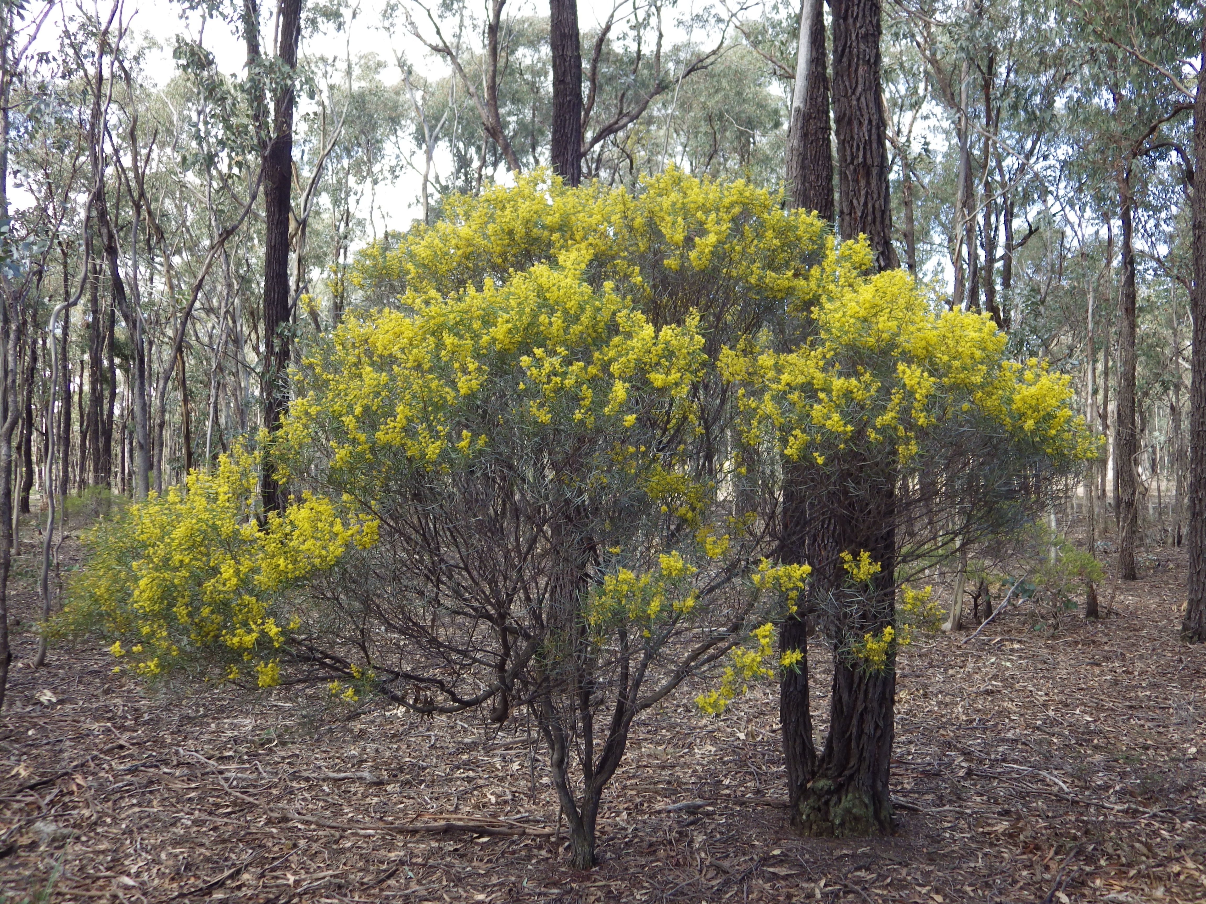
This ride is a golden opportunity to see the extensive wattle understorey in bloom through the Rushworth ironbark forest.
The planned ride is a 47 km loop, from Rushworth to Kings Cross clearing and return (see pic below for map and profile). There is also an opportunity for coffee, snacks or lunch in scenic Rushworth township on return.

- Date and Time: Saturday, 3rd September 2022. Start 9:30 am. The expected ride duration is about 3 to 3.5 hours depending on the number of stops.
- Ride Distance: 47 km loop.
- Meet up and start location: Available further down the page.
- Amenities: Rushworth at start and finish only. The ride is self-supported and there are no water or food sources on the ride. There is a toilet and shelter at the 33 km point, but there is no drinking water there. Please plan to carry whatever you might need.
- Terrain: There are no major climbs, but the route is rolling with regular short climbs and descents of around 3-5%. Total vertical metres is 360m for the ride.
- Ride surfaces: 87% natural surface and gravel roads, with remaining 13% quiet sealed road.
- Best Bike: No need for suspension as most of the surfaces are fairly smooth. But riders will probably find the jarring and vibration from the gravel roads uncomfortable on tyres less than 30 mm wide. To be comfortable you should have tyres wider than 40 mm if possible.
- Highlights: Rushworth historic township with good food options. Wattles and wildflowers in bloom. Whroo and Whroo cemetery. Very low car traffic. Good riding on red, scenic, smooth, natural surface and gravel tracks rolling and winding through the forest.
- Navigation and Communication: Many of the forest tracks are not marked and winding. It is difficult to maintain a sense of direction in this forest. Some areas along the route will be outside mobile phone and internet coverage. To prepare for this ride I think it is essential to download the gpx file and put it onto a gpx tracker that will operate outside of mobile and internet coverage. Adventure riders should always carry personal locator beacons for emergency situations.
- Link to gpx file: Links to download the gpx file are provided further down this page.
- Seasonal Ride Series: This route is part of the GABCY Seasonal Ride Series – a set of monthly rides that are in harmony with local weather patterns and natural environments. The aim is to showcase the most suitable and scenic time to ride in each location, as well as show the wide variety of rides available across the GABCY Network.
- Route also connects to: Golden Black Track, Ghostown Gambol, Camel Cornella, Kirwans Rushy Whroote, Lap of Local Lakes, Carag Carag Wetland Wetland. See – GABCY Network.
- Some pics of the ride route are below: Photos are from various times in the year, so they don’t always show wattle and wildflowers in bloom.


To continue reading full details of the ride – including maps, route options and to download gpx files please see – Wattle Day Ride page.
.
Leave a Reply